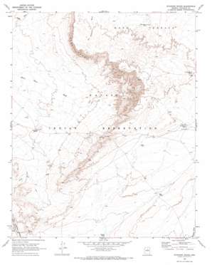
Standing Rocks Topo Map Arizona
To zoom in, hover over the map of Standing Rocks
USGS Topo Quad 35111e2 - 1:24,000 scale
| Topo Map Name: | Standing Rocks |
| USGS Topo Quad ID: | 35111e2 |
| Print Size: | ca. 21 1/4" wide x 27" high |
| Southeast Coordinates: | 35.5° N latitude / 111.125° W longitude |
| Map Center Coordinates: | 35.5625° N latitude / 111.1875° W longitude |
| U.S. State: | AZ |
| Filename: | o35111e2.jpg |
| Download Map JPG Image: | Standing Rocks topo map 1:24,000 scale |
| Map Type: | Topographic |
| Topo Series: | 7.5´ |
| Map Scale: | 1:24,000 |
| Source of Map Images: | United States Geological Survey (USGS) |
| Alternate Map Versions: |
Black Falls 4 SW AZ 1955, updated 1957 Download PDF Buy paper map Standing Rocks AZ 1969, updated 1973 Download PDF Buy paper map Standing Rocks AZ 2011 Download PDF Buy paper map Standing Rocks AZ 2014 Download PDF Buy paper map |
1:24,000 Topo Quads surrounding Standing Rocks
> Back to 35111e1 at 1:100,000 scale
> Back to 35110a1 at 1:250,000 scale
> Back to U.S. Topo Maps home
Standing Rocks topo map: Gazetteer
Standing Rocks: Pillars
Standing Rocks elevation 1348m 4422′Standing Rocks: Reservoirs
Bug Tanks elevation 1425m 4675′Cow Tank elevation 1456m 4776′
Kish Zhini Tank elevation 1476m 4842′
Lii Haditiih Tank elevation 1492m 4895′
No Water Tank elevation 1464m 4803′
Standing Rocks: Springs
Box Spring elevation 1355m 4445′Standing Rocks: Streams
Stone House Wash elevation 1321m 4333′Standing Rocks: Wells
Dry Spring Well elevation 1440m 4724′Natoni Well elevation 1465m 4806′
Standing Rocks digital topo map on disk
Buy this Standing Rocks topo map showing relief, roads, GPS coordinates and other geographical features, as a high-resolution digital map file on DVD:


