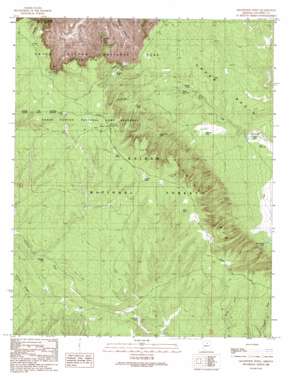
Grandview Point Topo Map Arizona
To zoom in, hover over the map of Grandview Point
USGS Topo Quad 35111h8 - 1:24,000 scale
| Topo Map Name: | Grandview Point |
| USGS Topo Quad ID: | 35111h8 |
| Print Size: | ca. 21 1/4" wide x 27" high |
| Southeast Coordinates: | 35.875° N latitude / 111.875° W longitude |
| Map Center Coordinates: | 35.9375° N latitude / 111.9375° W longitude |
| U.S. State: | AZ |
| Filename: | o35111h8.jpg |
| Download Map JPG Image: | Grandview Point topo map 1:24,000 scale |
| Map Type: | Topographic |
| Topo Series: | 7.5´ |
| Map Scale: | 1:24,000 |
| Source of Map Images: | United States Geological Survey (USGS) |
| Alternate Map Versions: |
Grandview Point AZ 1989, updated 1989 Download PDF Buy paper map Grandview Point AZ 1989, updated 1989 Download PDF Buy paper map Grandview Point AZ 2012 Download PDF Buy paper map Grandview Point AZ 2014 Download PDF Buy paper map |
| FStopo: | US Forest Service topo Grandview Point is available: Download FStopo PDF Download FStopo TIF |
1:24,000 Topo Quads surrounding Grandview Point
> Back to 35111e1 at 1:100,000 scale
> Back to 35110a1 at 1:250,000 scale
> Back to U.S. Topo Maps home
Grandview Point topo map: Gazetteer
Grandview Point: Cliffs
Grandview Point elevation 2106m 6909′South Rim elevation 1907m 6256′
Grandview Point: Dams
Little Trash Dam elevation 2014m 6607′Trash Dam elevation 2021m 6630′
Grandview Point: Forests
Tusayan Ranger District elevation 2193m 7194′Grandview Point: Lakes
Lockett Lake elevation 2272m 7454′Twin Lakes elevation 2286m 7500′
Grandview Point: Reservoirs
Belknap Tank elevation 2083m 6833′Brushy Tank elevation 2092m 6863′
Buggeln Tank elevation 2204m 7230′
Camp Thirtysix Tank elevation 2148m 7047′
Crazy Cow Tank elevation 2155m 7070′
Hearst Tanks elevation 2267m 7437′
Hull Tank elevation 2178m 7145′
Little Hull Tank elevation 2099m 6886′
Little Trash Dam Tank elevation 2014m 6607′
Lower Hull Tank elevation 2098m 6883′
New Lewis Tank elevation 2047m 6715′
Newt Lewis Tank elevation 2043m 6702′
Scott Tank elevation 2251m 7385′
Skinner Pasture Tank elevation 2152m 7060′
Skinner Tank elevation 2154m 7066′
Skinner Trick Tank elevation 2202m 7224′
Upper Lee Trick Tank elevation 2081m 6827′
Grandview Point: Ridges
Skinner Ridge elevation 0m 0′Grandview Point: Summits
Buggeln Hill elevation 2173m 7129′Sinking Ship elevation 2206m 7237′
Grandview Point: Trails
Arizona Trail elevation 2295m 7529′Grandview Point digital topo map on disk
Buy this Grandview Point topo map showing relief, roads, GPS coordinates and other geographical features, as a high-resolution digital map file on DVD:


