Crookton Topo Map Arizona
To zoom in, hover over the map of Crookton
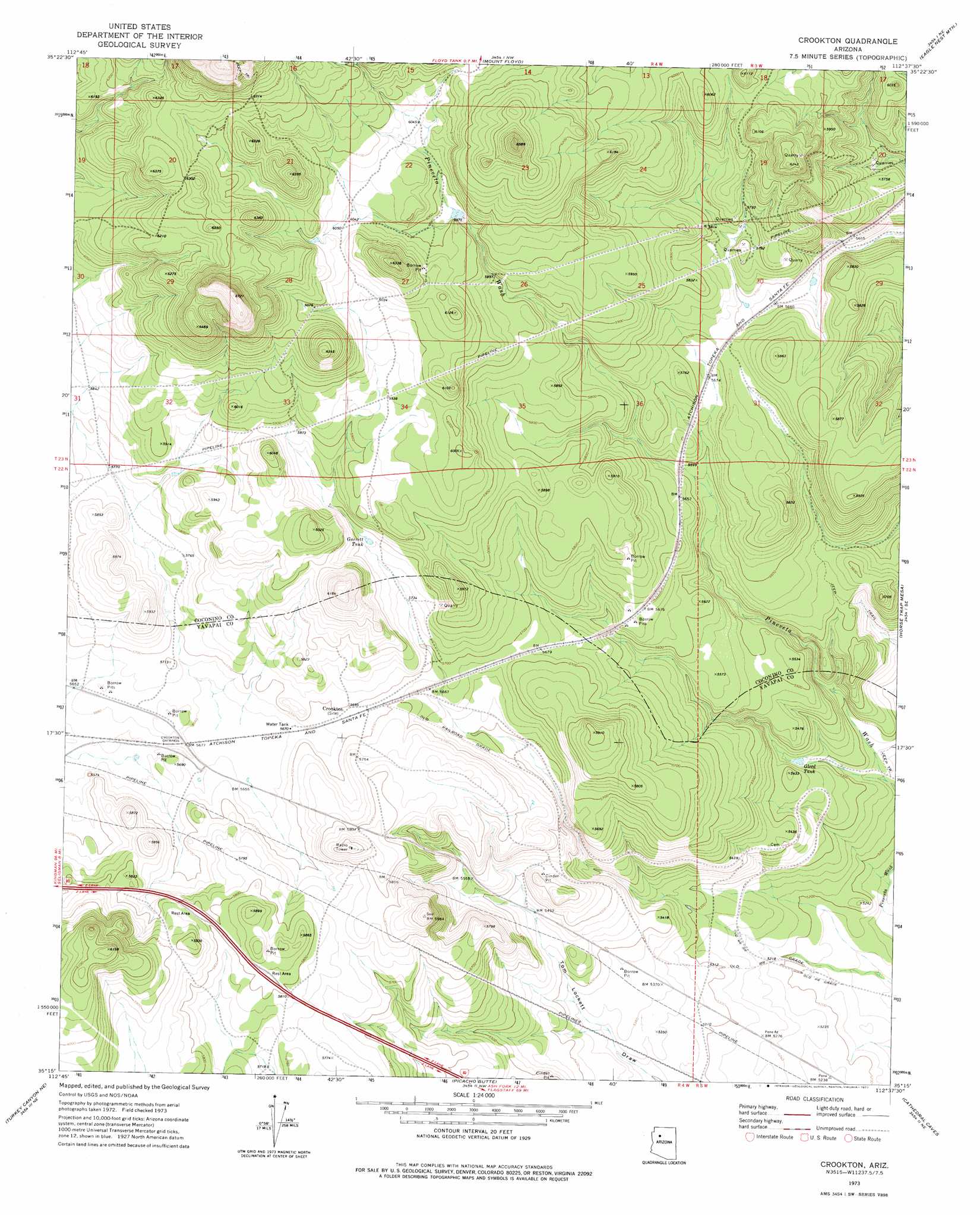
USGS Topo Quad 35112c6 - 1:24,000 scale
| Topo Map Name: | Crookton |
| USGS Topo Quad ID: | 35112c6 |
| Print Size: | ca. 21 1/4" wide x 27" high |
| Southeast Coordinates: | 35.25° N latitude / 112.625° W longitude |
| Map Center Coordinates: | 35.3125° N latitude / 112.6875° W longitude |
| U.S. State: | AZ |
| Filename: | o35112c6.jpg |
| Download Map JPG Image: | Crookton topo map 1:24,000 scale |
| Map Type: | Topographic |
| Topo Series: | 7.5´ |
| Map Scale: | 1:24,000 |
| Source of Map Images: | United States Geological Survey (USGS) |
| Alternate Map Versions: |
Crookton AZ 1973, updated 1977 Download PDF Buy paper map Crookton AZ 2011 Download PDF Buy paper map Crookton AZ 2014 Download PDF Buy paper map |
1:24,000 Topo Quads surrounding Crookton
Rhodes Canyon |
Big Bud Tank |
Bishop Lake |
Howard Spring |
Red Hill Ranch |
Red Mesa |
Trinity Mountain |
Mount Floyd |
Eagle Nest Mountain |
Stanford Tank |
Seligman West |
Seligman East |
Crookton |
Horse Trap Mesa |
Fitzgerald Hill |
Purcell Canyon |
Turkey Canyon Ne |
Picacho Butte |
Cathedral Caves |
Ash Fork |
Turkey Canyon |
Red Mountain |
South Butte |
Picacho Butte Se |
Meath Spring |
> Back to 35112a1 at 1:100,000 scale
> Back to 35112a1 at 1:250,000 scale
> Back to U.S. Topo Maps home
Crookton topo map: Gazetteer
Crookton: Crossings
Crookton Overpass elevation 1726m 5662′Crookton: Populated Places
Crookton elevation 1737m 5698′Crookton: Reservoirs
Garrett Tank elevation 1764m 5787′Gleed Tank elevation 1623m 5324′
Crookton digital topo map on disk
Buy this Crookton topo map showing relief, roads, GPS coordinates and other geographical features, as a high-resolution digital map file on DVD: