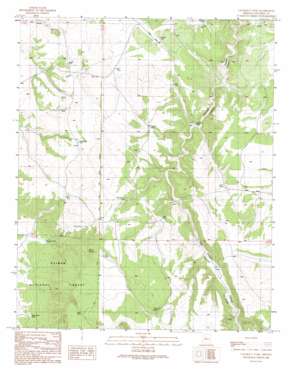
Cataract Tank Topo Map Arizona
To zoom in, hover over the map of Cataract Tank
USGS Topo Quad 35112d3 - 1:24,000 scale
| Topo Map Name: | Cataract Tank |
| USGS Topo Quad ID: | 35112d3 |
| Print Size: | ca. 21 1/4" wide x 27" high |
| Southeast Coordinates: | 35.375° N latitude / 112.25° W longitude |
| Map Center Coordinates: | 35.4375° N latitude / 112.3125° W longitude |
| U.S. State: | AZ |
| Filename: | o35112d3.jpg |
| Download Map JPG Image: | Cataract Tank topo map 1:24,000 scale |
| Map Type: | Topographic |
| Topo Series: | 7.5´ |
| Map Scale: | 1:24,000 |
| Source of Map Images: | United States Geological Survey (USGS) |
| Alternate Map Versions: |
Cataract Tank AZ 1989, updated 1990 Download PDF Buy paper map Cataract Tank AZ 2012 Download PDF Buy paper map Cataract Tank AZ 2014 Download PDF Buy paper map |
| FStopo: | US Forest Service topo Cataract Tank is available: Download FStopo PDF Download FStopo TIF |
1:24,000 Topo Quads surrounding Cataract Tank
> Back to 35112a1 at 1:100,000 scale
> Back to 35112a1 at 1:250,000 scale
> Back to U.S. Topo Maps home
Cataract Tank topo map: Gazetteer
Cataract Tank: Dams
Davis Dam elevation 1844m 6049′Cataract Tank: Reservoirs
Bull Tank elevation 1850m 6069′Cataract Tank elevation 1801m 5908′
Coyote Tank elevation 1829m 6000′
Coyote Tank elevation 1825m 5987′
Deer Tank elevation 1836m 6023′
Elk Tank elevation 1885m 6184′
Flying H Tank elevation 1909m 6263′
Frenchman Tank elevation 1785m 5856′
Horseshoe Tank elevation 1837m 6026′
Lion Tank elevation 1854m 6082′
Mesa Tank elevation 1928m 6325′
Perkins Tank elevation 1847m 6059′
Pipeline Tank elevation 1811m 5941′
Red Tank elevation 1830m 6003′
Robert Tank elevation 1816m 5958′
Robert Tank (historical) elevation 1815m 5954′
Sandstone Tank elevation 1860m 6102′
Toughy Tank elevation 1793m 5882′
Yeager Tank elevation 1825m 5987′
Cataract Tank: Springs
Burro Spring elevation 1880m 6167′Cataract Tank digital topo map on disk
Buy this Cataract Tank topo map showing relief, roads, GPS coordinates and other geographical features, as a high-resolution digital map file on DVD:


