Box K Ranch Topo Map Arizona
To zoom in, hover over the map of Box K Ranch
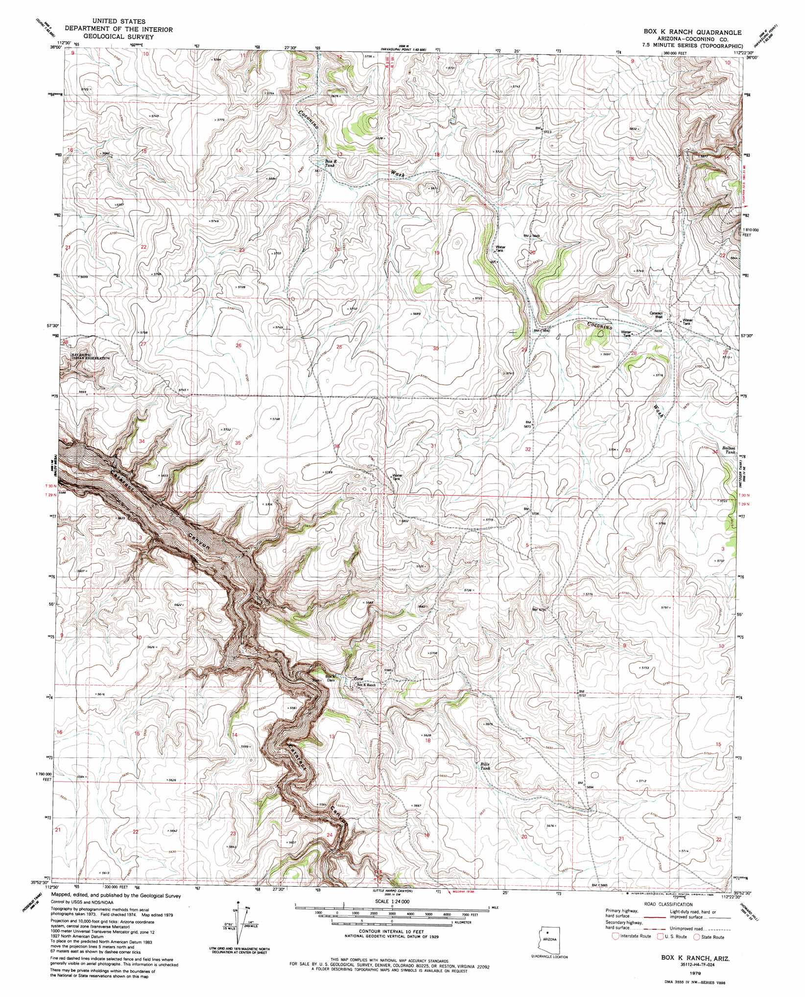
USGS Topo Quad 35112h4 - 1:24,000 scale
| Topo Map Name: | Box K Ranch |
| USGS Topo Quad ID: | 35112h4 |
| Print Size: | ca. 21 1/4" wide x 27" high |
| Southeast Coordinates: | 35.875° N latitude / 112.375° W longitude |
| Map Center Coordinates: | 35.9375° N latitude / 112.4375° W longitude |
| U.S. State: | AZ |
| Filename: | o35112h4.jpg |
| Download Map JPG Image: | Box K Ranch topo map 1:24,000 scale |
| Map Type: | Topographic |
| Topo Series: | 7.5´ |
| Map Scale: | 1:24,000 |
| Source of Map Images: | United States Geological Survey (USGS) |
| Alternate Map Versions: |
Box K Ranch AZ 1979, updated 1979 Download PDF Buy paper map Box K Ranch AZ 2011 Download PDF Buy paper map Box K Ranch AZ 2014 Download PDF Buy paper map |
1:24,000 Topo Quads surrounding Box K Ranch
Supai |
Topocoba Hilltop |
Explorers Monument |
Havasupai Point |
Shiva Temple |
Driftwood Canyon |
Antelope Point |
Chamisa Tank |
Piute Point |
Grand Canyon |
Hualapai Tank |
Baldy Basin |
Box K Ranch |
Metzger Tank |
Tusayan West |
Hazen Hole Tank |
Rosebud Tank |
Little Harpo Canyon |
Howard Hill |
Red Butte Sw |
Black Tank |
Tin House |
Markham Dam |
Miller Tank |
Valle Tank |
> Back to 35112e1 at 1:100,000 scale
> Back to 35112a1 at 1:250,000 scale
> Back to U.S. Topo Maps home
Box K Ranch topo map: Gazetteer
Box K Ranch: Dams
Box K Dam elevation 1669m 5475′Box K Ranch: Reservoirs
Balboa Tank elevation 1728m 5669′Bills Tank elevation 1708m 5603′
Box K Tank elevation 1713m 5620′
Box K Ranch: Wells
Cataract Well elevation 1729m 5672′Box K Ranch digital topo map on disk
Buy this Box K Ranch topo map showing relief, roads, GPS coordinates and other geographical features, as a high-resolution digital map file on DVD: