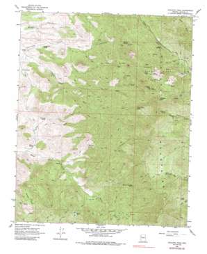
Hualapai Peak Topo Map Arizona
To zoom in, hover over the map of Hualapai Peak
USGS Topo Quad 35113a8 - 1:24,000 scale
| Topo Map Name: | Hualapai Peak |
| USGS Topo Quad ID: | 35113a8 |
| Print Size: | ca. 21 1/4" wide x 27" high |
| Southeast Coordinates: | 35° N latitude / 113.875° W longitude |
| Map Center Coordinates: | 35.0625° N latitude / 113.9375° W longitude |
| U.S. State: | AZ |
| Filename: | o35113a8.jpg |
| Download Map JPG Image: | Hualapai Peak topo map 1:24,000 scale |
| Map Type: | Topographic |
| Topo Series: | 7.5´ |
| Map Scale: | 1:24,000 |
| Source of Map Images: | United States Geological Survey (USGS) |
| Alternate Map Versions: |
Hualapai Peak AZ 1968, updated 1971 Download PDF Buy paper map Hualapai Peak AZ 1968, updated 1986 Download PDF Buy paper map Hualapai Peak AZ 2011 Download PDF Buy paper map Hualapai Peak AZ 2014 Download PDF Buy paper map |
1:24,000 Topo Quads surrounding Hualapai Peak
> Back to 35113a1 at 1:100,000 scale
> Back to 35112a1 at 1:250,000 scale
> Back to U.S. Topo Maps home
Hualapai Peak topo map: Gazetteer
Hualapai Peak: Areas
Potato Patch elevation 2311m 7582′Hualapai Peak: Basins
Whiskey Basin elevation 1366m 4481′Hualapai Peak: Mines
Flag Mine elevation 2152m 7060′Hualapai Peak: Parks
Hualapai Mountain County Park elevation 2433m 7982′Hualapai Peak: Springs
Black Inky Spring elevation 1260m 4133′Cedar Spring elevation 1733m 5685′
Cottonwood Spring elevation 1201m 3940′
Grande Spring elevation 1188m 3897′
Upper Moss Spring elevation 1781m 5843′
Walnut Creek Mine Spring elevation 1609m 5278′
Whiskey Spring elevation 1648m 5406′
Wild Cow Spring elevation 2164m 7099′
Willow Spring elevation 1105m 3625′
Yellow Flower Spring elevation 1860m 6102′
Hualapai Peak: Streams
Willow Creek elevation 1074m 3523′Hualapai Peak: Summits
Hayden Peak elevation 2542m 8339′Hualapai Peak elevation 2371m 7778′
Hualapai Peak: Valleys
Horse Canyon elevation 1195m 3920′Hualapai Peak: Wells
Tin Barn Well elevation 1394m 4573′Hualapai Peak digital topo map on disk
Buy this Hualapai Peak topo map showing relief, roads, GPS coordinates and other geographical features, as a high-resolution digital map file on DVD:


