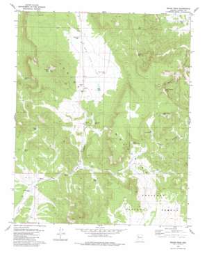
Squaw Peak Topo Map Arizona
To zoom in, hover over the map of Squaw Peak
USGS Topo Quad 35113b1 - 1:24,000 scale
| Topo Map Name: | Squaw Peak |
| USGS Topo Quad ID: | 35113b1 |
| Print Size: | ca. 21 1/4" wide x 27" high |
| Southeast Coordinates: | 35.125° N latitude / 113° W longitude |
| Map Center Coordinates: | 35.1875° N latitude / 113.0625° W longitude |
| U.S. State: | AZ |
| Filename: | o35113b1.jpg |
| Download Map JPG Image: | Squaw Peak topo map 1:24,000 scale |
| Map Type: | Topographic |
| Topo Series: | 7.5´ |
| Map Scale: | 1:24,000 |
| Source of Map Images: | United States Geological Survey (USGS) |
| Alternate Map Versions: |
Squaw Peak AZ 1980, updated 1980 Download PDF Buy paper map Squaw Peak AZ 1980, updated 1980 Download PDF Buy paper map Squaw Peak AZ 2012 Download PDF Buy paper map Squaw Peak AZ 2014 Download PDF Buy paper map |
| FStopo: | US Forest Service topo Squaw Peak is available: Download FStopo PDF Download FStopo TIF |
1:24,000 Topo Quads surrounding Squaw Peak
> Back to 35113a1 at 1:100,000 scale
> Back to 35112a1 at 1:250,000 scale
> Back to U.S. Topo Maps home
Squaw Peak topo map: Gazetteer
Squaw Peak: Flats
Red Lake Flat elevation 1731m 5679′Squaw Peak: Lakes
Red Lake elevation 1729m 5672′Squaw Peak: Reservoirs
Big Purcell Tank elevation 1802m 5912′Broken Dam Tank elevation 1634m 5360′
Brown Basin Tank elevation 1789m 5869′
Deer Tank elevation 1762m 5780′
Gosney Tank elevation 1724m 5656′
Greeley Tank elevation 1686m 5531′
Hooker Tank elevation 1697m 5567′
Jolly Place Tank elevation 1747m 5731′
Little Phil Tank elevation 1735m 5692′
Little Purcell Tank elevation 1772m 5813′
Mapes Tank elevation 1607m 5272′
Red Lake Tank elevation 1711m 5613′
Short Creek Tank elevation 1729m 5672′
Squaw Peak: Springs
Green Waterhole Spring elevation 1753m 5751′Squaw Peak: Summits
Squaw Peak elevation 2011m 6597′Squaw Peak: Valleys
Grapevine Canyon elevation 1640m 5380′Little Purcell Canyon elevation 1674m 5492′
Red Lake Draw elevation 1639m 5377′
Squaw Peak: Wells
Norton Well elevation 1768m 5800′Red Lake Well elevation 1732m 5682′
Squaw Peak digital topo map on disk
Buy this Squaw Peak topo map showing relief, roads, GPS coordinates and other geographical features, as a high-resolution digital map file on DVD:


