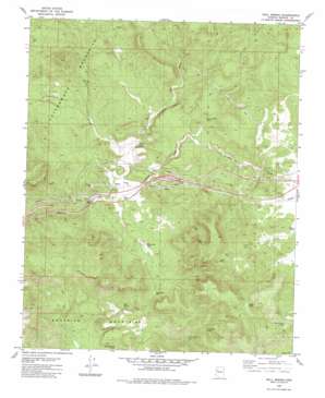
Bull Spring Topo Map Arizona
To zoom in, hover over the map of Bull Spring
USGS Topo Quad 35113b4 - 1:24,000 scale
| Topo Map Name: | Bull Spring |
| USGS Topo Quad ID: | 35113b4 |
| Print Size: | ca. 21 1/4" wide x 27" high |
| Southeast Coordinates: | 35.125° N latitude / 113.375° W longitude |
| Map Center Coordinates: | 35.1875° N latitude / 113.4375° W longitude |
| U.S. State: | AZ |
| Filename: | o35113b4.jpg |
| Download Map JPG Image: | Bull Spring topo map 1:24,000 scale |
| Map Type: | Topographic |
| Topo Series: | 7.5´ |
| Map Scale: | 1:24,000 |
| Source of Map Images: | United States Geological Survey (USGS) |
| Alternate Map Versions: |
Bull Spring AZ 1980, updated 1980 Download PDF Buy paper map Bull Spring AZ 1980, updated 1980 Download PDF Buy paper map Bull Spring AZ 2011 Download PDF Buy paper map Bull Spring AZ 2014 Download PDF Buy paper map |
1:24,000 Topo Quads surrounding Bull Spring
> Back to 35113a1 at 1:100,000 scale
> Back to 35112a1 at 1:250,000 scale
> Back to U.S. Topo Maps home
Bull Spring topo map: Gazetteer
Bull Spring: Reservoirs
B Flat Tank elevation 1625m 5331′Rucker Tank elevation 1551m 5088′
Three Sisters Tank elevation 1666m 5465′
White Rock Tank elevation 1462m 4796′
Bull Spring: Springs
Bull Spring elevation 1612m 5288′Casa Grande Spring elevation 1489m 4885′
Cottonwood Spring elevation 1506m 4940′
Knight Creek Spring elevation 1365m 4478′
Mud Spring elevation 1402m 4599′
Bull Spring: Streams
Lookout Wash elevation 1421m 4662′Tuckayou Wash elevation 1421m 4662′
Bull Spring: Wells
New Water Well elevation 1451m 4760′White Rock Well elevation 1478m 4849′
Bull Spring digital topo map on disk
Buy this Bull Spring topo map showing relief, roads, GPS coordinates and other geographical features, as a high-resolution digital map file on DVD:


