Valentine Se Topo Map Arizona
To zoom in, hover over the map of Valentine Se
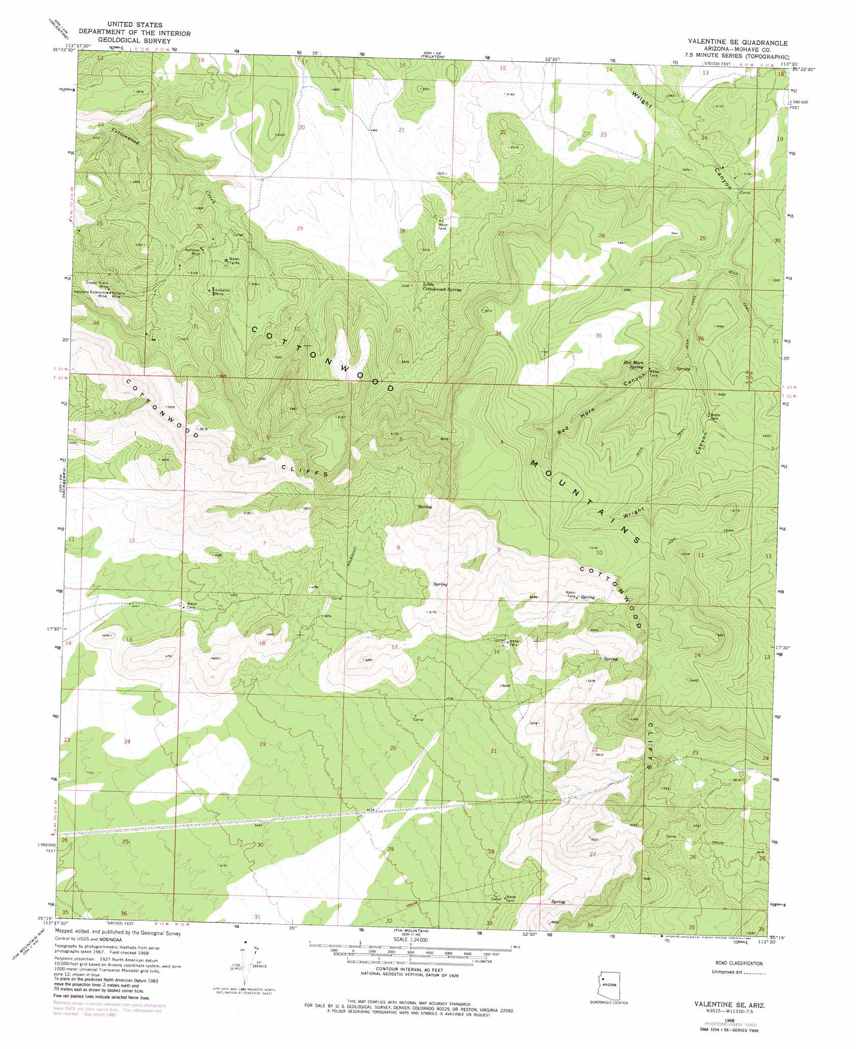
USGS Topo Quad 35113c5 - 1:24,000 scale
| Topo Map Name: | Valentine Se |
| USGS Topo Quad ID: | 35113c5 |
| Print Size: | ca. 21 1/4" wide x 27" high |
| Southeast Coordinates: | 35.25° N latitude / 113.5° W longitude |
| Map Center Coordinates: | 35.3125° N latitude / 113.5625° W longitude |
| U.S. State: | AZ |
| Filename: | o35113c5.jpg |
| Download Map JPG Image: | Valentine Se topo map 1:24,000 scale |
| Map Type: | Topographic |
| Topo Series: | 7.5´ |
| Map Scale: | 1:24,000 |
| Source of Map Images: | United States Geological Survey (USGS) |
| Alternate Map Versions: |
Valentine SE AZ 1968, updated 1971 Download PDF Buy paper map Valentine SE AZ 1968, updated 1980 Download PDF Buy paper map Valentine SE AZ 2011 Download PDF Buy paper map Valentine SE AZ 2014 Download PDF Buy paper map |
1:24,000 Topo Quads surrounding Valentine Se
Music Mountains Se |
Milkweed Canyon Sw |
Milkweed Canyon Se |
Peach Springs |
Nelson |
Antares |
Valentine |
Truxton |
Cherokee Point |
Blye Canyon Ne |
Peacock Peak |
Hackberry |
Valentine Se |
Tuckayou Spring |
Blye Canyon Se |
Hualapai Spring |
Tin Mountain Nw |
Tin Mountain |
Bull Spring |
Fort Rock Ranch |
Dean Peak |
Bottleneck Wash |
Austin Peak |
Penitentiary Mountain |
Devils Hump |
> Back to 35113a1 at 1:100,000 scale
> Back to 35112a1 at 1:250,000 scale
> Back to U.S. Topo Maps home
Valentine Se topo map: Gazetteer
Valentine Se: Mines
Alabama Mine elevation 1501m 4924′Copper Giant Mine elevation 1541m 5055′
Keystone Extension Mine elevation 1548m 5078′
Victoria Mine elevation 1554m 5098′
Walkover Mine elevation 1499m 4917′
Valentine Se: Ranges
Cottonwood Mountains elevation 1713m 5620′Valentine Se: Springs
Little Cottonwood Spring elevation 1570m 5150′Red Horn Spring elevation 1631m 5351′
Valentine Se: Summits
Slate Mountain elevation 1816m 5958′Valentine Se: Valleys
Red Horn Canyon elevation 1598m 5242′Valentine Se digital topo map on disk
Buy this Valentine Se topo map showing relief, roads, GPS coordinates and other geographical features, as a high-resolution digital map file on DVD: