Peacock Peak Topo Map Arizona
To zoom in, hover over the map of Peacock Peak
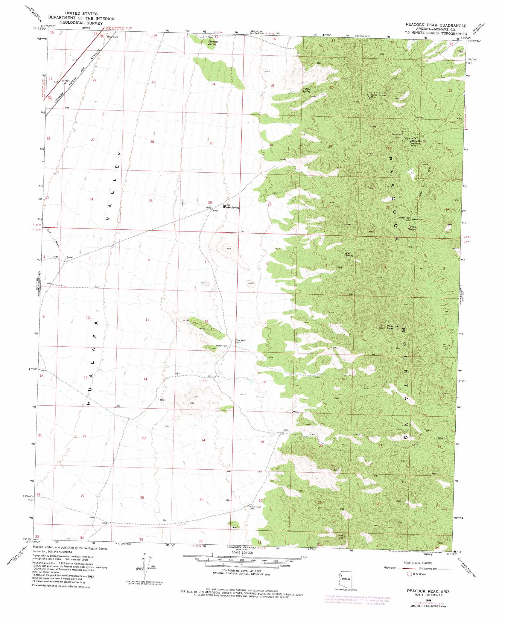
USGS Topo Quad 35113c7 - 1:24,000 scale
| Topo Map Name: | Peacock Peak |
| USGS Topo Quad ID: | 35113c7 |
| Print Size: | ca. 21 1/4" wide x 27" high |
| Southeast Coordinates: | 35.25° N latitude / 113.75° W longitude |
| Map Center Coordinates: | 35.3125° N latitude / 113.8125° W longitude |
| U.S. State: | AZ |
| Filename: | o35113c7.jpg |
| Download Map JPG Image: | Peacock Peak topo map 1:24,000 scale |
| Map Type: | Topographic |
| Topo Series: | 7.5´ |
| Map Scale: | 1:24,000 |
| Source of Map Images: | United States Geological Survey (USGS) |
| Alternate Map Versions: |
Peacock Peak AZ 1968, updated 1971 Download PDF Buy paper map Peacock Peak AZ 1968, updated 1980 Download PDF Buy paper map Peacock Peak AZ 1968, updated 1980 Download PDF Buy paper map Peacock Peak AZ 2011 Download PDF Buy paper map Peacock Peak AZ 2014 Download PDF Buy paper map |
1:24,000 Topo Quads surrounding Peacock Peak
Mount Tipton Se |
Music Mountains Sw |
Music Mountains Se |
Milkweed Canyon Sw |
Milkweed Canyon Se |
Elements Canyon |
Long Mountain |
Antares |
Valentine |
Truxton |
Stockton Hill |
Kingman Airport |
Peacock Peak |
Hackberry |
Valentine Se |
Kingman |
Rattlesnake Hill |
Hualapai Spring |
Tin Mountain Nw |
Tin Mountain |
Kingman Se |
Hualapai Peak |
Dean Peak |
Bottleneck Wash |
Austin Peak |
> Back to 35113a1 at 1:100,000 scale
> Back to 35112a1 at 1:250,000 scale
> Back to U.S. Topo Maps home
Peacock Peak topo map: Gazetteer
Peacock Peak: Mines
Hackberry Mine elevation 1386m 4547′North Hackberry Mine elevation 1477m 4845′
Sunshine Mine elevation 1402m 4599′
Peacock Peak: Ranges
Peacock Mountains elevation 1819m 5967′Peacock Peak: Springs
Crescent Spring elevation 1165m 3822′Mine Spring elevation 1381m 4530′
Mud Spring elevation 1452m 4763′
North Water Spring elevation 1210m 3969′
Trap Spring elevation 1439m 4721′
Willow Spring elevation 1359m 4458′
Peacock Peak: Summits
Peacock Peak elevation 1918m 6292′Peacock Peak: Wells
Ferichs Well elevation 1471m 4826′Five Wells elevation 1235m 4051′
West Well elevation 1460m 4790′
Peacock Peak digital topo map on disk
Buy this Peacock Peak topo map showing relief, roads, GPS coordinates and other geographical features, as a high-resolution digital map file on DVD: