Milkweed Canyon Sw Topo Map Arizona
To zoom in, hover over the map of Milkweed Canyon Sw
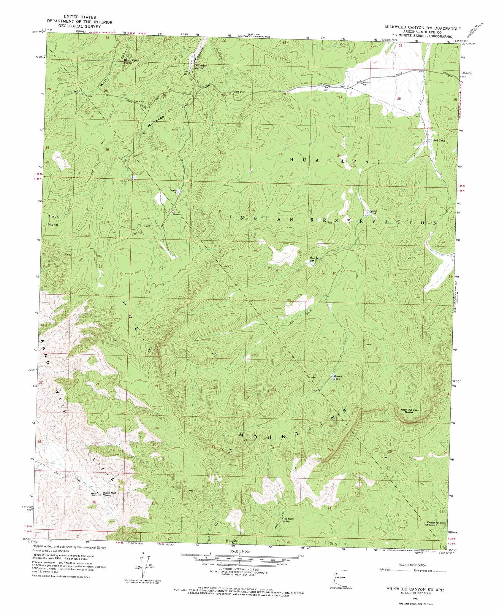
USGS Topo Quad 35113e6 - 1:24,000 scale
| Topo Map Name: | Milkweed Canyon Sw |
| USGS Topo Quad ID: | 35113e6 |
| Print Size: | ca. 21 1/4" wide x 27" high |
| Southeast Coordinates: | 35.5° N latitude / 113.625° W longitude |
| Map Center Coordinates: | 35.5625° N latitude / 113.6875° W longitude |
| U.S. State: | AZ |
| Filename: | o35113e6.jpg |
| Download Map JPG Image: | Milkweed Canyon Sw topo map 1:24,000 scale |
| Map Type: | Topographic |
| Topo Series: | 7.5´ |
| Map Scale: | 1:24,000 |
| Source of Map Images: | United States Geological Survey (USGS) |
| Alternate Map Versions: |
Milkweed Canyon SW AZ 1967, updated 1970 Download PDF Buy paper map Milkweed Canyon SW AZ 2011 Download PDF Buy paper map Milkweed Canyon SW AZ 2014 Download PDF Buy paper map |
1:24,000 Topo Quads surrounding Milkweed Canyon Sw
Quartermaster Canyon Sw |
Horse Flat |
Spencer Canyon |
Separation Canyon |
Travertine Rapids |
Music Mountains Nw |
Music Mountains Ne |
Milkweed Canyon Nw |
Hindu Canyon |
Peach Springs Canyon |
Music Mountains Sw |
Music Mountains Se |
Milkweed Canyon Sw |
Milkweed Canyon Se |
Peach Springs |
Long Mountain |
Antares |
Valentine |
Truxton |
Cherokee Point |
Kingman Airport |
Peacock Peak |
Hackberry |
Valentine Se |
Tuckayou Spring |
> Back to 35113e1 at 1:100,000 scale
> Back to 35112a1 at 1:250,000 scale
> Back to U.S. Topo Maps home
Milkweed Canyon Sw topo map: Gazetteer
Milkweed Canyon Sw: Reservoirs
Bear Canyon Two Hundred Ninety-Nine Trail elevation 1663m 5456′Boston Tank elevation 1725m 5659′
Quail Tank elevation 1613m 5291′
Red Tank elevation 1574m 5164′
Milkweed Canyon Sw: Springs
Black Rock Spring elevation 1293m 4242′Dewey Mahone Spring elevation 1427m 4681′
Flat Rock Spring elevation 1556m 5104′
Milkweed Spring elevation 1441m 4727′
West Water Spring elevation 1466m 4809′
Milkweed Canyon Sw: Summits
Laughing Jack Butte elevation 1877m 6158′Milkweed Canyon Sw digital topo map on disk
Buy this Milkweed Canyon Sw topo map showing relief, roads, GPS coordinates and other geographical features, as a high-resolution digital map file on DVD: