Frazier Wells Sw Topo Map Arizona
To zoom in, hover over the map of Frazier Wells Sw
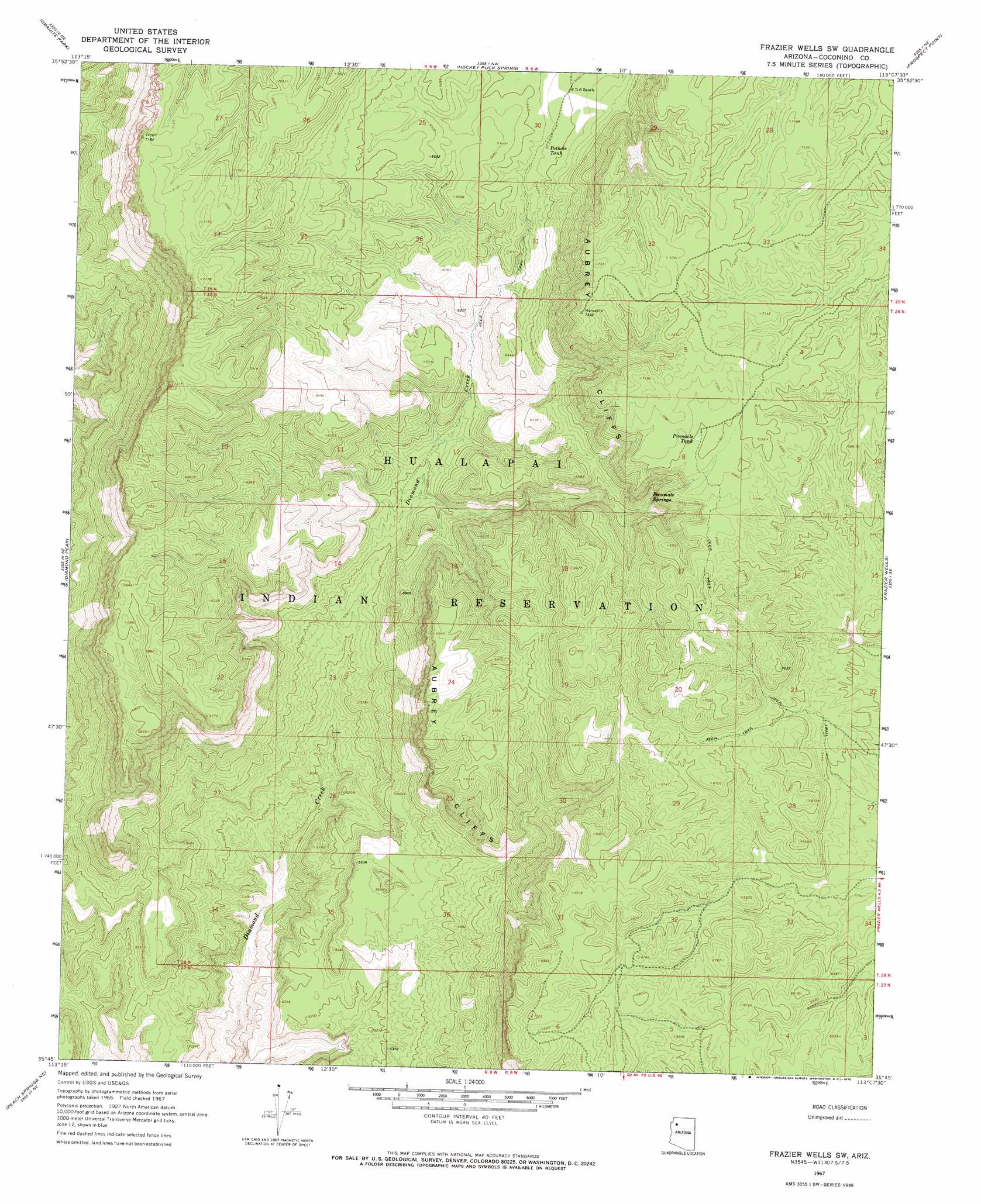
USGS Topo Quad 35113g2 - 1:24,000 scale
| Topo Map Name: | Frazier Wells Sw |
| USGS Topo Quad ID: | 35113g2 |
| Print Size: | ca. 21 1/4" wide x 27" high |
| Southeast Coordinates: | 35.75° N latitude / 113.125° W longitude |
| Map Center Coordinates: | 35.8125° N latitude / 113.1875° W longitude |
| U.S. State: | AZ |
| Filename: | o35113g2.jpg |
| Download Map JPG Image: | Frazier Wells Sw topo map 1:24,000 scale |
| Map Type: | Topographic |
| Topo Series: | 7.5´ |
| Map Scale: | 1:24,000 |
| Source of Map Images: | United States Geological Survey (USGS) |
| Alternate Map Versions: |
Frazier Wells SW AZ 1967, updated 1970 Download PDF Buy paper map Frazier Wells SW AZ 2011 Download PDF Buy paper map Frazier Wells SW AZ 2014 Download PDF Buy paper map |
1:24,000 Topo Quads surrounding Frazier Wells Sw
Whitmore Point Sw |
Whitmore Point Se |
Vulcans Throne Sw |
Vulcans Throne Se |
National Canyon Sw |
Price Point |
Granite Park |
Hockey Puck Spring |
Prospect Point |
National Tank |
Travertine Rapids |
Diamond Peak |
Frazier Wells Sw |
Frazier Wells |
Dike Tank |
Peach Springs Canyon |
Peach Springs Ne |
Robbers Roost Canyon |
Crater Canyon |
Rose Well Camp West |
Peach Springs |
Nelson |
Grand Canyon Caverns |
Big Chief Tank |
Rhodes Canyon |
> Back to 35113e1 at 1:100,000 scale
> Back to 35112a1 at 1:250,000 scale
> Back to U.S. Topo Maps home
Frazier Wells Sw topo map: Gazetteer
Frazier Wells Sw: Reservoirs
Pinnacle Tank elevation 2133m 6998′Pothole Tank elevation 1942m 6371′
Frazier Wells Sw: Springs
Pocomate Springs elevation 1921m 6302′Frazier Wells Sw digital topo map on disk
Buy this Frazier Wells Sw topo map showing relief, roads, GPS coordinates and other geographical features, as a high-resolution digital map file on DVD: