Prospect Point Topo Map Arizona
To zoom in, hover over the map of Prospect Point
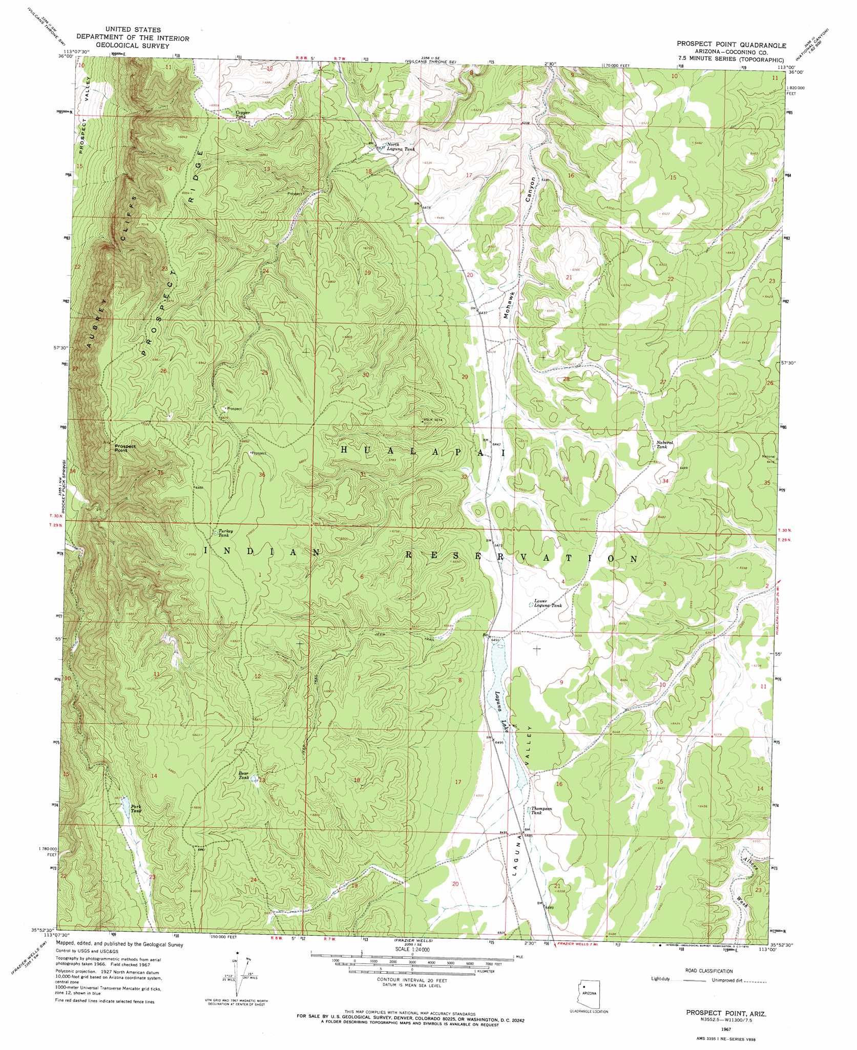
USGS Topo Quad 35113h1 - 1:24,000 scale
| Topo Map Name: | Prospect Point |
| USGS Topo Quad ID: | 35113h1 |
| Print Size: | ca. 21 1/4" wide x 27" high |
| Southeast Coordinates: | 35.875° N latitude / 113° W longitude |
| Map Center Coordinates: | 35.9375° N latitude / 113.0625° W longitude |
| U.S. State: | AZ |
| Filename: | o35113h1.jpg |
| Download Map JPG Image: | Prospect Point topo map 1:24,000 scale |
| Map Type: | Topographic |
| Topo Series: | 7.5´ |
| Map Scale: | 1:24,000 |
| Source of Map Images: | United States Geological Survey (USGS) |
| Alternate Map Versions: |
Prospect Point AZ 1967, updated 1970 Download PDF Buy paper map Prospect Point AZ 2011 Download PDF Buy paper map Prospect Point AZ 2014 Download PDF Buy paper map |
1:24,000 Topo Quads surrounding Prospect Point
Whitmore Point |
Whitmore Rapids |
Vulcans Throne |
Gateway Rapids |
Yunosi Point |
Whitmore Point Se |
Vulcans Throne Sw |
Vulcans Throne Se |
National Canyon Sw |
Higgins Tank |
Granite Park |
Hockey Puck Spring |
Prospect Point |
National Tank |
Supai Camp |
Diamond Peak |
Frazier Wells Sw |
Frazier Wells |
Dike Tank |
Supai Camp Se |
Peach Springs Ne |
Robbers Roost Canyon |
Crater Canyon |
Rose Well Camp West |
Rose Well Camp East |
> Back to 35113e1 at 1:100,000 scale
> Back to 35112a1 at 1:250,000 scale
> Back to U.S. Topo Maps home
Prospect Point topo map: Gazetteer
Prospect Point: Lakes
Laguna Lake elevation 1982m 6502′Prospect Point: Reservoirs
Bear Tank elevation 2056m 6745′Copper Tank elevation 2111m 6925′
Lower Laguna Tank elevation 1975m 6479′
Natural Tank elevation 1984m 6509′
North Laguna Tank elevation 1971m 6466′
Park Tank elevation 2020m 6627′
Thompson Tank elevation 1982m 6502′
Turkey Tank elevation 2116m 6942′
Prospect Point: Ridges
Prospect Ridge elevation 2119m 6952′Prospect Point: Summits
Prospect Point elevation 2098m 6883′Prospect Point: Valleys
Laguna Valley elevation 1970m 6463′Prospect Point digital topo map on disk
Buy this Prospect Point topo map showing relief, roads, GPS coordinates and other geographical features, as a high-resolution digital map file on DVD: