Bridge Canyon Topo Map Nevada
To zoom in, hover over the map of Bridge Canyon
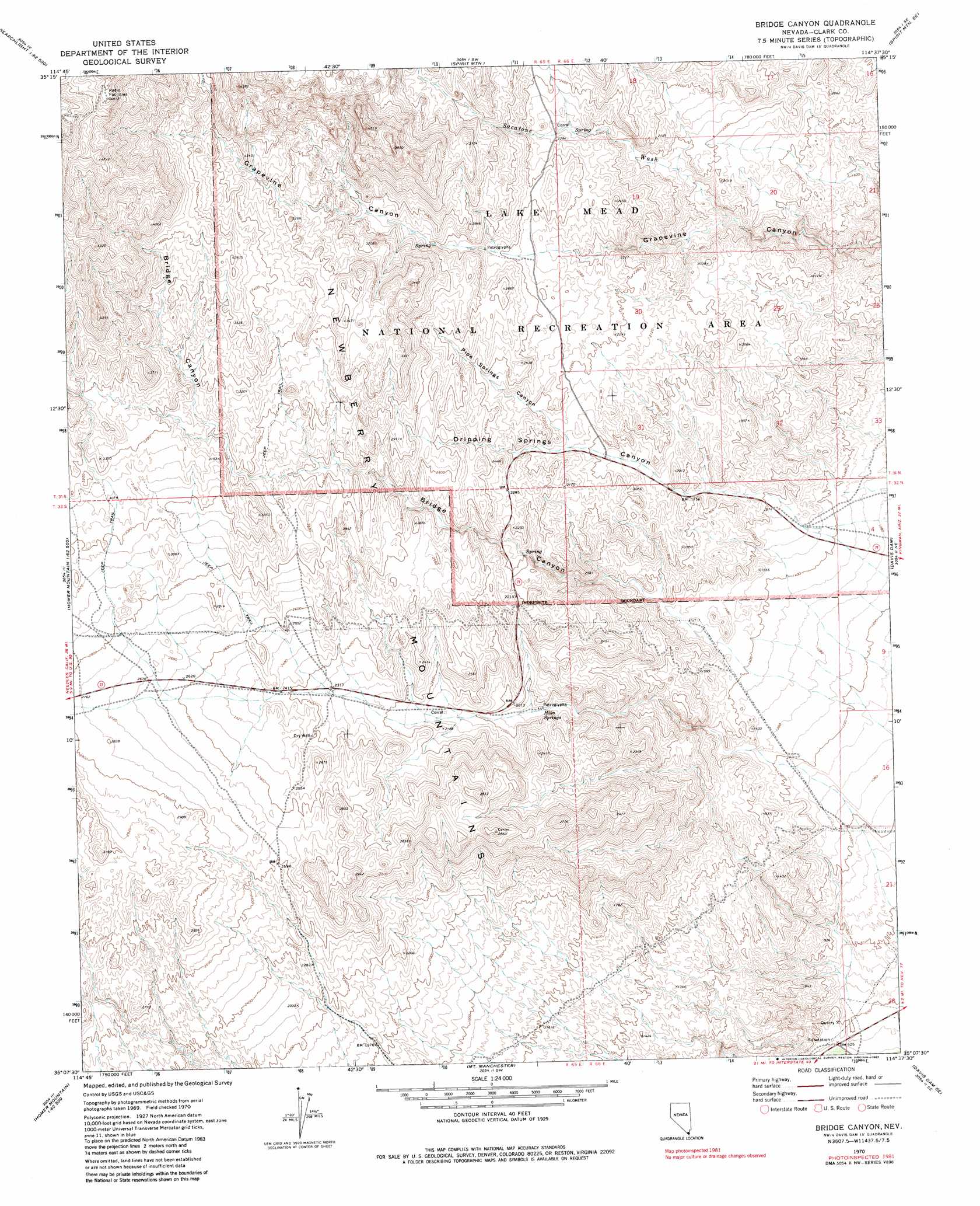
USGS Topo Quad 35114b6 - 1:24,000 scale
| Topo Map Name: | Bridge Canyon |
| USGS Topo Quad ID: | 35114b6 |
| Print Size: | ca. 21 1/4" wide x 27" high |
| Southeast Coordinates: | 35.125° N latitude / 114.625° W longitude |
| Map Center Coordinates: | 35.1875° N latitude / 114.6875° W longitude |
| U.S. State: | NV |
| Filename: | o35114b6.jpg |
| Download Map JPG Image: | Bridge Canyon topo map 1:24,000 scale |
| Map Type: | Topographic |
| Topo Series: | 7.5´ |
| Map Scale: | 1:24,000 |
| Source of Map Images: | United States Geological Survey (USGS) |
| Alternate Map Versions: |
Bridge Canyon NV 1970, updated 1973 Download PDF Buy paper map Bridge Canyon NV 1970, updated 1983 Download PDF Buy paper map Bridge Canyon NV 2012 Download PDF Buy paper map Bridge Canyon NV 2015 Download PDF Buy paper map |
1:24,000 Topo Quads surrounding Bridge Canyon
Searchlight |
Fourth Of July Mountain |
Spirit Mountain Nw |
Spirit Mountain Ne |
Grasshopper Junction Nw |
Tenmile Well |
Searchlight Se |
Spirit Mountain |
Spirit Mountain Se |
Burns Spring |
West Of Juniper Mine |
Juniper Mine |
Bridge Canyon |
Davis Dam |
Union Pass |
Homer Mountain |
East Of Homer Mountain |
Mount Manchester |
Davis Dam Se |
Oatman |
Homer |
Bannock |
Needles Nw |
Needles Ne |
Boundary Cone |
> Back to 35114a1 at 1:100,000 scale
> Back to 35114a1 at 1:250,000 scale
> Back to U.S. Topo Maps home
Bridge Canyon topo map: Gazetteer
Bridge Canyon: Ranges
Newberry Mountains elevation 794m 2604′Bridge Canyon: Springs
Dripping Spring elevation 617m 2024′Hiko Springs elevation 578m 1896′
Moss Spring elevation 794m 2604′
Quail Spring elevation 728m 2388′
Rats Nest Spring elevation 1290m 4232′
Rattlesnake Spring elevation 1045m 3428′
Sacatone Spring elevation 674m 2211′
Bridge Canyon: Streams
Sacatone Wash elevation 502m 1646′Bridge Canyon: Summits
Conical Peak elevation 838m 2749′Little Peak elevation 1466m 4809′
Middle Peak elevation 1244m 4081′
Bridge Canyon: Valleys
Bridge Canyon elevation 427m 1400′Dripping Springs Canyon elevation 451m 1479′
Pipe Springs Canyon elevation 630m 2066′
Sacatone Canyon elevation 497m 1630′
Bridge Canyon: Wells
Firpos Well elevation 733m 2404′Bridge Canyon digital topo map on disk
Buy this Bridge Canyon topo map showing relief, roads, GPS coordinates and other geographical features, as a high-resolution digital map file on DVD:
Southern Sierra Nevada, California & Southern Nevada
Buy digital topo maps: Southern Sierra Nevada, California & Southern Nevada