Juniper Mine Topo Map Nevada
To zoom in, hover over the map of Juniper Mine
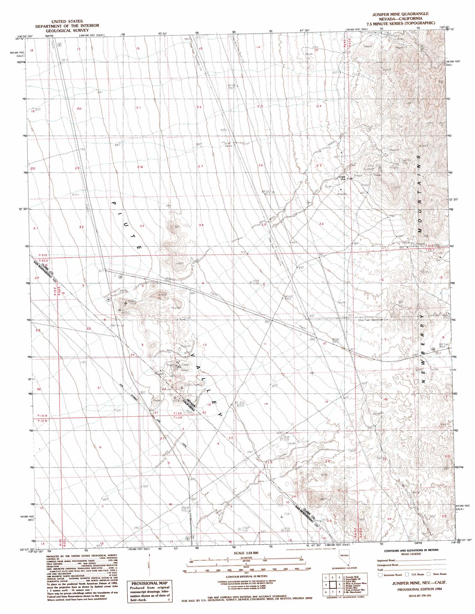
USGS Topo Quad 35114b7 - 1:24,000 scale
| Topo Map Name: | Juniper Mine |
| USGS Topo Quad ID: | 35114b7 |
| Print Size: | ca. 21 1/4" wide x 27" high |
| Southeast Coordinates: | 35.125° N latitude / 114.75° W longitude |
| Map Center Coordinates: | 35.1875° N latitude / 114.8125° W longitude |
| U.S. States: | NV, CA |
| Filename: | o35114b7.jpg |
| Download Map JPG Image: | Juniper Mine topo map 1:24,000 scale |
| Map Type: | Topographic |
| Topo Series: | 7.5´ |
| Map Scale: | 1:24,000 |
| Source of Map Images: | United States Geological Survey (USGS) |
| Alternate Map Versions: |
Juniper Mine NV 1984, updated 1984 Download PDF Buy paper map Juniper Mine NV 2012 Download PDF Buy paper map Juniper Mine NV 2014 Download PDF Buy paper map |
1:24,000 Topo Quads surrounding Juniper Mine
Hopps Well |
Searchlight |
Fourth Of July Mountain |
Spirit Mountain Nw |
Spirit Mountain Ne |
Hart Peak |
Tenmile Well |
Searchlight Se |
Spirit Mountain |
Spirit Mountain Se |
East Of Grotto Hills |
West Of Juniper Mine |
Juniper Mine |
Bridge Canyon |
Davis Dam |
Signal Hill |
Homer Mountain |
East Of Homer Mountain |
Mount Manchester |
Davis Dam Se |
Goffs |
Homer |
Bannock |
Needles Nw |
Needles Ne |
> Back to 35114a1 at 1:100,000 scale
> Back to 35114a1 at 1:250,000 scale
> Back to U.S. Topo Maps home
Juniper Mine topo map: Gazetteer
Juniper Mine: Mines
Chiquita Mine elevation 820m 2690′Cottonwood Mine elevation 1158m 3799′
Juniper Mine elevation 1061m 3480′
Leadville Mine elevation 807m 2647′
Juniper Mine: Populated Places
Kerwin Camp (historical) elevation 840m 2755′Juniper Mine: Ranges
Chiquita Hills elevation 797m 2614′Juniper Mine: Springs
Juniper Spring elevation 1047m 3435′Juniper Mine digital topo map on disk
Buy this Juniper Mine topo map showing relief, roads, GPS coordinates and other geographical features, as a high-resolution digital map file on DVD:
Southern Sierra Nevada, California & Southern Nevada
Buy digital topo maps: Southern Sierra Nevada, California & Southern Nevada