Mount Tipton Se Topo Map Arizona
To zoom in, hover over the map of Mount Tipton Se
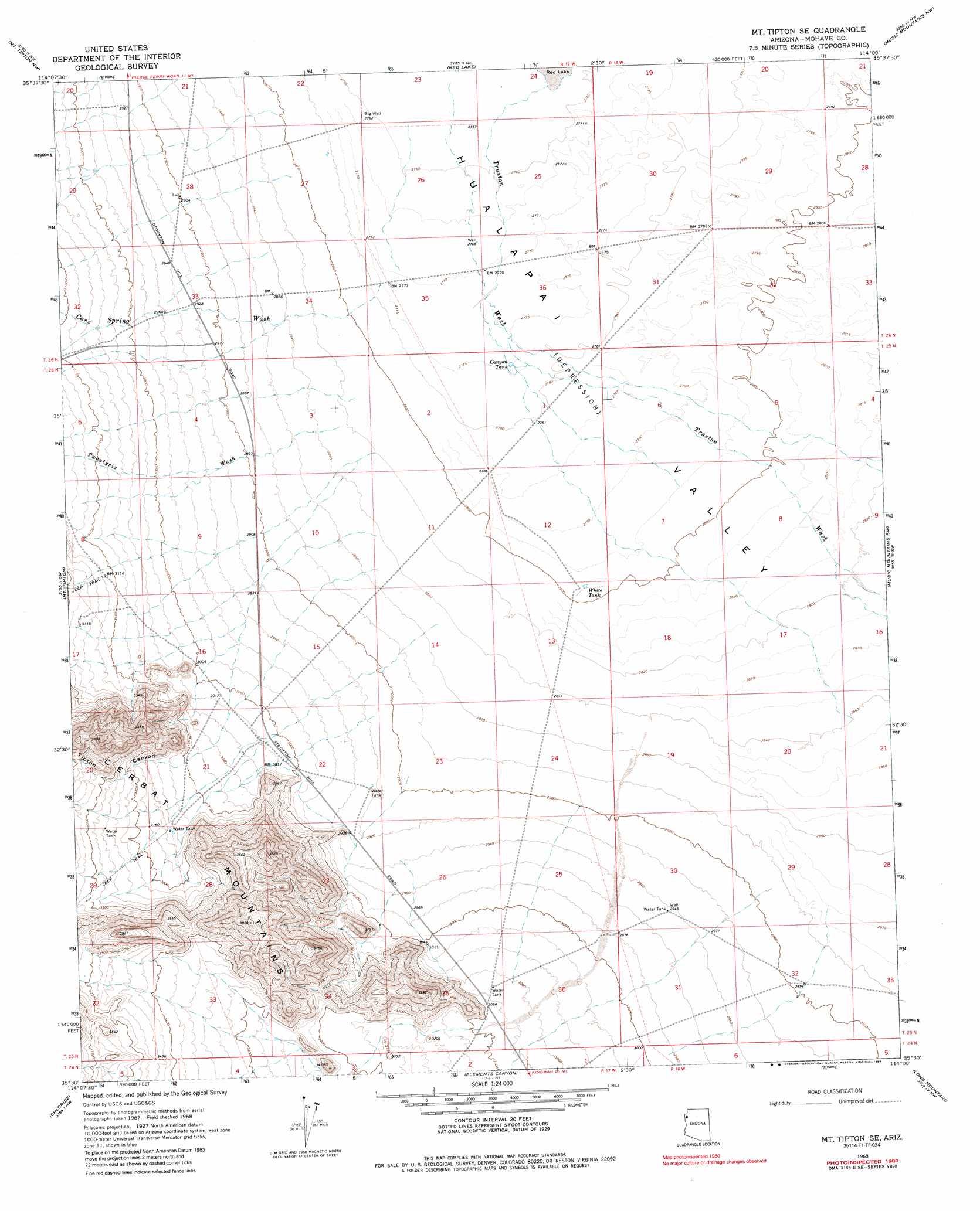
USGS Topo Quad 35114e1 - 1:24,000 scale
| Topo Map Name: | Mount Tipton Se |
| USGS Topo Quad ID: | 35114e1 |
| Print Size: | ca. 21 1/4" wide x 27" high |
| Southeast Coordinates: | 35.5° N latitude / 114° W longitude |
| Map Center Coordinates: | 35.5625° N latitude / 114.0625° W longitude |
| U.S. State: | AZ |
| Filename: | o35114e1.jpg |
| Download Map JPG Image: | Mount Tipton Se topo map 1:24,000 scale |
| Map Type: | Topographic |
| Topo Series: | 7.5´ |
| Map Scale: | 1:24,000 |
| Source of Map Images: | United States Geological Survey (USGS) |
| Alternate Map Versions: |
Mt. Tipton SE AZ 1968, updated 1971 Download PDF Buy paper map Mt. Tipton SE AZ 1968, updated 1985 Download PDF Buy paper map Mount Tipton SE AZ 2011 Download PDF Buy paper map Mount Tipton SE AZ 2014 Download PDF Buy paper map |
1:24,000 Topo Quads surrounding Mount Tipton Se
Senator Mountain |
Gold Basin |
Garnet Mountain |
Quartermaster Canyon Sw |
Horse Flat |
White Hills East |
Mount Tipton Nw |
Red Lake |
Music Mountains Nw |
Music Mountains Ne |
Dolan Springs |
Mount Tipton |
Mount Tipton Se |
Music Mountains Sw |
Music Mountains Se |
Grasshopper Junction |
Chloride |
Elements Canyon |
Long Mountain |
Antares |
Grasshopper Junction Se |
Cerbat |
Stockton Hill |
Kingman Airport |
Peacock Peak |
> Back to 35114e1 at 1:100,000 scale
> Back to 35114a1 at 1:250,000 scale
> Back to U.S. Topo Maps home
Mount Tipton Se topo map: Gazetteer
Mount Tipton Se: Reservoirs
Canyon Tank elevation 847m 2778′White Tank elevation 854m 2801′
Mount Tipton Se: Streams
Cane Spring Wash elevation 847m 2778′Truxton Wash elevation 839m 2752′
Twentysix Wash elevation 862m 2828′
Mount Tipton Se: Valleys
Tipton Canyon elevation 945m 3100′Mount Tipton Se digital topo map on disk
Buy this Mount Tipton Se topo map showing relief, roads, GPS coordinates and other geographical features, as a high-resolution digital map file on DVD:
Southern Sierra Nevada, California & Southern Nevada
Buy digital topo maps: Southern Sierra Nevada, California & Southern Nevada