Mount Tipton Topo Map Arizona
To zoom in, hover over the map of Mount Tipton
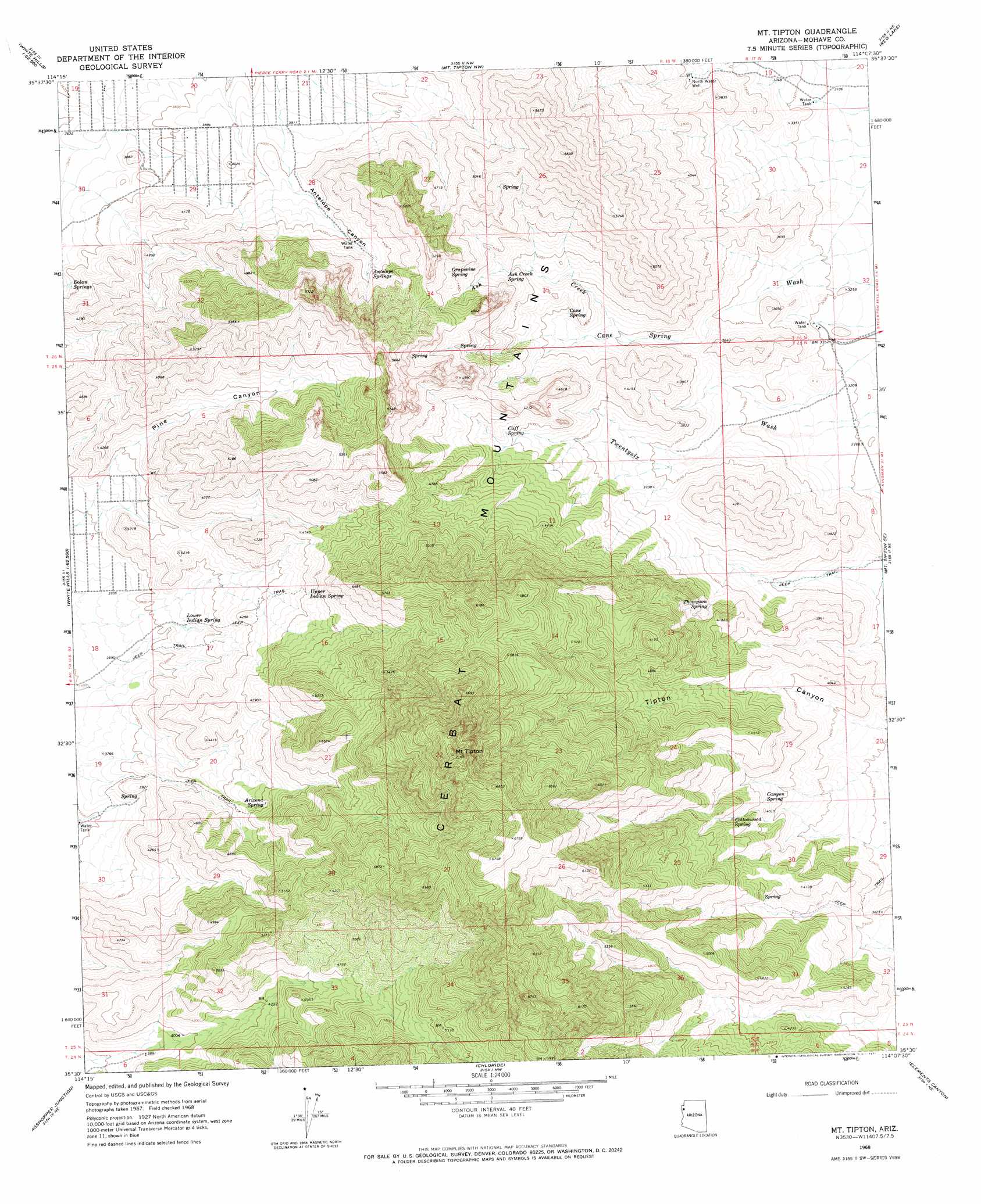
USGS Topo Quad 35114e2 - 1:24,000 scale
| Topo Map Name: | Mount Tipton |
| USGS Topo Quad ID: | 35114e2 |
| Print Size: | ca. 21 1/4" wide x 27" high |
| Southeast Coordinates: | 35.5° N latitude / 114.125° W longitude |
| Map Center Coordinates: | 35.5625° N latitude / 114.1875° W longitude |
| U.S. State: | AZ |
| Filename: | o35114e2.jpg |
| Download Map JPG Image: | Mount Tipton topo map 1:24,000 scale |
| Map Type: | Topographic |
| Topo Series: | 7.5´ |
| Map Scale: | 1:24,000 |
| Source of Map Images: | United States Geological Survey (USGS) |
| Alternate Map Versions: |
Mt. Tipton AZ 1968, updated 1971 Download PDF Buy paper map Mount Tipton AZ 2011 Download PDF Buy paper map Mount Tipton AZ 2014 Download PDF Buy paper map |
1:24,000 Topo Quads surrounding Mount Tipton
Senator Mountain Sw |
Senator Mountain |
Gold Basin |
Garnet Mountain |
Quartermaster Canyon Sw |
White Hills West |
White Hills East |
Mount Tipton Nw |
Red Lake |
Music Mountains Nw |
Middle Water Spring |
Dolan Springs |
Mount Tipton |
Mount Tipton Se |
Music Mountains Sw |
Grasshopper Junction Nw |
Grasshopper Junction |
Chloride |
Elements Canyon |
Long Mountain |
Burns Spring |
Grasshopper Junction Se |
Cerbat |
Stockton Hill |
Kingman Airport |
> Back to 35114e1 at 1:100,000 scale
> Back to 35114a1 at 1:250,000 scale
> Back to U.S. Topo Maps home
Mount Tipton topo map: Gazetteer
Mount Tipton: Springs
Antelope Springs elevation 1331m 4366′Arizona Spring elevation 1338m 4389′
Ash Creek Spring elevation 1229m 4032′
Cane Spring elevation 1156m 3792′
Canyon Spring elevation 1198m 3930′
Cliff Spring elevation 1237m 4058′
Cottonwood Spring elevation 1255m 4117′
Dolan Springs elevation 1143m 3750′
Grapevine Spring elevation 1384m 4540′
Lower Indian Spring elevation 1183m 3881′
Thompson Spring elevation 1144m 3753′
Upper Indian Spring elevation 1351m 4432′
Mount Tipton: Streams
Ash Creek elevation 1089m 3572′Mount Tipton: Summits
Mount Tipton elevation 2177m 7142′Mount Tipton: Valleys
Antelope Canyon elevation 1208m 3963′Pine Canyon elevation 1220m 4002′
Mount Tipton: Wells
North Water Well elevation 1088m 3569′Mount Tipton digital topo map on disk
Buy this Mount Tipton topo map showing relief, roads, GPS coordinates and other geographical features, as a high-resolution digital map file on DVD:
Southern Sierra Nevada, California & Southern Nevada
Buy digital topo maps: Southern Sierra Nevada, California & Southern Nevada