Dolan Springs Topo Map Arizona
To zoom in, hover over the map of Dolan Springs
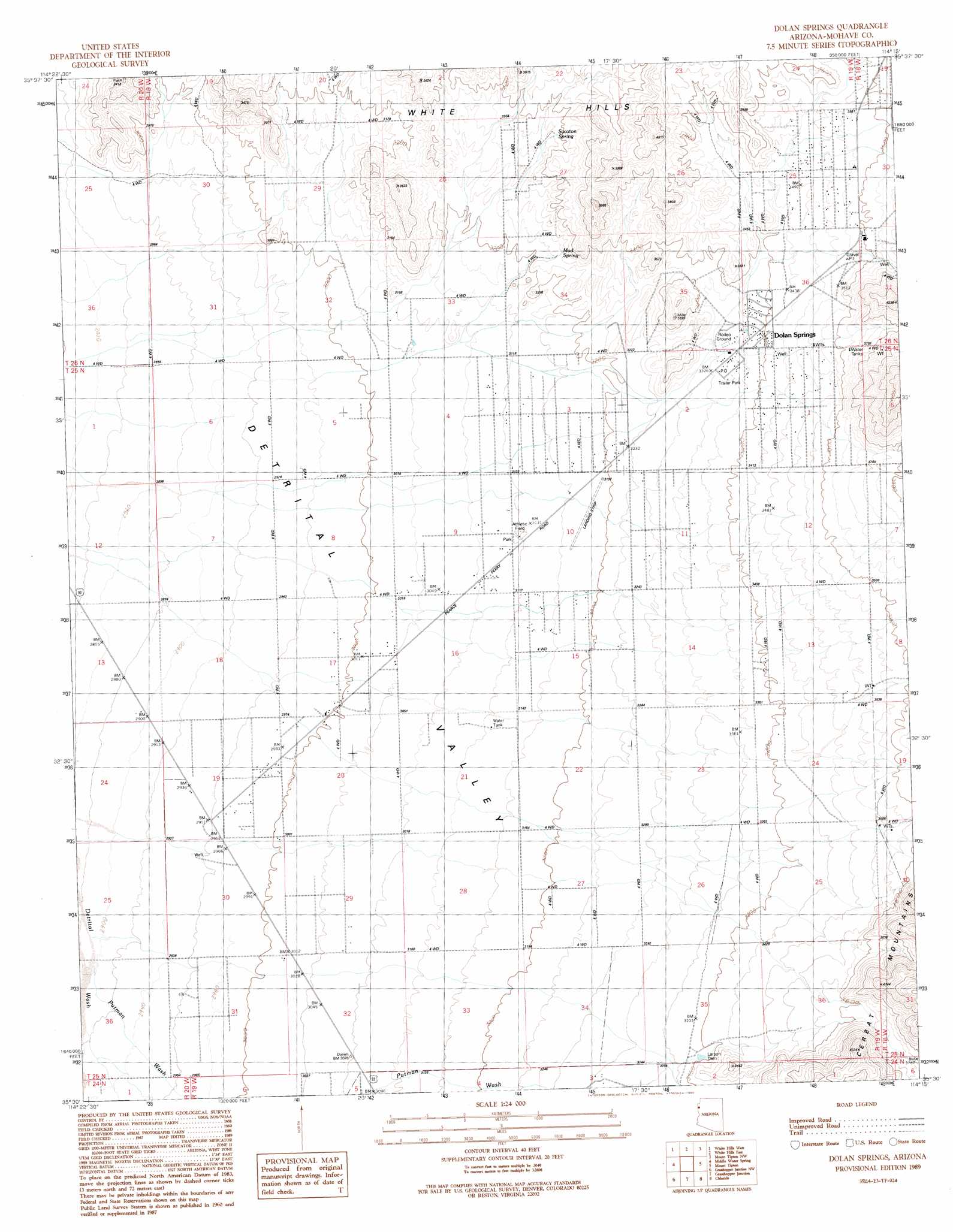
USGS Topo Quad 35114e3 - 1:24,000 scale
| Topo Map Name: | Dolan Springs |
| USGS Topo Quad ID: | 35114e3 |
| Print Size: | ca. 21 1/4" wide x 27" high |
| Southeast Coordinates: | 35.5° N latitude / 114.25° W longitude |
| Map Center Coordinates: | 35.5625° N latitude / 114.3125° W longitude |
| U.S. State: | AZ |
| Filename: | o35114e3.jpg |
| Download Map JPG Image: | Dolan Springs topo map 1:24,000 scale |
| Map Type: | Topographic |
| Topo Series: | 7.5´ |
| Map Scale: | 1:24,000 |
| Source of Map Images: | United States Geological Survey (USGS) |
| Alternate Map Versions: |
Dolan Springs AZ 1989, updated 1990 Download PDF Buy paper map Dolan Springs AZ 2011 Download PDF Buy paper map Dolan Springs AZ 2014 Download PDF Buy paper map |
1:24,000 Topo Quads surrounding Dolan Springs
Housholder Pass |
Senator Mountain Sw |
Senator Mountain |
Gold Basin |
Garnet Mountain |
Mohave Mine |
White Hills West |
White Hills East |
Mount Tipton Nw |
Red Lake |
Mount Perkins |
Middle Water Spring |
Dolan Springs |
Mount Tipton |
Mount Tipton Se |
Spirit Mountain Ne |
Grasshopper Junction Nw |
Grasshopper Junction |
Chloride |
Elements Canyon |
Spirit Mountain Se |
Burns Spring |
Grasshopper Junction Se |
Cerbat |
Stockton Hill |
> Back to 35114e1 at 1:100,000 scale
> Back to 35114a1 at 1:250,000 scale
> Back to U.S. Topo Maps home
Dolan Springs topo map: Gazetteer
Dolan Springs: Airports
Lake Mohave Ranchos Airport elevation 968m 3175′Dolan Springs: Dams
Larson Dam elevation 1028m 3372′Dolan Springs: Populated Places
Dolan Springs elevation 1026m 3366′Dolan Springs: Post Offices
Dolan Springs Post Office elevation 1013m 3323′Dolan Springs: Reservoirs
Number One Trough Tank elevation 995m 3264′Dolan Springs: Springs
Mud Spring elevation 987m 3238′Sacaton Spring elevation 0m 0′
Dolan Springs: Streams
Putman Wash elevation 887m 2910′Dolan Springs digital topo map on disk
Buy this Dolan Springs topo map showing relief, roads, GPS coordinates and other geographical features, as a high-resolution digital map file on DVD:
Southern Sierra Nevada, California & Southern Nevada
Buy digital topo maps: Southern Sierra Nevada, California & Southern Nevada