Mount Tipton Nw Topo Map Arizona
To zoom in, hover over the map of Mount Tipton Nw
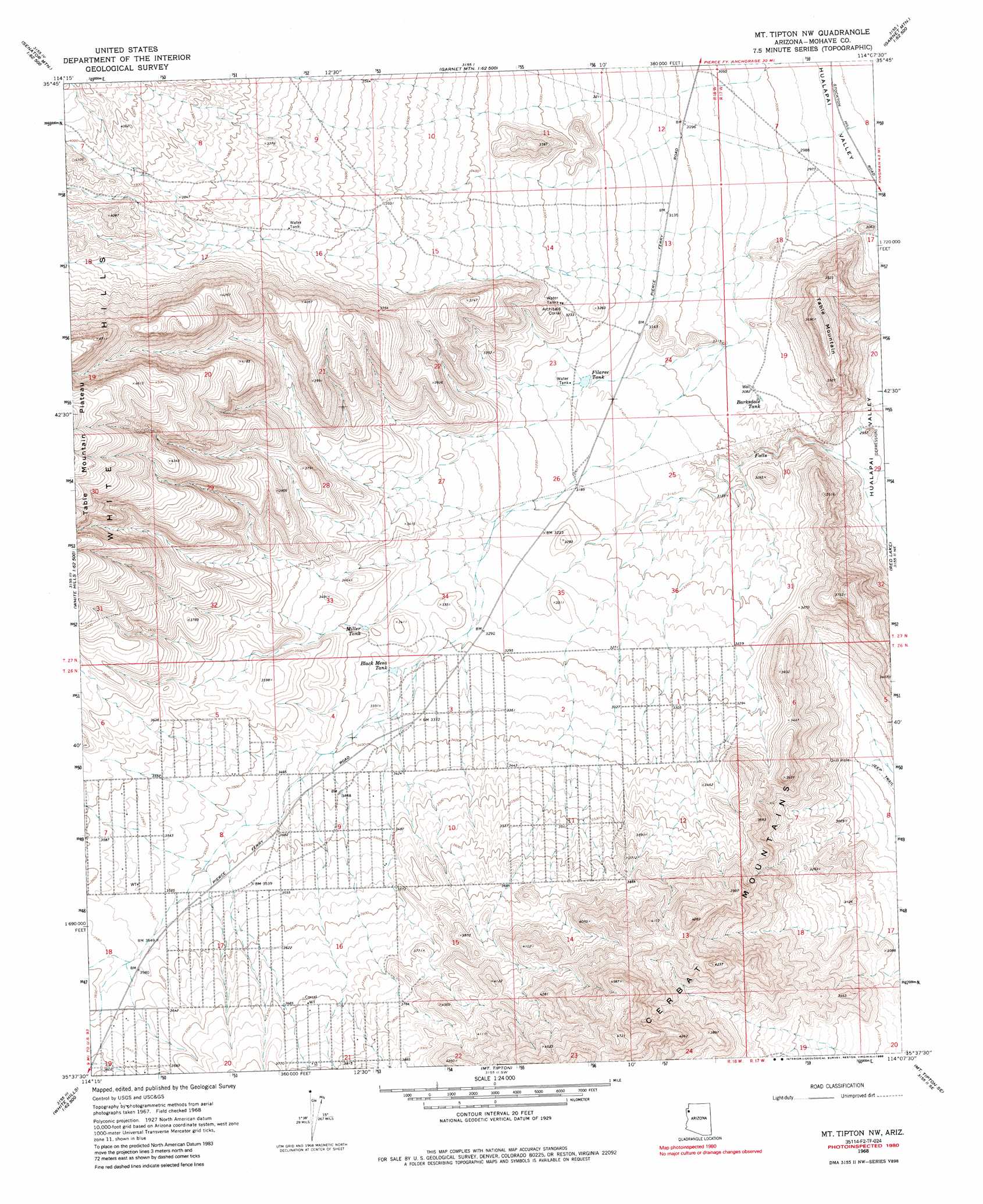
USGS Topo Quad 35114f2 - 1:24,000 scale
| Topo Map Name: | Mount Tipton Nw |
| USGS Topo Quad ID: | 35114f2 |
| Print Size: | ca. 21 1/4" wide x 27" high |
| Southeast Coordinates: | 35.625° N latitude / 114.125° W longitude |
| Map Center Coordinates: | 35.6875° N latitude / 114.1875° W longitude |
| U.S. State: | AZ |
| Filename: | o35114f2.jpg |
| Download Map JPG Image: | Mount Tipton Nw topo map 1:24,000 scale |
| Map Type: | Topographic |
| Topo Series: | 7.5´ |
| Map Scale: | 1:24,000 |
| Source of Map Images: | United States Geological Survey (USGS) |
| Alternate Map Versions: |
Mt. Tipton NW AZ 1968, updated 1971 Download PDF Buy paper map Mt. Tipton NW AZ 1968, updated 1986 Download PDF Buy paper map Mount Tipton NW AZ 2011 Download PDF Buy paper map Mount Tipton NW AZ 2014 Download PDF Buy paper map |
1:24,000 Topo Quads surrounding Mount Tipton Nw
Senator Mountain Nw |
Senator Mountain Ne |
Garnet Mountain Nw |
Meadview South |
Grapevine Canyon |
Senator Mountain Sw |
Senator Mountain |
Gold Basin |
Garnet Mountain |
Quartermaster Canyon Sw |
White Hills West |
White Hills East |
Mount Tipton Nw |
Red Lake |
Music Mountains Nw |
Middle Water Spring |
Dolan Springs |
Mount Tipton |
Mount Tipton Se |
Music Mountains Sw |
Grasshopper Junction Nw |
Grasshopper Junction |
Chloride |
Elements Canyon |
Long Mountain |
> Back to 35114e1 at 1:100,000 scale
> Back to 35114a1 at 1:250,000 scale
> Back to U.S. Topo Maps home
Mount Tipton Nw topo map: Gazetteer
Mount Tipton Nw: Reservoirs
Barksdale Tank elevation 937m 3074′Black Mesa Tank elevation 1020m 3346′
Filarea Tank elevation 958m 3143′
Miller Tank elevation 1029m 3375′
Mount Tipton Nw: Summits
Table Mountain elevation 1119m 3671′Mount Tipton Nw digital topo map on disk
Buy this Mount Tipton Nw topo map showing relief, roads, GPS coordinates and other geographical features, as a high-resolution digital map file on DVD:
Southern Sierra Nevada, California & Southern Nevada
Buy digital topo maps: Southern Sierra Nevada, California & Southern Nevada