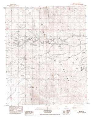
Nelson Topo Map Nevada
To zoom in, hover over the map of Nelson
USGS Topo Quad 35114f7 - 1:24,000 scale
| Topo Map Name: | Nelson |
| USGS Topo Quad ID: | 35114f7 |
| Print Size: | ca. 21 1/4" wide x 27" high |
| Southeast Coordinates: | 35.625° N latitude / 114.75° W longitude |
| Map Center Coordinates: | 35.6875° N latitude / 114.8125° W longitude |
| U.S. State: | NV |
| Filename: | o35114f7.jpg |
| Download Map JPG Image: | Nelson topo map 1:24,000 scale |
| Map Type: | Topographic |
| Topo Series: | 7.5´ |
| Map Scale: | 1:24,000 |
| Source of Map Images: | United States Geological Survey (USGS) |
| Alternate Map Versions: |
Nelson NV 1984, updated 1984 Download PDF Buy paper map Nelson NV 2012 Download PDF Buy paper map Nelson NV 2014 Download PDF Buy paper map |
1:24,000 Topo Quads surrounding Nelson
> Back to 35114e1 at 1:100,000 scale
> Back to 35114a1 at 1:250,000 scale
> Back to U.S. Topo Maps home
Nelson topo map: Gazetteer
Nelson: Arches
Murl Emery Arch elevation 1021m 3349′Nelson: Arroyos
Gracy Wash elevation 973m 3192′Nelson: Mines
Bell Mine elevation 496m 1627′Belmont-Phoenix Mine elevation 1256m 4120′
Black Hawk Mine elevation 1029m 3375′
Capitol Hill Mine elevation 557m 1827′
Carnation Mine elevation 1059m 3474′
Combination Mine elevation 1352m 4435′
Dolores Mine elevation 1132m 3713′
Duncan Mine elevation 697m 2286′
Eldorado Crown Mines elevation 655m 2148′
Eldorado Empire Mines elevation 1044m 3425′
Eldorado Rand Mines elevation 1189m 3900′
Eldorado Rover Mines elevation 710m 2329′
Gettysburg Mine elevation 787m 2582′
Golden Empire Mine elevation 1337m 4386′
Honest Miner Mine elevation 1204m 3950′
Jubilee Mine elevation 664m 2178′
Magnolia Mine elevation 1129m 3704′
McKinley Mine elevation 1151m 3776′
Mockingbird Mine elevation 1129m 3704′
Morning Star Mine elevation 841m 2759′
Nevada Eagle Mine elevation 480m 1574′
Occidental Mine elevation 1221m 4005′
Oro Plata Mine elevation 1151m 3776′
Patsy Mine elevation 1057m 3467′
Quaker City Mine elevation 1247m 4091′
Rand Mine elevation 1194m 3917′
Rich Hill Mine elevation 1279m 4196′
Silver Legion Mine elevation 1261m 4137′
Solar Mine elevation 1173m 3848′
Techatticup Mine elevation 755m 2477′
Wall Street Mine elevation 1043m 3421′
Wall Street Mine elevation 1049m 3441′
Nelson: Populated Places
Camp Booth (historical) elevation 967m 3172′Camp Duncan (historical) elevation 769m 2522′
Lucky Jim Camp elevation 745m 2444′
Marie Camp elevation 870m 2854′
Nelson elevation 907m 2975′
Nelson: Post Offices
Nelson Post Office (historical) elevation 923m 3028′Nelson: Springs
Bridge Spring elevation 1036m 3398′Eldorado Rover Spring elevation 1299m 4261′
Huse Spring elevation 787m 2582′
Knob Hill Spring elevation 1318m 4324′
Miners Spring elevation 655m 2148′
Tule Spring elevation 1177m 3861′
Nelson: Streams
January Wash elevation 724m 2375′Morning Star Wash elevation 543m 1781′
Nelson: Summits
Knob Hill elevation 1348m 4422′Mount Duncan elevation 831m 2726′
Nelson: Valleys
Copper Canyon elevation 854m 2801′Nelson digital topo map on disk
Buy this Nelson topo map showing relief, roads, GPS coordinates and other geographical features, as a high-resolution digital map file on DVD:
Southern Sierra Nevada, California & Southern Nevada
Buy digital topo maps: Southern Sierra Nevada, California & Southern Nevada


