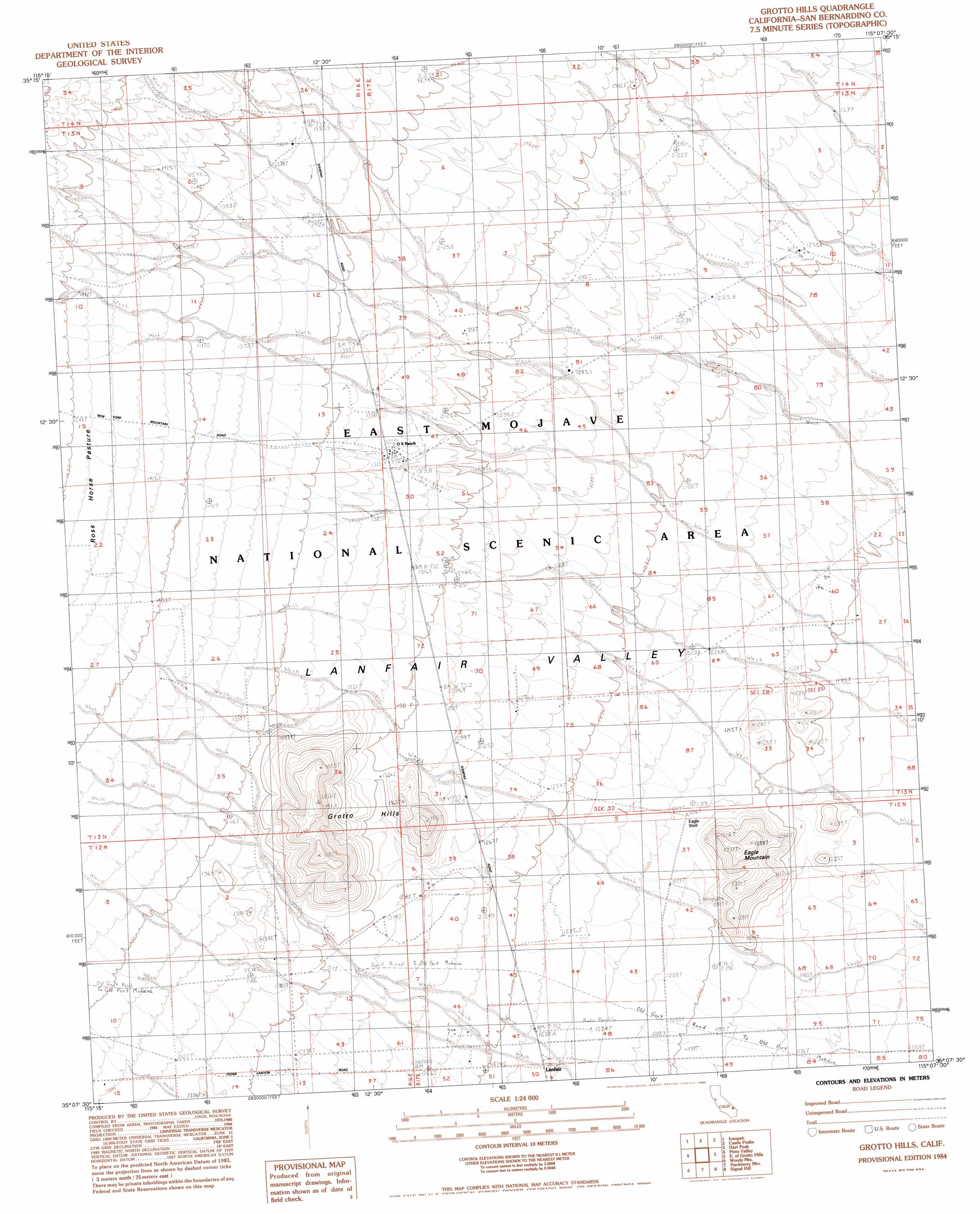
Grotto Hills Topo Map California
To zoom in, hover over the map of Grotto Hills
USGS Topo Quad 35115b2 - 1:24,000 scale
| Topo Map Name: | Grotto Hills |
| USGS Topo Quad ID: | 35115b2 |
| Print Size: | ca. 21 1/4" wide x 27" high |
| Southeast Coordinates: | 35.125° N latitude / 115.125° W longitude |
| Map Center Coordinates: | 35.1875° N latitude / 115.1875° W longitude |
| U.S. State: | CA |
| Filename: | o35115b2.jpg |
| Download Map JPG Image: | Grotto Hills topo map 1:24,000 scale |
| Map Type: | Topographic |
| Topo Series: | 7.5´ |
| Map Scale: | 1:24,000 |
| Source of Map Images: | United States Geological Survey (USGS) |
| Alternate Map Versions: |
Grotto Hills CA 1984, updated 1984 Download PDF Buy paper map Grotto Hills CA 2012 Download PDF Buy paper map Grotto Hills CA 2015 Download PDF Buy paper map |
1:24,000 Topo Quads surrounding Grotto Hills
Mineral Hill |
Nipton |
Crescent Peak |
Hopps Well |
Searchlight |
Joshua |
Ivanpah |
Castle Peaks |
Hart Peak |
Tenmile Well |
Mid Hills |
Pinto Valley |
Grotto Hills |
East Of Grotto Hills |
West Of Juniper Mine |
Columbia Mountain |
Woods Mountains |
Hackberry Mountain |
Signal Hill |
Homer Mountain |
Colton Well |
Desert Spring |
Fenner Hills |
Goffs |
Homer |
> Back to 35115a1 at 1:100,000 scale
> Back to 35114a1 at 1:250,000 scale
> Back to U.S. Topo Maps home
Grotto Hills topo map: Gazetteer
Grotto Hills: Populated Places
Lanfair elevation 1233m 4045′Grotto Hills: Summits
Grotto Hills elevation 1491m 4891′Lanfair Buttes elevation 1328m 4356′
Grotto Hills: Wells
Eagle Well elevation 1216m 3989′Grotto Hills digital topo map on disk
Buy this Grotto Hills topo map showing relief, roads, GPS coordinates and other geographical features, as a high-resolution digital map file on DVD:
Southern Sierra Nevada, California & Southern Nevada
Buy digital topo maps: Southern Sierra Nevada, California & Southern Nevada