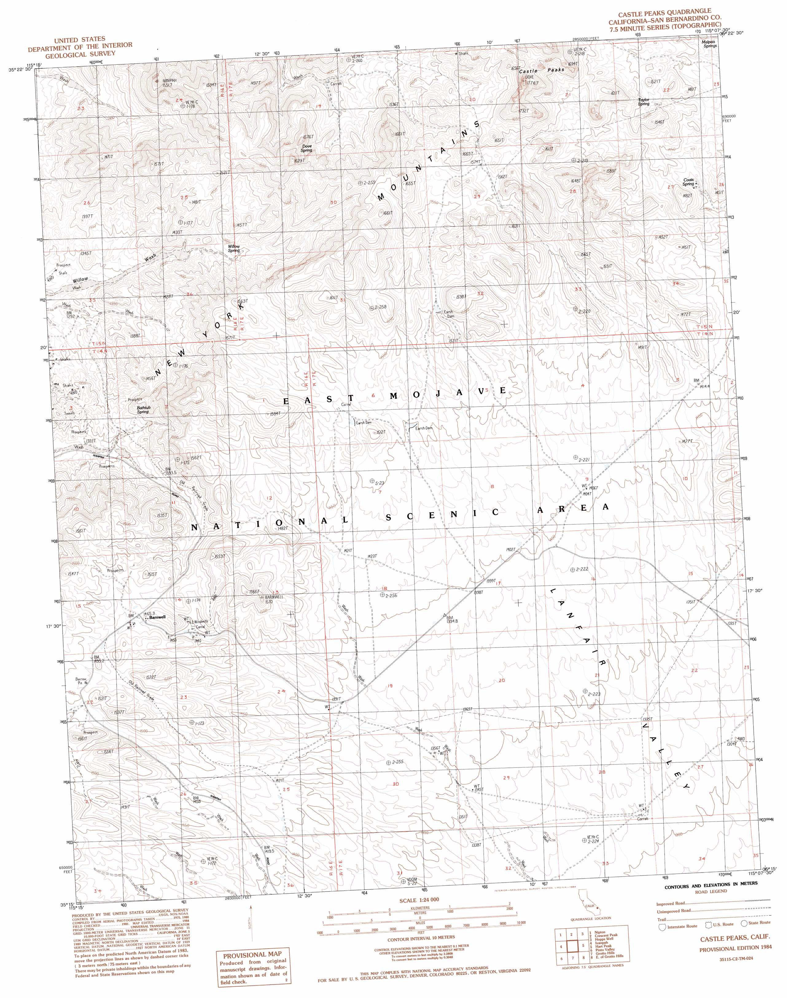
Castle Peaks Topo Map California
To zoom in, hover over the map of Castle Peaks
USGS Topo Quad 35115c2 - 1:24,000 scale
| Topo Map Name: | Castle Peaks |
| USGS Topo Quad ID: | 35115c2 |
| Print Size: | ca. 21 1/4" wide x 27" high |
| Southeast Coordinates: | 35.25° N latitude / 115.125° W longitude |
| Map Center Coordinates: | 35.3125° N latitude / 115.1875° W longitude |
| U.S. State: | CA |
| Filename: | o35115c2.jpg |
| Download Map JPG Image: | Castle Peaks topo map 1:24,000 scale |
| Map Type: | Topographic |
| Topo Series: | 7.5´ |
| Map Scale: | 1:24,000 |
| Source of Map Images: | United States Geological Survey (USGS) |
| Alternate Map Versions: |
Castle Peaks CA 1984, updated 1984 Download PDF Buy paper map Castle Peaks CA 2012 Download PDF Buy paper map Castle Peaks CA 2015 Download PDF Buy paper map |
1:24,000 Topo Quads surrounding Castle Peaks
Ivanpah Lake |
Desert |
Mccullough Mountain |
Highland Spring |
Nelson Sw |
Mineral Hill |
Nipton |
Crescent Peak |
Hopps Well |
Searchlight |
Joshua |
Ivanpah |
Castle Peaks |
Hart Peak |
Tenmile Well |
Mid Hills |
Pinto Valley |
Grotto Hills |
East Of Grotto Hills |
West Of Juniper Mine |
Columbia Mountain |
Woods Mountains |
Hackberry Mountain |
Signal Hill |
Homer Mountain |
> Back to 35115a1 at 1:100,000 scale
> Back to 35114a1 at 1:250,000 scale
> Back to U.S. Topo Maps home
Castle Peaks topo map: Gazetteer
Castle Peaks: Airports
Hart Mine Airport elevation 1388m 4553′Castle Peaks: Populated Places
Barnwell elevation 1465m 4806′Castle Peaks: Ranges
New York Mountains elevation 1559m 5114′New York Mountains elevation 1559m 5114′
Castle Peaks: Springs
Bathtub Spring elevation 1396m 4580′Coats Spring elevation 1413m 4635′
Dove Spring elevation 1449m 4753′
Indian Spring elevation 1525m 5003′
Malpais Springs elevation 1420m 4658′
Taylor Spring elevation 1475m 4839′
Willow Spring elevation 1391m 4563′
Castle Peaks: Summits
Castle Peaks elevation 1712m 5616′Castle Peaks: Valleys
Lanfair Valley elevation 1503m 4931′Castle Peaks digital topo map on disk
Buy this Castle Peaks topo map showing relief, roads, GPS coordinates and other geographical features, as a high-resolution digital map file on DVD:
Southern Sierra Nevada, California & Southern Nevada
Buy digital topo maps: Southern Sierra Nevada, California & Southern Nevada