Solomons Knob Topo Map California
To zoom in, hover over the map of Solomons Knob
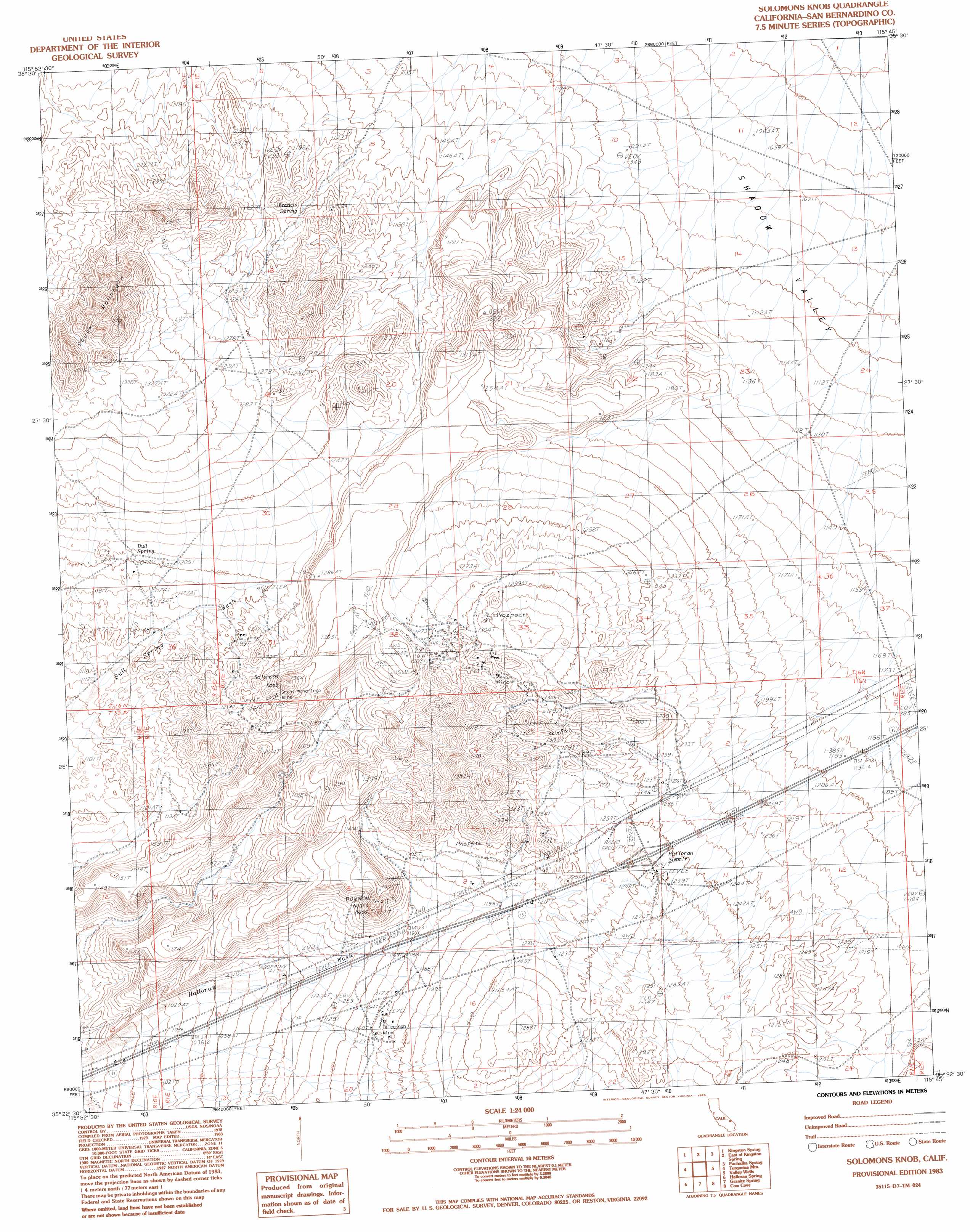
USGS Topo Quad 35115d7 - 1:24,000 scale
| Topo Map Name: | Solomons Knob |
| USGS Topo Quad ID: | 35115d7 |
| Print Size: | ca. 21 1/4" wide x 27" high |
| Southeast Coordinates: | 35.375° N latitude / 115.75° W longitude |
| Map Center Coordinates: | 35.4375° N latitude / 115.8125° W longitude |
| U.S. State: | CA |
| Filename: | o35115d7.jpg |
| Download Map JPG Image: | Solomons Knob topo map 1:24,000 scale |
| Map Type: | Topographic |
| Topo Series: | 7.5´ |
| Map Scale: | 1:24,000 |
| Source of Map Images: | United States Geological Survey (USGS) |
| Alternate Map Versions: |
Solomons Knob CA 1983, updated 1983 Download PDF Buy paper map Solomons Knob CA 1983, updated 1985 Download PDF Buy paper map Solomons Knob CA 2012 Download PDF Buy paper map Solomons Knob CA 2015 Download PDF Buy paper map |
1:24,000 Topo Quads surrounding Solomons Knob
Valjean Hills |
Kingston Peak |
East Of Kingston Peak |
Mesquite Mountain |
Mesquite Lake |
Silurian Hills |
Kingston Spring |
East Of Kingston Spring |
Pachalka Spring |
Clark Mountain |
North Of Baker |
Turquoise Mountain |
Solomons Knob |
Valley Wells |
Mescal Range |
Baker |
Halloran Spring |
Granite Spring |
Cow Cove |
Cima Dome |
Soda Lake North |
Seventeenmile Point |
Indian Spring |
Marl Mountains |
Cima |
> Back to 35115a1 at 1:100,000 scale
> Back to 35114a1 at 1:250,000 scale
> Back to U.S. Topo Maps home
Solomons Knob topo map: Gazetteer
Solomons Knob: Gaps
Halloran Summit elevation 1281m 4202′Solomons Knob: Mines
Great Wanamingo Mine elevation 1269m 4163′Romona Mine elevation 1322m 4337′
Telegraph Mine elevation 1180m 3871′
Solomons Knob: Populated Places
Yucca Grove elevation 1259m 4130′Solomons Knob: Springs
Bull Spring elevation 1206m 3956′Francis Spring elevation 1213m 3979′
Solomons Knob: Summits
Negro Head elevation 1276m 4186′Solomons Knob elevation 1354m 4442′
Squaw Mountain elevation 1474m 4835′
Solomons Knob digital topo map on disk
Buy this Solomons Knob topo map showing relief, roads, GPS coordinates and other geographical features, as a high-resolution digital map file on DVD:
Southern Sierra Nevada, California & Southern Nevada
Buy digital topo maps: Southern Sierra Nevada, California & Southern Nevada