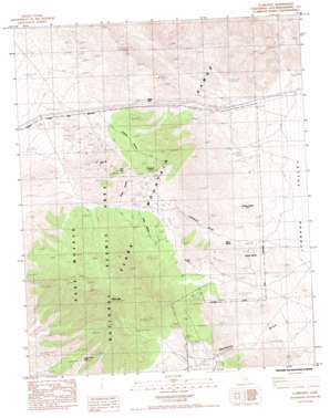
Clark Mountain Topo Map California
To zoom in, hover over the map of Clark Mountain
USGS Topo Quad 35115e5 - 1:24,000 scale
| Topo Map Name: | Clark Mountain |
| USGS Topo Quad ID: | 35115e5 |
| Print Size: | ca. 21 1/4" wide x 27" high |
| Southeast Coordinates: | 35.5° N latitude / 115.5° W longitude |
| Map Center Coordinates: | 35.5625° N latitude / 115.5625° W longitude |
| U.S. State: | CA |
| Filename: | o35115e5.jpg |
| Download Map JPG Image: | Clark Mountain topo map 1:24,000 scale |
| Map Type: | Topographic |
| Topo Series: | 7.5´ |
| Map Scale: | 1:24,000 |
| Source of Map Images: | United States Geological Survey (USGS) |
| Alternate Map Versions: |
Clark Mtn. CA 1985, updated 1985 Download PDF Buy paper map Clark Mountain CA 2012 Download PDF Buy paper map Clark Mountain CA 2015 Download PDF Buy paper map |
1:24,000 Topo Quads surrounding Clark Mountain
> Back to 35115e1 at 1:100,000 scale
> Back to 35114a1 at 1:250,000 scale
> Back to U.S. Topo Maps home
Clark Mountain topo map: Gazetteer
Clark Mountain: Gaps
Keany Pass elevation 1477m 4845′Clark Mountain: Mines
Antimony Mine elevation 1325m 4347′Benson Mine elevation 1625m 5331′
Colosseum Mine elevation 1770m 5807′
Copper World Mine elevation 1662m 5452′
Greens Mine elevation 1641m 5383′
Stonewall Mine elevation 1613m 5291′
Taylor Mine elevation 1699m 5574′
Clark Mountain: Ranges
Clark Mountain Range elevation 1642m 5387′Clark Mountain: Springs
Burro Spring elevation 1471m 4826′Ivanpah Springs elevation 1277m 4189′
Whiskey Spring elevation 1276m 4186′
Whitfield Spring elevation 1538m 5045′
Willow Spring elevation 1308m 4291′
Clark Mountain: Summits
Clark Mountain elevation 2390m 7841′Clark Mountain: Valleys
Colosseum Gorge elevation 1182m 3877′Curtis Canyon elevation 1581m 5187′
Greens Canyon elevation 1370m 4494′
Kiwisar Canyon elevation 1550m 5085′
Clark Mountain: Wells
Greens Well elevation 1612m 5288′Clark Mountain digital topo map on disk
Buy this Clark Mountain topo map showing relief, roads, GPS coordinates and other geographical features, as a high-resolution digital map file on DVD:
Southern Sierra Nevada, California & Southern Nevada
Buy digital topo maps: Southern Sierra Nevada, California & Southern Nevada


