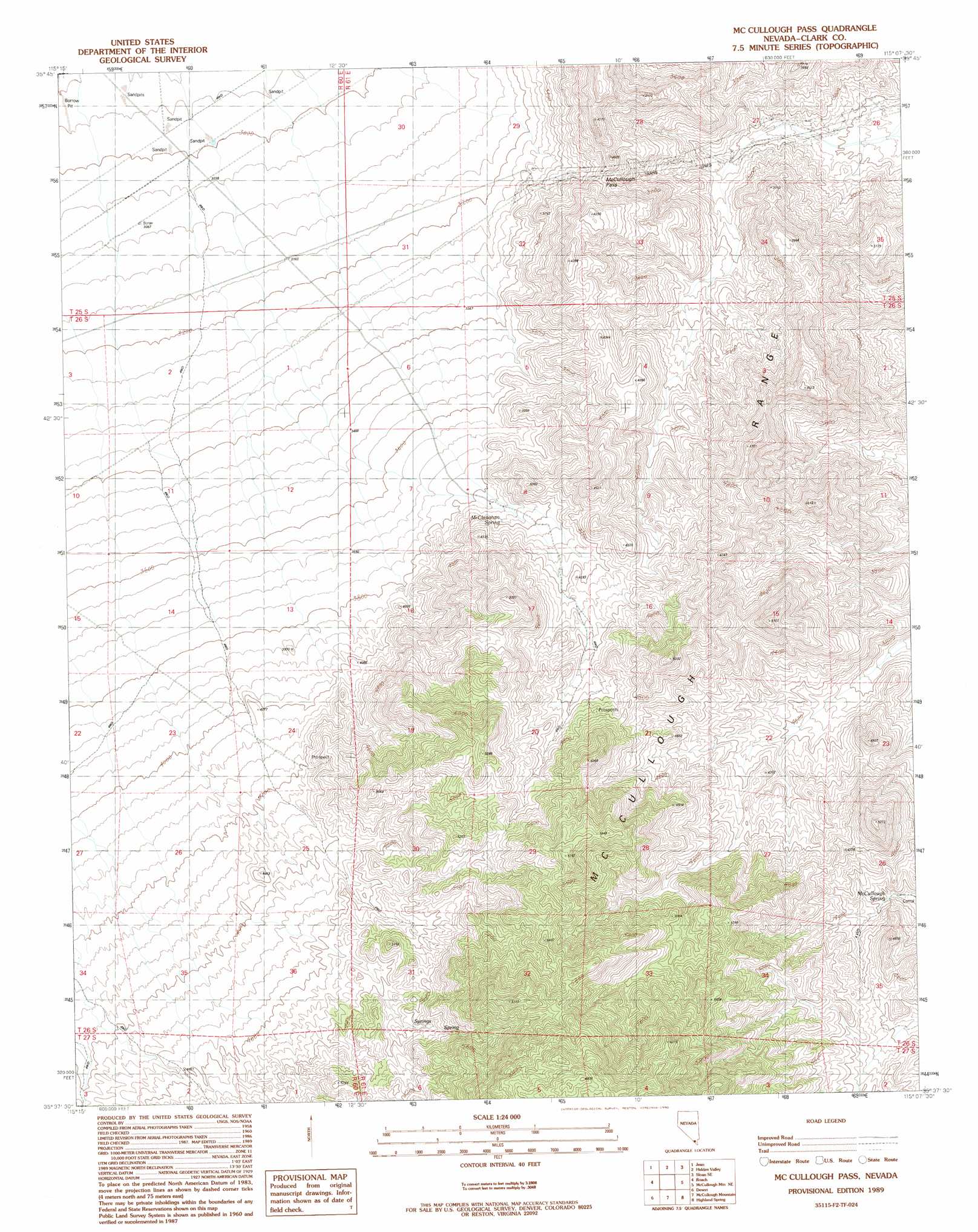
Mccullough Pass Topo Map Nevada
To zoom in, hover over the map of Mccullough Pass
USGS Topo Quad 35115f2 - 1:24,000 scale
| Topo Map Name: | Mccullough Pass |
| USGS Topo Quad ID: | 35115f2 |
| Print Size: | ca. 21 1/4" wide x 27" high |
| Southeast Coordinates: | 35.625° N latitude / 115.125° W longitude |
| Map Center Coordinates: | 35.6875° N latitude / 115.1875° W longitude |
| U.S. State: | NV |
| Filename: | o35115f2.jpg |
| Download Map JPG Image: | Mccullough Pass topo map 1:24,000 scale |
| Map Type: | Topographic |
| Topo Series: | 7.5´ |
| Map Scale: | 1:24,000 |
| Source of Map Images: | United States Geological Survey (USGS) |
| Alternate Map Versions: |
McCullough Pass NV 1989, updated 1990 Download PDF Buy paper map McCullough Pass NV 2012 Download PDF Buy paper map McCullough Pass NV 2014 Download PDF Buy paper map |
1:24,000 Topo Quads surrounding Mccullough Pass
Cottonwood Pass |
Bird Spring |
Sloan |
Sloan Ne |
Boulder City Nw |
Goodsprings |
Jean |
Hidden Valley |
Sloan Se |
Boulder City Sw |
State Line Pass |
Roach |
Mccullough Pass |
Mccullough Mountain Ne |
Keyhole Canyon |
Ivanpah Lake |
Desert |
Mccullough Mountain |
Highland Spring |
Nelson Sw |
Mineral Hill |
Nipton |
Crescent Peak |
Hopps Well |
Searchlight |
> Back to 35115e1 at 1:100,000 scale
> Back to 35114a1 at 1:250,000 scale
> Back to U.S. Topo Maps home
Mccullough Pass topo map: Gazetteer
Mccullough Pass: Gaps
McCullough Pass elevation 1128m 3700′Mccullough Pass: Springs
McClanahan Spring elevation 1203m 3946′McCullough Spring elevation 1259m 4130′
Mccullough Pass digital topo map on disk
Buy this Mccullough Pass topo map showing relief, roads, GPS coordinates and other geographical features, as a high-resolution digital map file on DVD:
Southern Sierra Nevada, California & Southern Nevada
Buy digital topo maps: Southern Sierra Nevada, California & Southern Nevada