State Line Pass Topo Map Nevada
To zoom in, hover over the map of State Line Pass
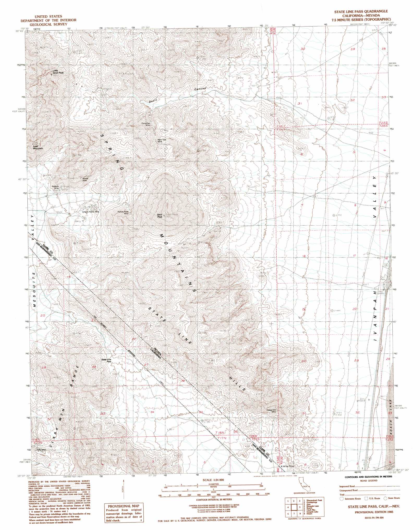
USGS Topo Quad 35115f4 - 1:24,000 scale
| Topo Map Name: | State Line Pass |
| USGS Topo Quad ID: | 35115f4 |
| Print Size: | ca. 21 1/4" wide x 27" high |
| Southeast Coordinates: | 35.625° N latitude / 115.375° W longitude |
| Map Center Coordinates: | 35.6875° N latitude / 115.4375° W longitude |
| U.S. States: | NV, CA |
| Filename: | o35115f4.jpg |
| Download Map JPG Image: | State Line Pass topo map 1:24,000 scale |
| Map Type: | Topographic |
| Topo Series: | 7.5´ |
| Map Scale: | 1:24,000 |
| Source of Map Images: | United States Geological Survey (USGS) |
| Alternate Map Versions: |
State Line Pass CA 1985, updated 1985 Download PDF Buy paper map State Line Pass CA 2012 Download PDF Buy paper map State Line Pass CA 2015 Download PDF Buy paper map |
1:24,000 Topo Quads surrounding State Line Pass
Green Monster Mine |
Potosi |
Cottonwood Pass |
Bird Spring |
Sloan |
West Of Shenandoah Peak |
Shenandoah Peak |
Goodsprings |
Jean |
Hidden Valley |
Mesquite Mountain |
Mesquite Lake |
State Line Pass |
Roach |
Mccullough Pass |
Pachalka Spring |
Clark Mountain |
Ivanpah Lake |
Desert |
Mccullough Mountain |
Valley Wells |
Mescal Range |
Mineral Hill |
Nipton |
Crescent Peak |
> Back to 35115e1 at 1:100,000 scale
> Back to 35114a1 at 1:250,000 scale
> Back to U.S. Topo Maps home
State Line Pass topo map: Gazetteer
State Line Pass: Gaps
State Line Pass elevation 1105m 3625′Stateline Pass elevation 1360m 4461′
State Line Pass: Mines
Addison Mine elevation 1087m 3566′Brandy Mine elevation 1247m 4091′
Christmas Mine elevation 1300m 4265′
Copper Hill Mine elevation 1060m 3477′
Eureka Mine elevation 1389m 4557′
Ingomar and Milford Number Two Mines elevation 1071m 3513′
Kelly Mine elevation 1198m 3930′
Mountain Queen Mine elevation 1383m 4537′
New Year Mine elevation 1513m 4963′
Picture Rock Mine elevation 1298m 4258′
Silver Gem Mine elevation 1344m 4409′
Tam O'Shanter Mine elevation 1240m 4068′
Umpire Perlite Mine elevation 1042m 3418′
State Line Pass: Ranges
State Line Hills elevation 1495m 4904′State Line Pass: Summits
Devil Peak elevation 1785m 5856′Lead Mountain elevation 1401m 4596′
Little Devil Peak elevation 1638m 5374′
State Line Pass: Valleys
Devil Canyon elevation 1007m 3303′State Line Pass digital topo map on disk
Buy this State Line Pass topo map showing relief, roads, GPS coordinates and other geographical features, as a high-resolution digital map file on DVD:
Southern Sierra Nevada, California & Southern Nevada
Buy digital topo maps: Southern Sierra Nevada, California & Southern Nevada