Blackwater Mine Topo Map California
To zoom in, hover over the map of Blackwater Mine
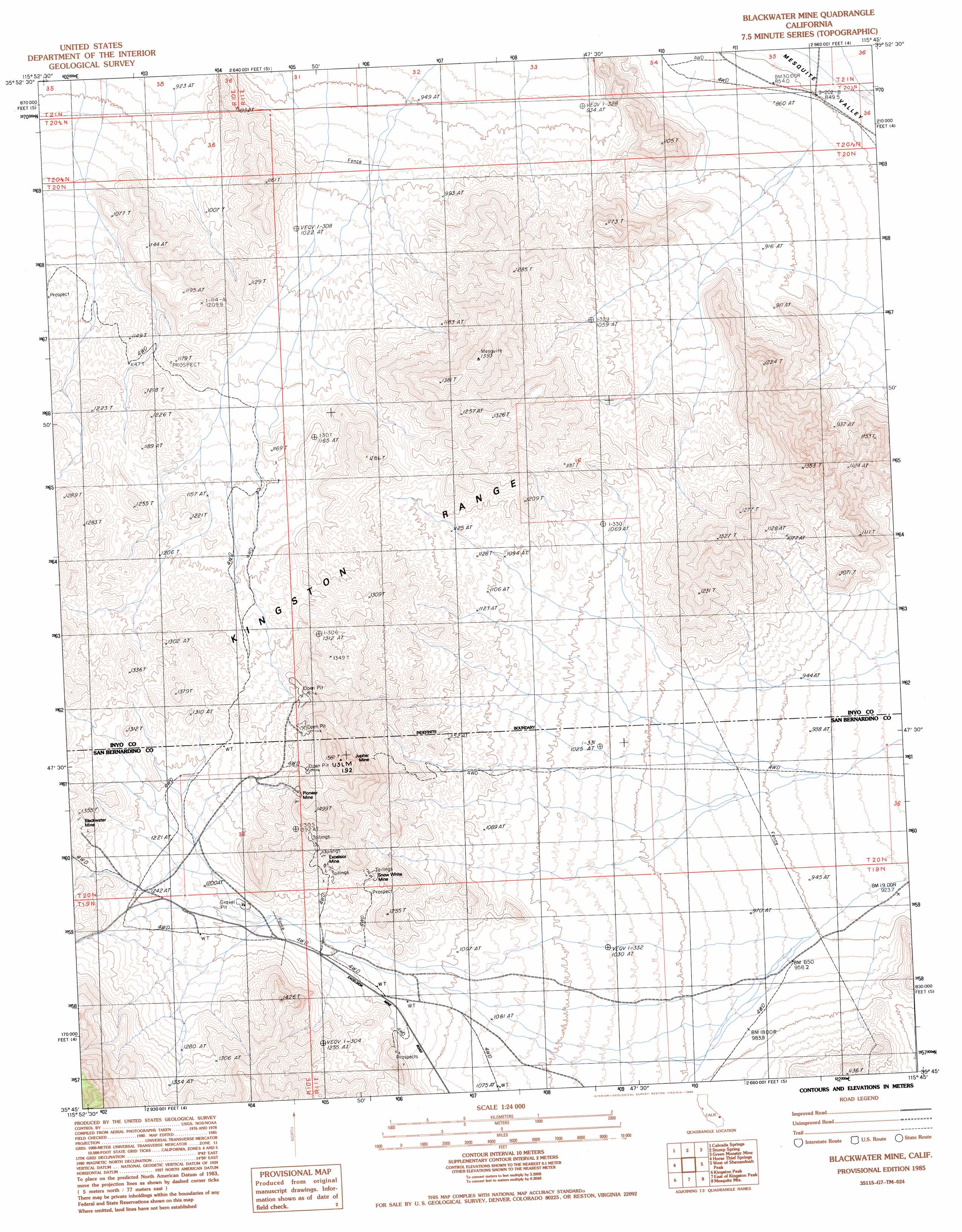
USGS Topo Quad 35115g7 - 1:24,000 scale
| Topo Map Name: | Blackwater Mine |
| USGS Topo Quad ID: | 35115g7 |
| Print Size: | ca. 21 1/4" wide x 27" high |
| Southeast Coordinates: | 35.75° N latitude / 115.75° W longitude |
| Map Center Coordinates: | 35.8125° N latitude / 115.8125° W longitude |
| U.S. State: | CA |
| Filename: | o35115g7.jpg |
| Download Map JPG Image: | Blackwater Mine topo map 1:24,000 scale |
| Map Type: | Topographic |
| Topo Series: | 7.5´ |
| Map Scale: | 1:24,000 |
| Source of Map Images: | United States Geological Survey (USGS) |
| Alternate Map Versions: |
Blackwater Mine CA 1985, updated 1985 Download PDF Buy paper map Blackwater Mine CA 2012 Download PDF Buy paper map Blackwater Mine CA 2015 Download PDF Buy paper map |
1:24,000 Topo Quads surrounding Blackwater Mine
Nopah Peak |
Mound Spring |
Hidden Hills Ranch |
Lost Cabin Spring |
Mountain Springs |
North Of Tecopa Pass |
Calvada Springs |
Stump Spring |
Green Monster Mine |
Potosi |
Tecopa Pass |
Horse Thief Springs |
Blackwater Mine |
West Of Shenandoah Peak |
Shenandoah Peak |
Valjean Hills |
Kingston Peak |
East Of Kingston Peak |
Mesquite Mountain |
Mesquite Lake |
Silurian Hills |
Kingston Spring |
East Of Kingston Spring |
Pachalka Spring |
Clark Mountain |
> Back to 35115e1 at 1:100,000 scale
> Back to 35114a1 at 1:250,000 scale
> Back to U.S. Topo Maps home
Blackwater Mine topo map: Gazetteer
Blackwater Mine: Mines
Blackwater Mine elevation 1302m 4271′Excelsior Mine elevation 1282m 4206′
Jupiter Mine elevation 1353m 4438′
Pioneer Mine elevation 1377m 4517′
Snow White Mine elevation 1213m 3979′
Blackwater Mine digital topo map on disk
Buy this Blackwater Mine topo map showing relief, roads, GPS coordinates and other geographical features, as a high-resolution digital map file on DVD:
Southern Sierra Nevada, California & Southern Nevada
Buy digital topo maps: Southern Sierra Nevada, California & Southern Nevada