Baker Topo Map California
To zoom in, hover over the map of Baker
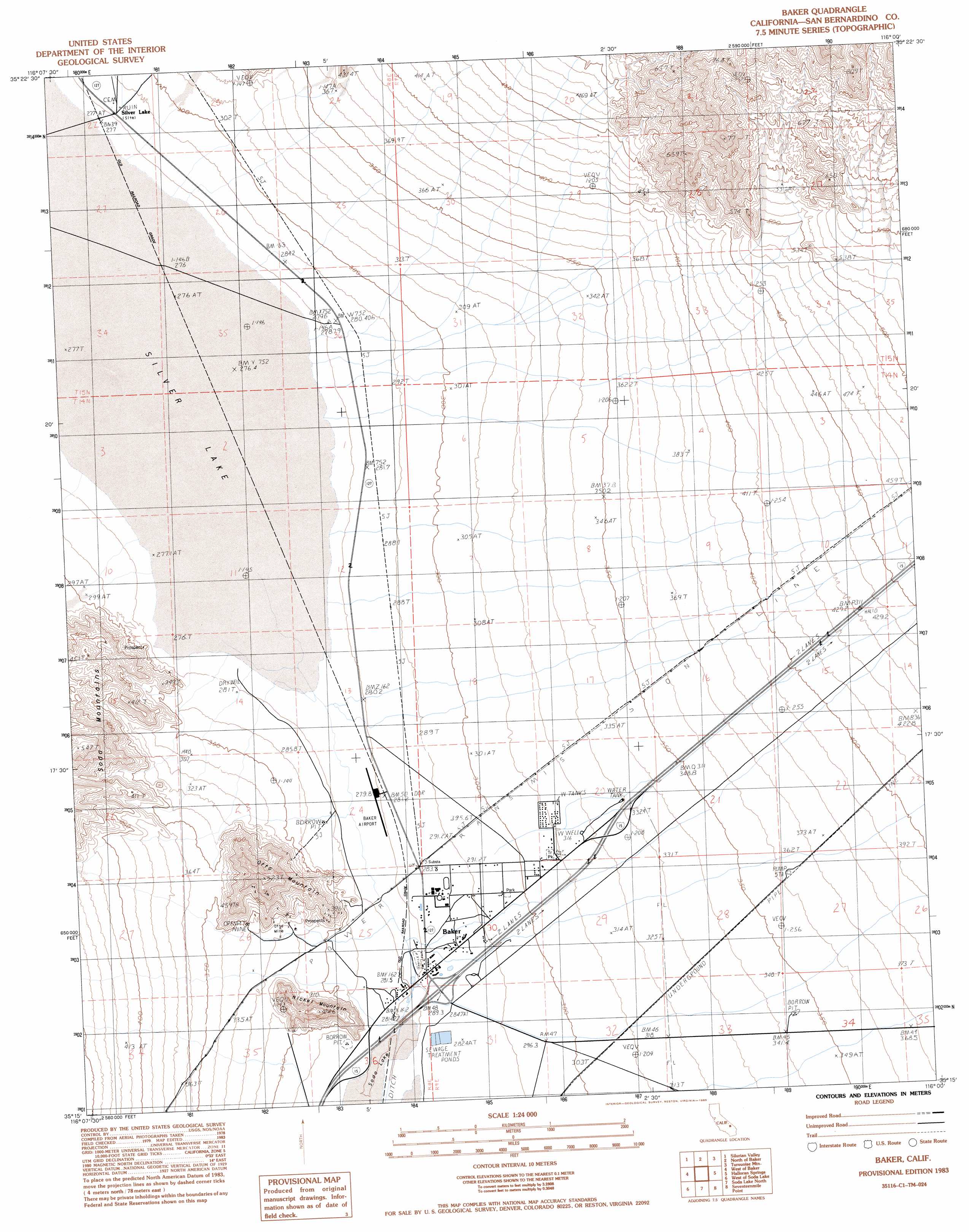
USGS Topo Quad 35116c1 - 1:24,000 scale
| Topo Map Name: | Baker |
| USGS Topo Quad ID: | 35116c1 |
| Print Size: | ca. 21 1/4" wide x 27" high |
| Southeast Coordinates: | 35.25° N latitude / 116° W longitude |
| Map Center Coordinates: | 35.3125° N latitude / 116.0625° W longitude |
| U.S. State: | CA |
| Filename: | o35116c1.jpg |
| Download Map JPG Image: | Baker topo map 1:24,000 scale |
| Map Type: | Topographic |
| Topo Series: | 7.5´ |
| Map Scale: | 1:24,000 |
| Source of Map Images: | United States Geological Survey (USGS) |
| Alternate Map Versions: |
Baker CA 1983, updated 1983 Download PDF Buy paper map Baker CA 1983, updated 1985 Download PDF Buy paper map Baker CA 2012 Download PDF Buy paper map Baker CA 2015 Download PDF Buy paper map |
1:24,000 Topo Quads surrounding Baker
Sheep Creek Spring |
Silurian Lake |
Silurian Hills |
Kingston Spring |
East Of Kingston Spring |
Red Pass Lake Ne |
Silurian Valley |
North Of Baker |
Turquoise Mountain |
Solomons Knob |
Red Pass Lake |
West Of Baker |
Baker |
Halloran Spring |
Granite Spring |
Cronise Lakes |
West Of Soda Lake |
Soda Lake North |
Seventeenmile Point |
Indian Spring |
Cave Mountain |
Crucero Hill |
Soda Lake South |
Cowhole Mountain |
Old Dad Mountain |
> Back to 35116a1 at 1:100,000 scale
> Back to 35116a1 at 1:250,000 scale
> Back to U.S. Topo Maps home
Baker topo map: Gazetteer
Baker: Airports
Baker Airport elevation 279m 915′Silver Lake Airport (historical) elevation 276m 905′
Baker: Flats
Silver Lake elevation 280m 918′Baker: Mines
Otto Mine elevation 355m 1164′Baker: Parks
Chet Hoffman Park elevation 297m 974′Baker: Populated Places
Baker elevation 285m 935′Baker: Post Offices
Baker Post Office elevation 309m 1013′Baker: Streams
Halloran Wash elevation 353m 1158′Baker: Summits
Nickel Mountain elevation 423m 1387′Otto Mountain elevation 519m 1702′
Baker digital topo map on disk
Buy this Baker topo map showing relief, roads, GPS coordinates and other geographical features, as a high-resolution digital map file on DVD:
Southern Sierra Nevada, California & Southern Nevada
Buy digital topo maps: Southern Sierra Nevada, California & Southern Nevada