Leach Spring Topo Map California
To zoom in, hover over the map of Leach Spring
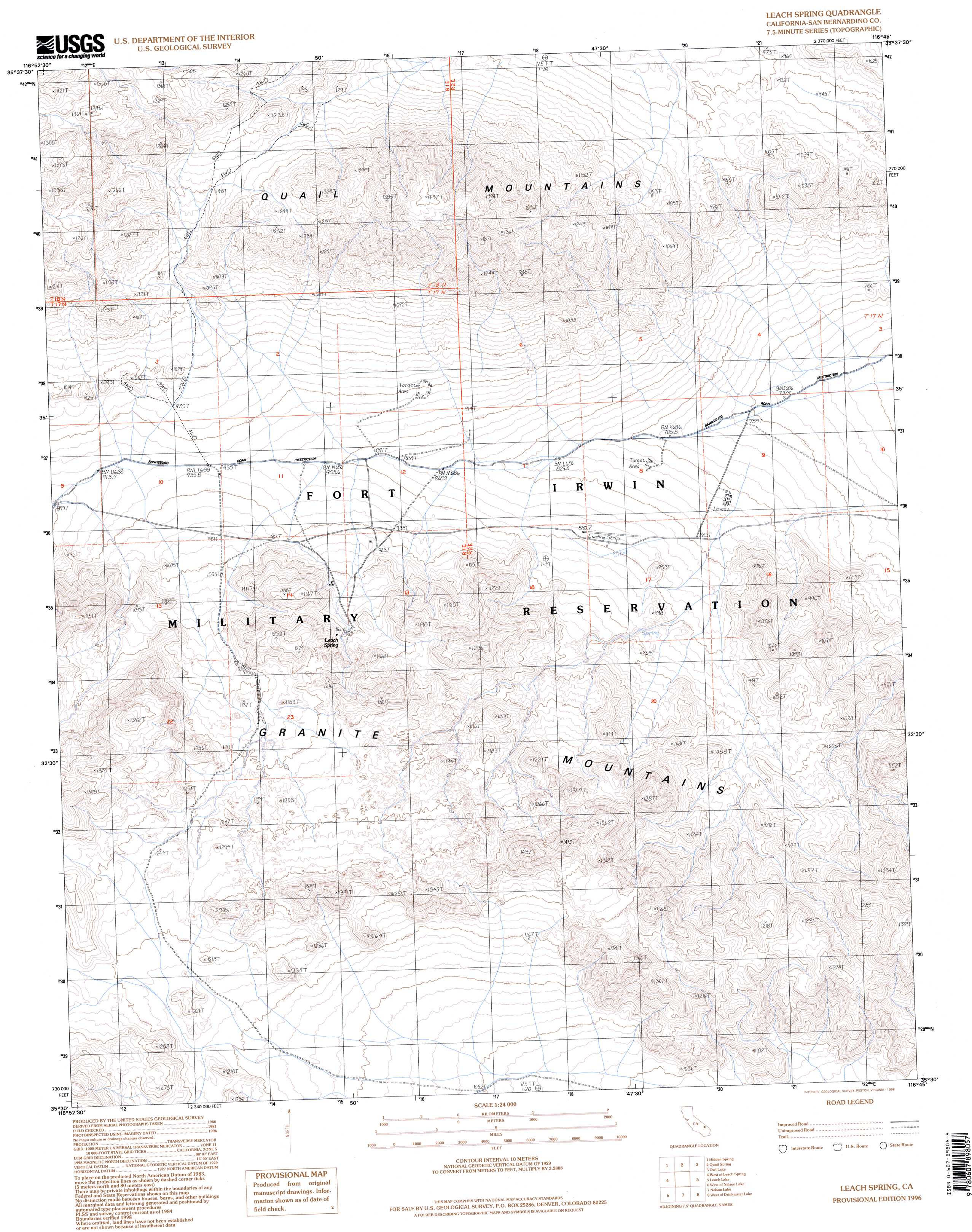
USGS Topo Quad 35116e7 - 1:24,000 scale
| Topo Map Name: | Leach Spring |
| USGS Topo Quad ID: | 35116e7 |
| Print Size: | ca. 21 1/4" wide x 27" high |
| Southeast Coordinates: | 35.5° N latitude / 116.75° W longitude |
| Map Center Coordinates: | 35.5625° N latitude / 116.8125° W longitude |
| U.S. State: | CA |
| Filename: | o35116e7.jpg |
| Download Map JPG Image: | Leach Spring topo map 1:24,000 scale |
| Map Type: | Topographic |
| Topo Series: | 7.5´ |
| Map Scale: | 1:24,000 |
| Source of Map Images: | United States Geological Survey (USGS) |
| Alternate Map Versions: |
Leach Spring CA 1984, updated 1985 Download PDF Buy paper map Leach Spring CA 1996, updated 1998 Download PDF Buy paper map Leach Spring CA 2012 Download PDF Buy paper map Leach Spring CA 2015 Download PDF Buy paper map |
1:24,000 Topo Quads surrounding Leach Spring
Sourdough Spring |
Wingate Wash West |
Wingate Wash East |
Confidence Hills West |
Confidence Hills East |
Wingate Pass |
Hidden Spring |
Quail Spring |
Owl Lake |
East Of Owl Lake |
Pilot Knob Valley East |
West Of Leach Spring |
Leach Spring |
Leach Lake |
East Of Leach Lake |
Eagle Crags |
West Of Nelson Lake |
Nelson Lake |
West Of Drinkwater Lake |
Drinkwater Lake |
Superior Valley |
Goldstone |
East Of Goldstone |
Fort Irwin |
Tiefort Mountains |
> Back to 35116e1 at 1:100,000 scale
> Back to 35116a1 at 1:250,000 scale
> Back to U.S. Topo Maps home
Leach Spring topo map: Gazetteer
Leach Spring: Ranges
Quail Mountains elevation 1218m 3996′Leach Spring: Springs
Leach Spring elevation 1119m 3671′Leach Spring digital topo map on disk
Buy this Leach Spring topo map showing relief, roads, GPS coordinates and other geographical features, as a high-resolution digital map file on DVD:
Southern Sierra Nevada, California & Southern Nevada
Buy digital topo maps: Southern Sierra Nevada, California & Southern Nevada