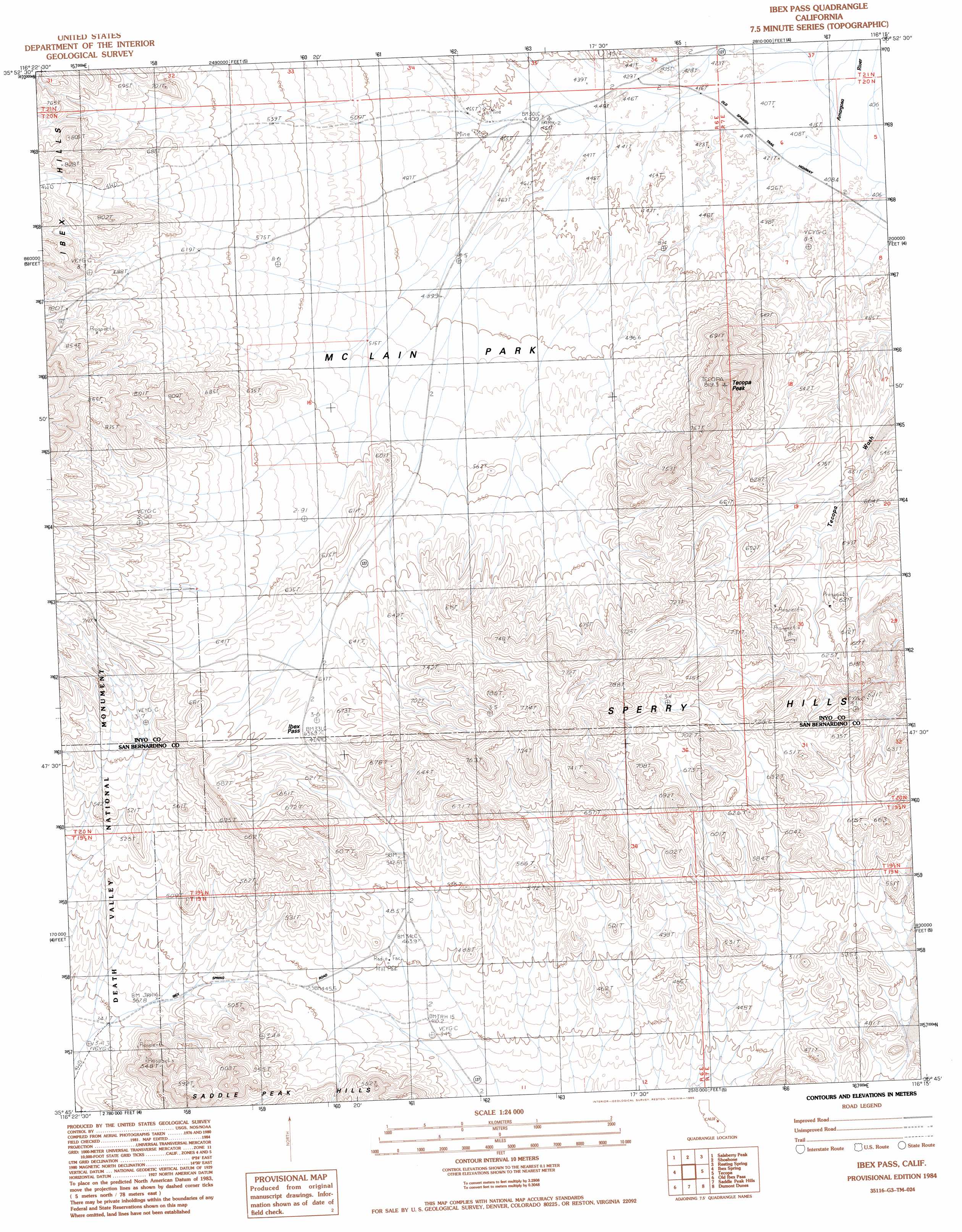
Ibex Pass Topo Map California
To zoom in, hover over the map of Ibex Pass
USGS Topo Quad 35116g3 - 1:24,000 scale
| Topo Map Name: | Ibex Pass |
| USGS Topo Quad ID: | 35116g3 |
| Print Size: | ca. 21 1/4" wide x 27" high |
| Southeast Coordinates: | 35.75° N latitude / 116.25° W longitude |
| Map Center Coordinates: | 35.8125° N latitude / 116.3125° W longitude |
| U.S. State: | CA |
| Filename: | o35116g3.jpg |
| Download Map JPG Image: | Ibex Pass topo map 1:24,000 scale |
| Map Type: | Topographic |
| Topo Series: | 7.5´ |
| Map Scale: | 1:24,000 |
| Source of Map Images: | United States Geological Survey (USGS) |
| Alternate Map Versions: |
Ibex Pass CA 1984, updated 1985 Download PDF Buy paper map Ibex Pass CA 1984, updated 1985 Download PDF Buy paper map Ibex Pass CA 2012 Download PDF Buy paper map Ibex Pass CA 2015 Download PDF Buy paper map |
1:24,000 Topo Quads surrounding Ibex Pass
Funeral Peak |
Deadman Pass |
East Of Deadman Pass |
Twelve Mile Spring |
Nopah Peak |
Epaulet Peak |
Salsberry Peak |
Shoshone |
Resting Spring |
North Of Tecopa Pass |
Confidence Hills East |
Ibex Spring |
Ibex Pass |
Tecopa |
Tecopa Pass |
East Of Owl Lake |
Old Ibex Pass |
Saddle Peak Hills |
Dumont Dunes |
Valjean Hills |
East Of Leach Lake |
Avawatz Pass |
Sheep Creek Spring |
Silurian Lake |
Silurian Hills |
> Back to 35116e1 at 1:100,000 scale
> Back to 35116a1 at 1:250,000 scale
> Back to U.S. Topo Maps home
Ibex Pass topo map: Gazetteer
Ibex Pass: Gaps
Ibex Pass elevation 633m 2076′Ibex Pass: Ranges
Sperry Hills elevation 813m 2667′Ibex Pass: Summits
Tecopa Peak elevation 814m 2670′Ibex Pass digital topo map on disk
Buy this Ibex Pass topo map showing relief, roads, GPS coordinates and other geographical features, as a high-resolution digital map file on DVD:
Southern Sierra Nevada, California & Southern Nevada
Buy digital topo maps: Southern Sierra Nevada, California & Southern Nevada