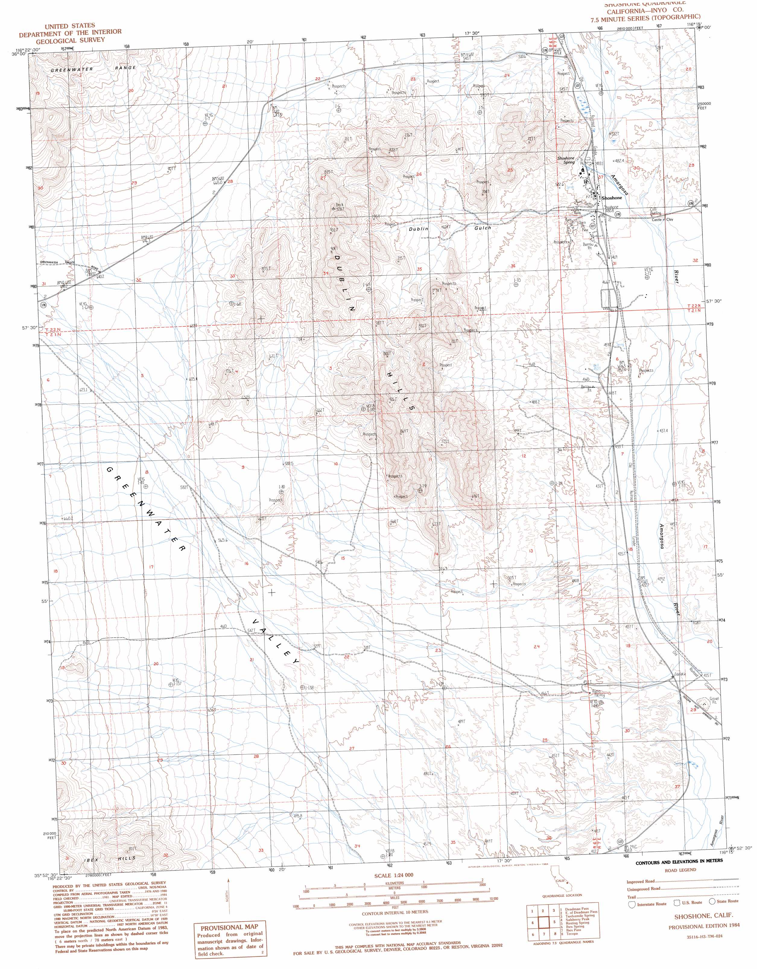
Shoshone Topo Map California
To zoom in, hover over the map of Shoshone
USGS Topo Quad 35116h3 - 1:24,000 scale
| Topo Map Name: | Shoshone |
| USGS Topo Quad ID: | 35116h3 |
| Print Size: | ca. 21 1/4" wide x 27" high |
| Southeast Coordinates: | 35.875° N latitude / 116.25° W longitude |
| Map Center Coordinates: | 35.9375° N latitude / 116.3125° W longitude |
| U.S. State: | CA |
| Filename: | o35116h3.jpg |
| Download Map JPG Image: | Shoshone topo map 1:24,000 scale |
| Map Type: | Topographic |
| Topo Series: | 7.5´ |
| Map Scale: | 1:24,000 |
| Source of Map Images: | United States Geological Survey (USGS) |
| Alternate Map Versions: |
Shoshone CA 1984, updated 1984 Download PDF Buy paper map Shoshone CA 2012 Download PDF Buy paper map Shoshone CA 2015 Download PDF Buy paper map |
1:24,000 Topo Quads surrounding Shoshone
Greenwater Canyon |
West Of Eagle Mountain |
Eagle Mountain |
Stewart Valley |
Sixmile Spring |
Funeral Peak |
Deadman Pass |
East Of Deadman Pass |
Twelve Mile Spring |
Nopah Peak |
Epaulet Peak |
Salsberry Peak |
Shoshone |
Resting Spring |
North Of Tecopa Pass |
Confidence Hills East |
Ibex Spring |
Ibex Pass |
Tecopa |
Tecopa Pass |
East Of Owl Lake |
Old Ibex Pass |
Saddle Peak Hills |
Dumont Dunes |
Valjean Hills |
> Back to 35116e1 at 1:100,000 scale
> Back to 35116a1 at 1:250,000 scale
> Back to U.S. Topo Maps home
Shoshone topo map: Gazetteer
Shoshone: Airports
Shoshone Airport elevation 476m 1561′Shoshone: Populated Places
Shoshone elevation 483m 1584′Shoshone: Ranges
Dublin Hills elevation 769m 2522′Shoshone: Springs
Shoshone Spring elevation 493m 1617′Shoshone: Valleys
Dublin Gulch elevation 491m 1610′Greenwater Valley elevation 570m 1870′
Shoshone digital topo map on disk
Buy this Shoshone topo map showing relief, roads, GPS coordinates and other geographical features, as a high-resolution digital map file on DVD:
Southern Sierra Nevada, California & Southern Nevada
Buy digital topo maps: Southern Sierra Nevada, California & Southern Nevada