Superior Lake Topo Map California
To zoom in, hover over the map of Superior Lake
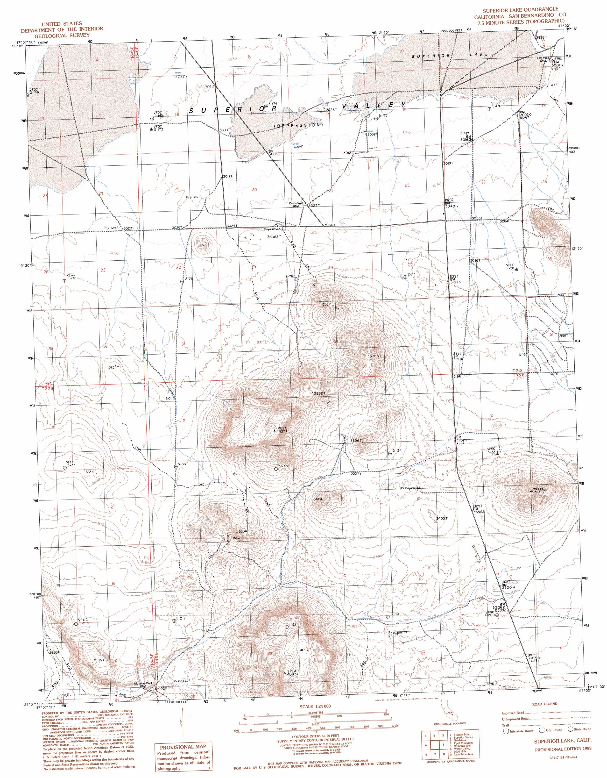
USGS Topo Quad 35117b1 - 1:24,000 scale
| Topo Map Name: | Superior Lake |
| USGS Topo Quad ID: | 35117b1 |
| Print Size: | ca. 21 1/4" wide x 27" high |
| Southeast Coordinates: | 35.125° N latitude / 117° W longitude |
| Map Center Coordinates: | 35.1875° N latitude / 117.0625° W longitude |
| U.S. State: | CA |
| Filename: | o35117b1.jpg |
| Download Map JPG Image: | Superior Lake topo map 1:24,000 scale |
| Map Type: | Topographic |
| Topo Series: | 7.5´ |
| Map Scale: | 1:24,000 |
| Source of Map Images: | United States Geological Survey (USGS) |
| Alternate Map Versions: |
Superior Lake CA 1988, updated 1988 Download PDF Buy paper map Superior Lake CA 2012 Download PDF Buy paper map Superior Lake CA 2015 Download PDF Buy paper map |
1:24,000 Topo Quads surrounding Superior Lake
Black Hills |
Pilot Knob |
Eagle Crags |
West Of Nelson Lake |
Nelson Lake |
Blackwater Well |
Slocum Mountain |
Superior Valley |
Goldstone |
East Of Goldstone |
Bird Spring |
Opal Mountain |
Superior Lake |
Williams Well |
Paradise Range |
Lockhart |
Water Valley |
Mud Hills |
Lane Mountain |
Coyote Lake |
Twelve Gauge Lake |
Hinkley |
Barstow |
Nebo |
Yermo |
> Back to 35117a1 at 1:100,000 scale
> Back to 35116a1 at 1:250,000 scale
> Back to U.S. Topo Maps home
Superior Lake topo map: Gazetteer
Superior Lake: Flats
Superior Lake elevation 914m 2998′Superior Lake: Wells
Crutts Well elevation 922m 3024′East Well elevation 915m 3001′
Murphys Well elevation 886m 2906′
Superior Lake digital topo map on disk
Buy this Superior Lake topo map showing relief, roads, GPS coordinates and other geographical features, as a high-resolution digital map file on DVD:
Southern Sierra Nevada, California & Southern Nevada
Buy digital topo maps: Southern Sierra Nevada, California & Southern Nevada