Slocum Mountain Topo Map California
To zoom in, hover over the map of Slocum Mountain
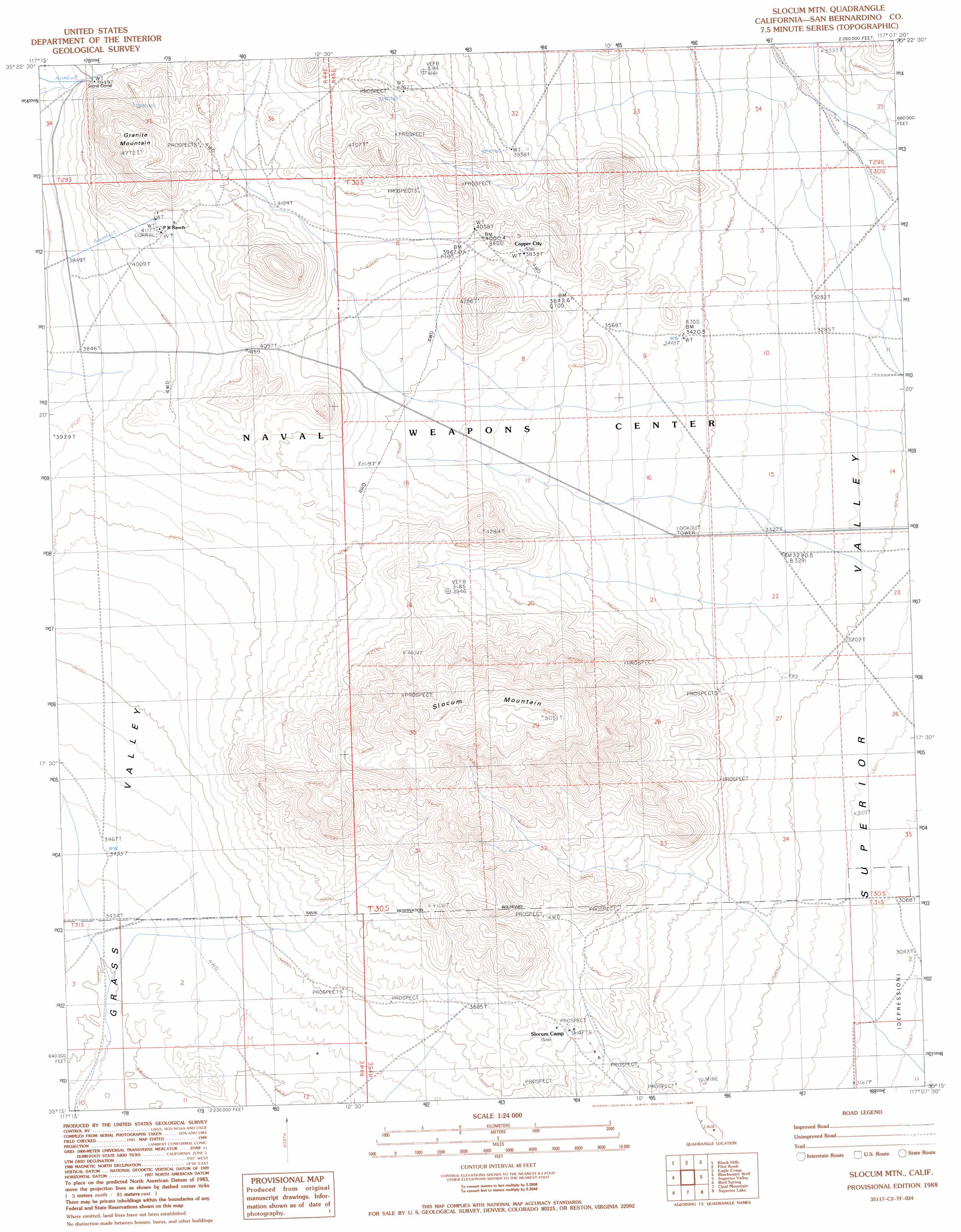
USGS Topo Quad 35117c2 - 1:24,000 scale
| Topo Map Name: | Slocum Mountain |
| USGS Topo Quad ID: | 35117c2 |
| Print Size: | ca. 21 1/4" wide x 27" high |
| Southeast Coordinates: | 35.25° N latitude / 117.125° W longitude |
| Map Center Coordinates: | 35.3125° N latitude / 117.1875° W longitude |
| U.S. State: | CA |
| Filename: | o35117c2.jpg |
| Download Map JPG Image: | Slocum Mountain topo map 1:24,000 scale |
| Map Type: | Topographic |
| Topo Series: | 7.5´ |
| Map Scale: | 1:24,000 |
| Source of Map Images: | United States Geological Survey (USGS) |
| Alternate Map Versions: |
Slocum Mtn CA 1988, updated 1988 Download PDF Buy paper map Slocum Mountain CA 2012 Download PDF Buy paper map Slocum Mountain CA 2015 Download PDF Buy paper map |
1:24,000 Topo Quads surrounding Slocum Mountain
Spangler Hills East |
Christmas Canyon |
Pilot Knob Valley West |
Pilot Knob Valley East |
West Of Leach Spring |
West Of Black Hills |
Black Hills |
Pilot Knob |
Eagle Crags |
West Of Nelson Lake |
Cuddeback Lake |
Blackwater Well |
Slocum Mountain |
Superior Valley |
Goldstone |
Fremont Peak |
Bird Spring |
Opal Mountain |
Superior Lake |
Williams Well |
The Buttes |
Lockhart |
Water Valley |
Mud Hills |
Lane Mountain |
> Back to 35117a1 at 1:100,000 scale
> Back to 35116a1 at 1:250,000 scale
> Back to U.S. Topo Maps home
Slocum Mountain topo map: Gazetteer
Slocum Mountain: Populated Places
Copper City elevation 1198m 3930′Slocum Mountain: Summits
Granite Mountain elevation 1453m 4767′Slocum Mountain elevation 1541m 5055′
Slocum Mountain: Valleys
Grass Valley elevation 1082m 3549′Slocum Mountain digital topo map on disk
Buy this Slocum Mountain topo map showing relief, roads, GPS coordinates and other geographical features, as a high-resolution digital map file on DVD:
Southern Sierra Nevada, California & Southern Nevada
Buy digital topo maps: Southern Sierra Nevada, California & Southern Nevada