Garlock Topo Map California
To zoom in, hover over the map of Garlock
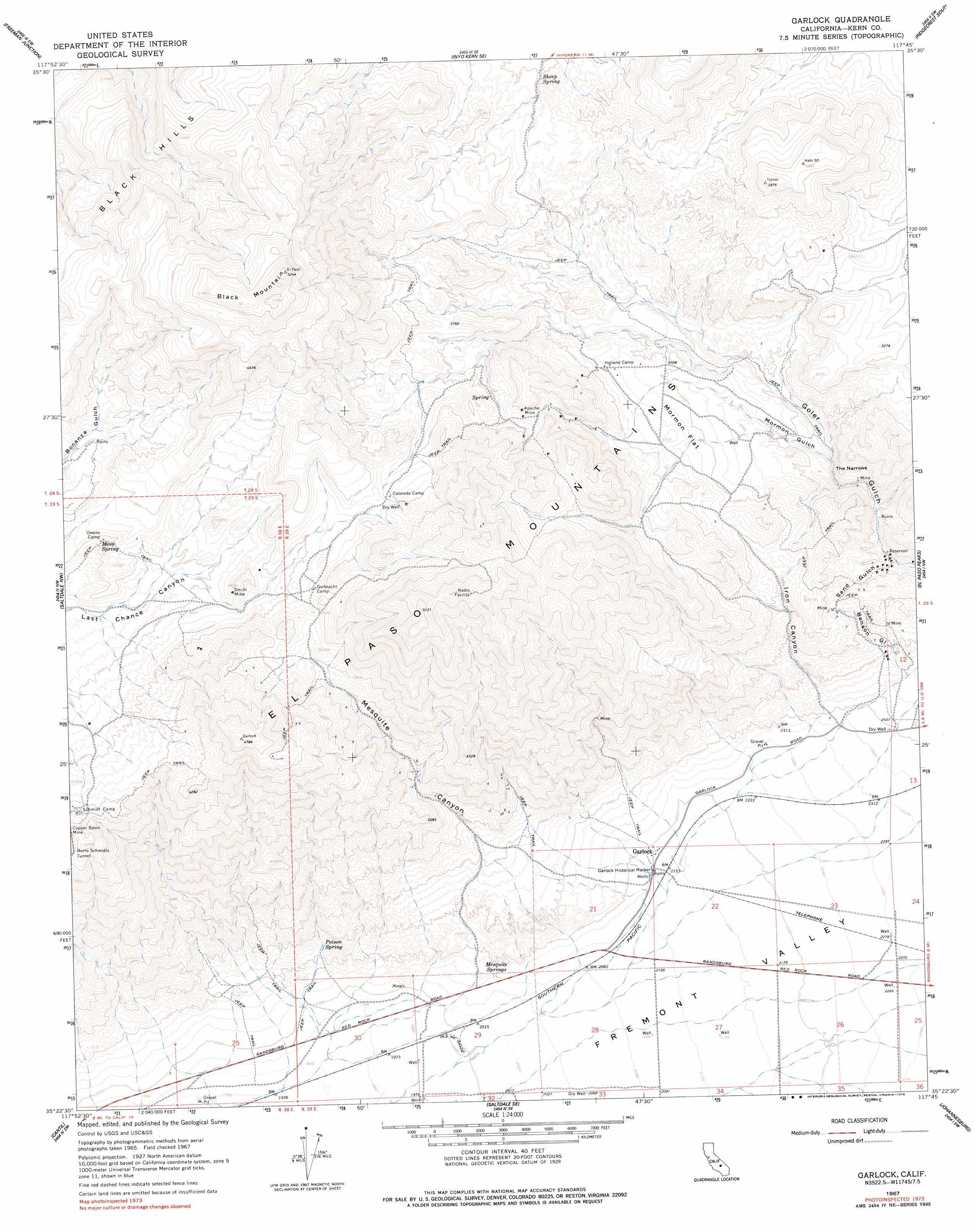
USGS Topo Quad 35117d7 - 1:24,000 scale
| Topo Map Name: | Garlock |
| USGS Topo Quad ID: | 35117d7 |
| Print Size: | ca. 21 1/4" wide x 27" high |
| Southeast Coordinates: | 35.375° N latitude / 117.75° W longitude |
| Map Center Coordinates: | 35.4375° N latitude / 117.8125° W longitude |
| U.S. State: | CA |
| Filename: | o35117d7.jpg |
| Download Map JPG Image: | Garlock topo map 1:24,000 scale |
| Map Type: | Topographic |
| Topo Series: | 7.5´ |
| Map Scale: | 1:24,000 |
| Source of Map Images: | United States Geological Survey (USGS) |
| Alternate Map Versions: |
Garlock CA 1967, updated 1968 Download PDF Buy paper map Garlock CA 1967, updated 1978 Download PDF Buy paper map Garlock CA 1967, updated 1995 Download PDF Buy paper map Garlock CA 2012 Download PDF Buy paper map Garlock CA 2015 Download PDF Buy paper map |
1:24,000 Topo Quads surrounding Garlock
Walker Pass |
Owens Peak |
Inyokern |
Ridgecrest North |
Lone Butte |
Horse Canyon |
Freeman Junction |
Inyokern Se |
Ridgecrest South |
Spangler Hills West |
Dove Spring |
Saltdale Nw |
Garlock |
El Paso Peaks |
Klinker Mountain |
Cinco |
Cantil |
Saltdale Se |
Johannesburg |
Red Mountain |
Mojave Ne |
California City North |
Galileo Hill |
Boron Nw |
Boron Ne |
> Back to 35117a1 at 1:100,000 scale
> Back to 35116a1 at 1:250,000 scale
> Back to U.S. Topo Maps home
Garlock topo map: Gazetteer
Garlock: Flats
Mormon Flat elevation 1004m 3293′Garlock: Gaps
The Narrows elevation 867m 2844′Garlock: Mines
Apache Mine elevation 1158m 3799′Prospect Mine elevation 1201m 3940′
Smith Mine elevation 1147m 3763′
Garlock: Parks
Garlock Historical Marker elevation 661m 2168′Garlock: Populated Places
Garlock elevation 661m 2168′Old Garlock elevation 605m 1984′
Garlock: Ranges
Black Hills elevation 1316m 4317′El Paso Mountains elevation 1479m 4852′
Garlock: Springs
Mesa Spring elevation 1096m 3595′Mesquite Springs elevation 644m 2112′
Poison Spring elevation 694m 2276′
Sheep Spring elevation 1042m 3418′
Garlock: Summits
Black Mountain elevation 1589m 5213′Garlock: Valleys
Benson Gulch elevation 761m 2496′Goler Gulch elevation 762m 2500′
Iron Canyon elevation 735m 2411′
Mesquite Canyon elevation 673m 2208′
Mormon Gulch elevation 865m 2837′
Sand Gulch elevation 815m 2673′
Garlock digital topo map on disk
Buy this Garlock topo map showing relief, roads, GPS coordinates and other geographical features, as a high-resolution digital map file on DVD:
Southern Sierra Nevada, California & Southern Nevada
Buy digital topo maps: Southern Sierra Nevada, California & Southern Nevada