Pilot Knob Valley West Topo Map California
To zoom in, hover over the map of Pilot Knob Valley West
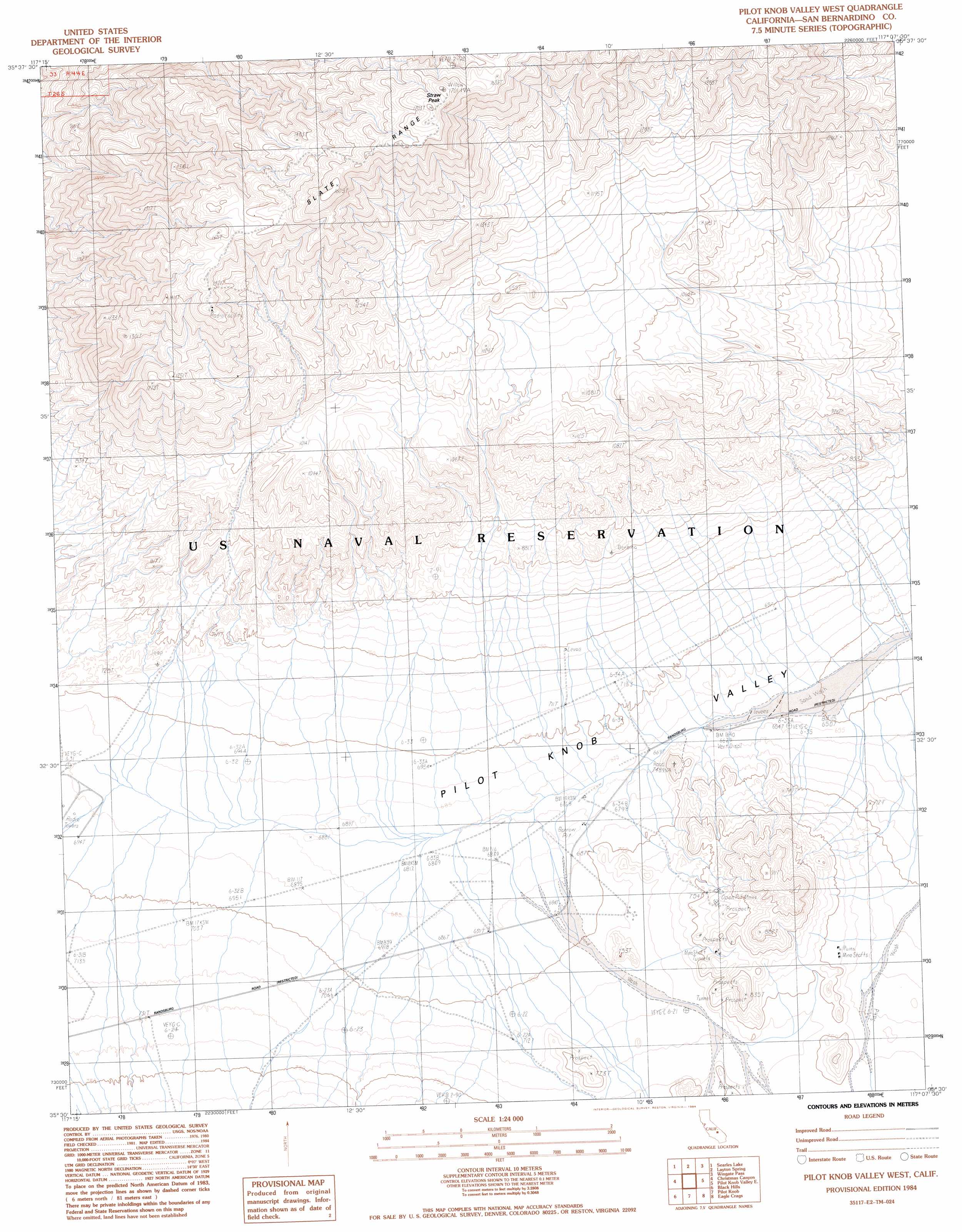
USGS Topo Quad 35117e2 - 1:24,000 scale
| Topo Map Name: | Pilot Knob Valley West |
| USGS Topo Quad ID: | 35117e2 |
| Print Size: | ca. 21 1/4" wide x 27" high |
| Southeast Coordinates: | 35.5° N latitude / 117.125° W longitude |
| Map Center Coordinates: | 35.5625° N latitude / 117.1875° W longitude |
| U.S. State: | CA |
| Filename: | o35117e2.jpg |
| Download Map JPG Image: | Pilot Knob Valley West topo map 1:24,000 scale |
| Map Type: | Topographic |
| Topo Series: | 7.5´ |
| Map Scale: | 1:24,000 |
| Source of Map Images: | United States Geological Survey (USGS) |
| Alternate Map Versions: |
Pilot Knob Valley West CA 1984, updated 1984 Download PDF Buy paper map Pilot Knob Valley West CA 2012 Download PDF Buy paper map Pilot Knob Valley West CA 2015 Download PDF Buy paper map |
1:24,000 Topo Quads surrounding Pilot Knob Valley West
Trona West |
Trona East |
Copper Queen Canyon |
Sourdough Spring |
Wingate Wash West |
Westend |
Searles Lake |
Layton Spring |
Wingate Pass |
Hidden Spring |
Spangler Hills East |
Christmas Canyon |
Pilot Knob Valley West |
Pilot Knob Valley East |
West Of Leach Spring |
West Of Black Hills |
Black Hills |
Pilot Knob |
Eagle Crags |
West Of Nelson Lake |
Cuddeback Lake |
Blackwater Well |
Slocum Mountain |
Superior Valley |
Goldstone |
> Back to 35117e1 at 1:100,000 scale
> Back to 35116a1 at 1:250,000 scale
> Back to U.S. Topo Maps home
Pilot Knob Valley West topo map: Gazetteer
Pilot Knob Valley West: Ranges
Slate Range elevation 1583m 5193′Pilot Knob Valley West: Summits
Straw Peak elevation 1679m 5508′Pilot Knob Valley West digital topo map on disk
Buy this Pilot Knob Valley West topo map showing relief, roads, GPS coordinates and other geographical features, as a high-resolution digital map file on DVD:
Southern Sierra Nevada, California & Southern Nevada
Buy digital topo maps: Southern Sierra Nevada, California & Southern Nevada