Ninemile Canyon Topo Map California
To zoom in, hover over the map of Ninemile Canyon
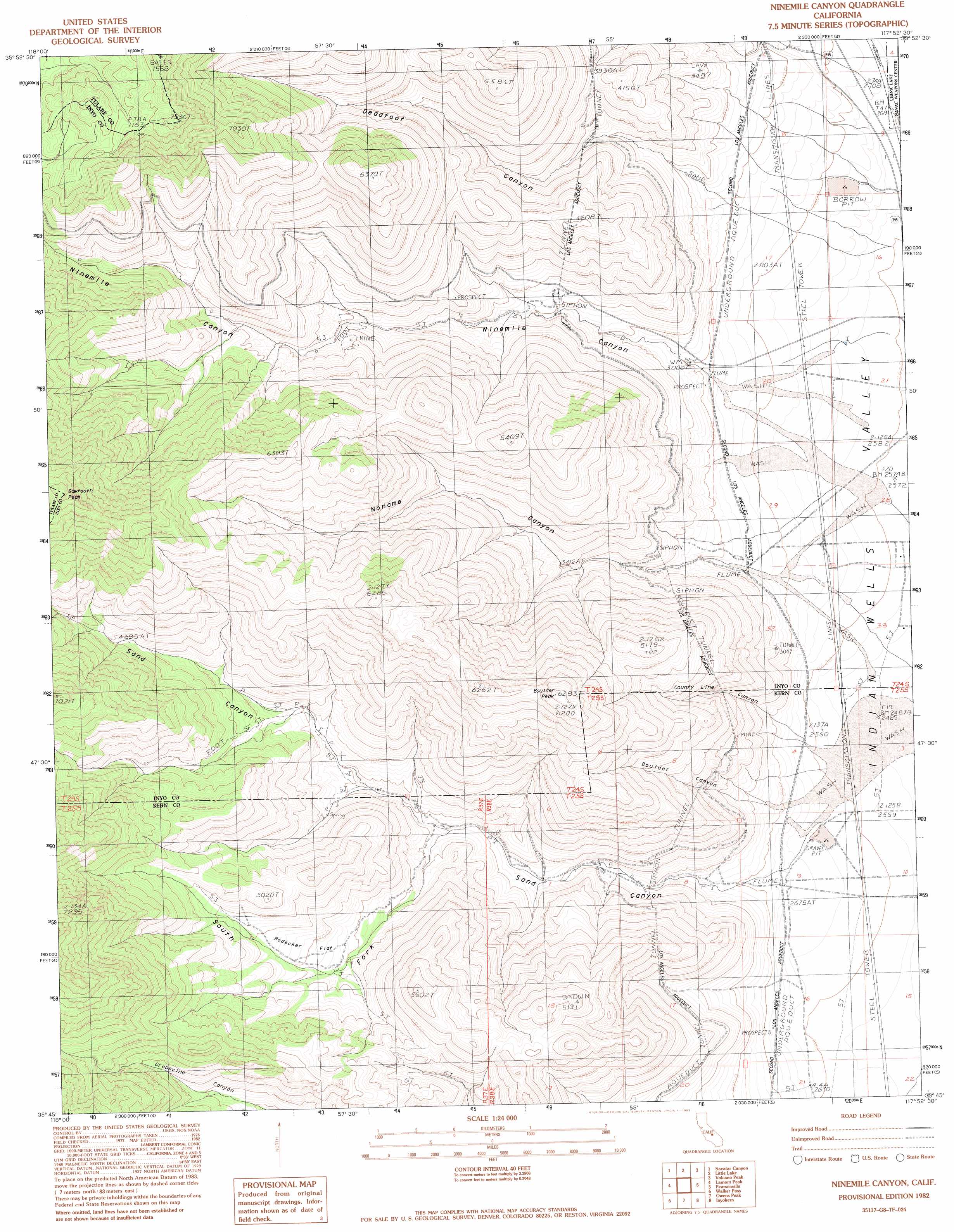
USGS Topo Quad 35117g8 - 1:24,000 scale
| Topo Map Name: | Ninemile Canyon |
| USGS Topo Quad ID: | 35117g8 |
| Print Size: | ca. 21 1/4" wide x 27" high |
| Southeast Coordinates: | 35.75° N latitude / 117.875° W longitude |
| Map Center Coordinates: | 35.8125° N latitude / 117.9375° W longitude |
| U.S. State: | CA |
| Filename: | o35117g8.jpg |
| Download Map JPG Image: | Ninemile Canyon topo map 1:24,000 scale |
| Map Type: | Topographic |
| Topo Series: | 7.5´ |
| Map Scale: | 1:24,000 |
| Source of Map Images: | United States Geological Survey (USGS) |
| Alternate Map Versions: |
Ninemile Canyon CA 1982, updated 1983 Download PDF Buy paper map Ninemile Canyon CA 2012 Download PDF Buy paper map Ninemile Canyon CA 2015 Download PDF Buy paper map |
1:24,000 Topo Quads surrounding Ninemile Canyon
Crag Peak |
Long Canyon |
Coso Junction |
Cactus Peak |
Petroglyph Canyon |
Rockhouse Basin |
Sacatar Canyon |
Little Lake |
Volcano Peak |
Airport Lake |
White Dome |
Lamont Peak |
Ninemile Canyon |
Pearsonville |
White Hills |
Onyx |
Walker Pass |
Owens Peak |
Inyokern |
Ridgecrest North |
Cane Canyon |
Horse Canyon |
Freeman Junction |
Inyokern Se |
Ridgecrest South |
> Back to 35117e1 at 1:100,000 scale
> Back to 35116a1 at 1:250,000 scale
> Back to U.S. Topo Maps home
Ninemile Canyon topo map: Gazetteer
Ninemile Canyon: Flats
Rodecker Flat elevation 1276m 4186′Ninemile Canyon: Summits
Boulder Peak elevation 1911m 6269′Sawtooth Peak elevation 2435m 7988′
Ninemile Canyon: Valleys
Boulder Canyon elevation 896m 2939′County Line Canyon elevation 841m 2759′
Deadfoot Canyon elevation 930m 3051′
Fivemile Canyon elevation 880m 2887′
Ninemile Canyon elevation 908m 2979′
Noname Canyon elevation 878m 2880′
Sand Canyon elevation 837m 2746′
South Fork Sand Canyon elevation 1059m 3474′
Ninemile Canyon digital topo map on disk
Buy this Ninemile Canyon topo map showing relief, roads, GPS coordinates and other geographical features, as a high-resolution digital map file on DVD:
Southern Sierra Nevada, California & Southern Nevada
Buy digital topo maps: Southern Sierra Nevada, California & Southern Nevada