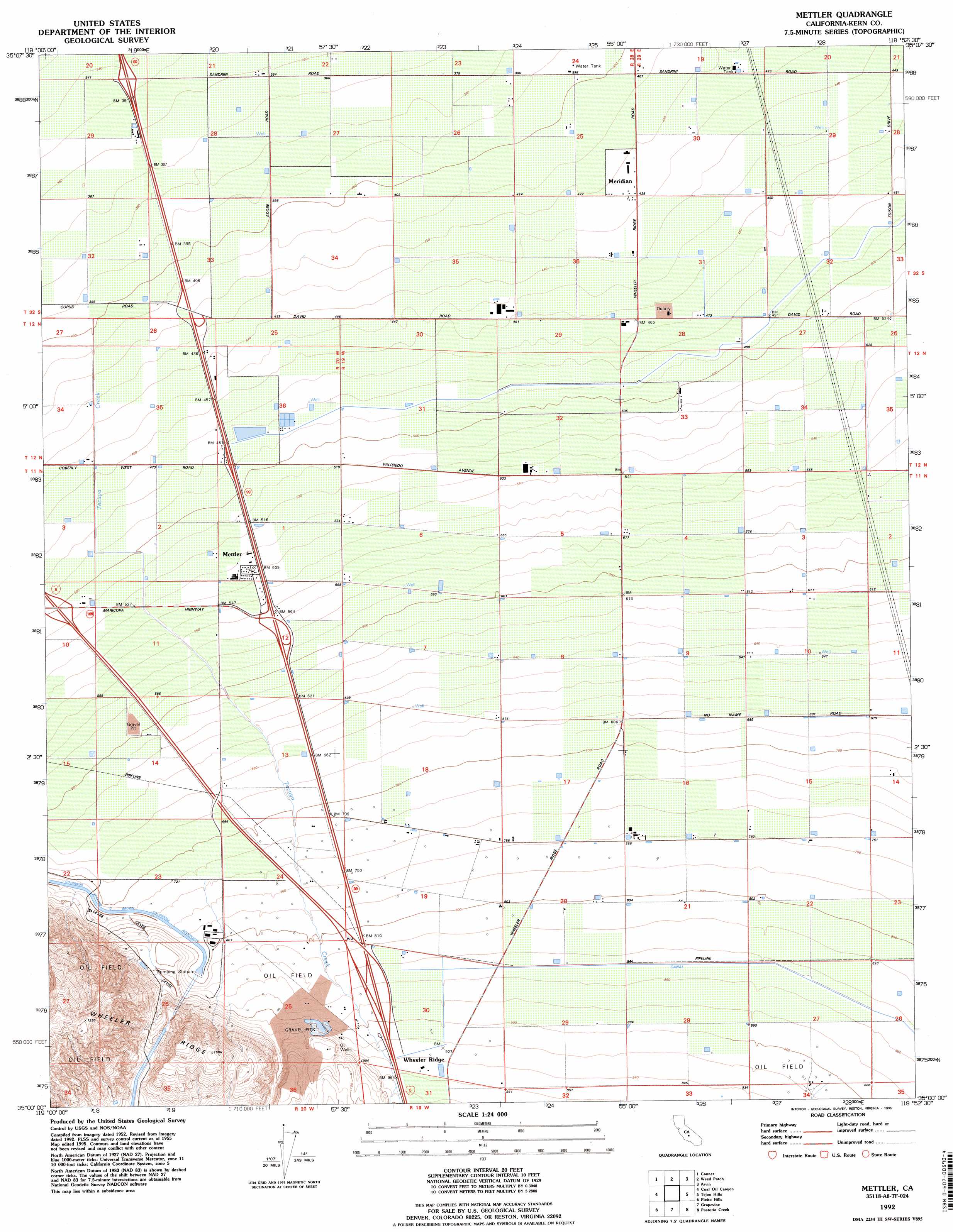
Mettler Topo Map California
To zoom in, hover over the map of Mettler
USGS Topo Quad 35118a8 - 1:24,000 scale
| Topo Map Name: | Mettler |
| USGS Topo Quad ID: | 35118a8 |
| Print Size: | ca. 21 1/4" wide x 27" high |
| Southeast Coordinates: | 35° N latitude / 118.875° W longitude |
| Map Center Coordinates: | 35.0625° N latitude / 118.9375° W longitude |
| U.S. State: | CA |
| Filename: | o35118a8.jpg |
| Download Map JPG Image: | Mettler topo map 1:24,000 scale |
| Map Type: | Topographic |
| Topo Series: | 7.5´ |
| Map Scale: | 1:24,000 |
| Source of Map Images: | United States Geological Survey (USGS) |
| Alternate Map Versions: |
West of Tejon Hills CA 1934, updated 1950 Download PDF Buy paper map Mettler CA 1955, updated 1956 Download PDF Buy paper map Mettler CA 1955, updated 1969 Download PDF Buy paper map Mettler CA 1955, updated 1976 Download PDF Buy paper map Mettler CA 1992, updated 1995 Download PDF Buy paper map Mettler CA 2012 Download PDF Buy paper map Mettler CA 2015 Download PDF Buy paper map |
1:24,000 Topo Quads surrounding Mettler
Stevens |
Gosford |
Lamont |
Edison |
Bena |
Millux |
Conner |
Weed Patch |
Arvin |
Bear Mountain |
Conner Sw |
Coal Oil Canyon |
Mettler |
Tejon Hills |
Tejon Ranch |
Eagle Rest Peak |
Pleito Hills |
Grapevine |
Pastoria Creek |
Winters Ridge |
Sawmill Mountain |
Cuddy Valley |
Frazier Mountain |
Lebec |
La Liebre Ranch |
> Back to 35118a1 at 1:100,000 scale
> Back to 35118a1 at 1:250,000 scale
> Back to U.S. Topo Maps home
Mettler topo map: Gazetteer
Mettler: Populated Places
Meridian elevation 132m 433′Mettler elevation 165m 541′
Wheeler Ridge elevation 291m 954′
Mettler: Streams
Grapevine Creek elevation 259m 849′Salt Creek elevation 295m 967′
Mettler digital topo map on disk
Buy this Mettler topo map showing relief, roads, GPS coordinates and other geographical features, as a high-resolution digital map file on DVD:
Southern Sierra Nevada, California & Southern Nevada
Buy digital topo maps: Southern Sierra Nevada, California & Southern Nevada