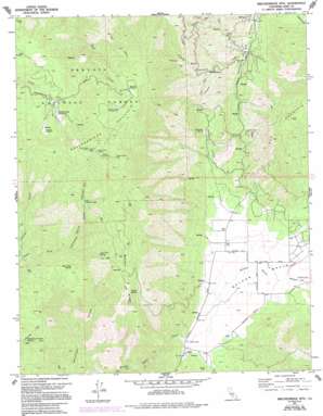
Breckenridge Mountain Topo Map California
To zoom in, hover over the map of Breckenridge Mountain
USGS Topo Quad 35118d5 - 1:24,000 scale
| Topo Map Name: | Breckenridge Mountain |
| USGS Topo Quad ID: | 35118d5 |
| Print Size: | ca. 21 1/4" wide x 27" high |
| Southeast Coordinates: | 35.375° N latitude / 118.5° W longitude |
| Map Center Coordinates: | 35.4375° N latitude / 118.5625° W longitude |
| U.S. State: | CA |
| Filename: | o35118d5.jpg |
| Download Map JPG Image: | Breckenridge Mountain topo map 1:24,000 scale |
| Map Type: | Topographic |
| Topo Series: | 7.5´ |
| Map Scale: | 1:24,000 |
| Source of Map Images: | United States Geological Survey (USGS) |
| Alternate Map Versions: |
Breckenridge Mtn CA 1972, updated 1975 Download PDF Buy paper map Breckenridge Mtn CA 1972, updated 1975 Download PDF Buy paper map Breckenridge Mountain CA 1972, updated 1986 Download PDF Buy paper map Breckenridge Mountain CA 1972, updated 1994 Download PDF Buy paper map Breckenridge Mtn CA 1972, updated 1994 Download PDF Buy paper map Breckenridge Mountain CA 2012 Download PDF Buy paper map Breckenridge Mountain CA 2015 Download PDF Buy paper map |
| FStopo: | US Forest Service topo Breckenridge Mountain is available: Download FStopo PDF Download FStopo TIF |
1:24,000 Topo Quads surrounding Breckenridge Mountain
> Back to 35118a1 at 1:100,000 scale
> Back to 35118a1 at 1:250,000 scale
> Back to U.S. Topo Maps home
Breckenridge Mountain topo map: Gazetteer
Breckenridge Mountain: Airports
Flying S Ranch Airport elevation 1052m 3451′Breckenridge Mountain: Basins
Walker Basin elevation 1029m 3375′Breckenridge Mountain: Flats
Breckenridge Meadows elevation 1836m 6023′Breckenridge Meadows elevation 1790m 5872′
Bull Flat elevation 1708m 5603′
Golf Meadow elevation 1779m 5836′
Munzer Meadow elevation 1853m 6079′
Squirrel Meadow elevation 2027m 6650′
Breckenridge Mountain: Gaps
Cherry Gap elevation 1740m 5708′Breckenridge Mountain: Mines
Tungsten Chief Mine elevation 1336m 4383′Breckenridge Mountain: Reservoirs
Julia Lake elevation 983m 3225′Breckenridge Mountain: Ridges
Banada Ridge elevation 1718m 5636′Breckenridge Mountain: Springs
Agua Fria Spring elevation 1557m 5108′Barrel Spring elevation 1937m 6354′
Bear Trap Spring elevation 1393m 4570′
Deer Springs elevation 1933m 6341′
Dutchman Prospect Spring elevation 1095m 3592′
Home Spring elevation 1506m 4940′
Johnson Spring elevation 1290m 4232′
Metoe Spring elevation 1963m 6440′
Murphy Spring elevation 1242m 4074′
Breckenridge Mountain: Streams
Flying Dutchman Creek elevation 1067m 3500′Rancheria Creek elevation 1040m 3412′
Breckenridge Mountain: Summits
Breckenridge Mountain elevation 2289m 7509′Hole in the Mountain elevation 1743m 5718′
Breckenridge Mountain: Valleys
Johnson Canyon elevation 1160m 3805′Weiss Canyon elevation 1255m 4117′
Breckenridge Mountain digital topo map on disk
Buy this Breckenridge Mountain topo map showing relief, roads, GPS coordinates and other geographical features, as a high-resolution digital map file on DVD:
Southern Sierra Nevada, California & Southern Nevada
Buy digital topo maps: Southern Sierra Nevada, California & Southern Nevada


