Woody Topo Map California
To zoom in, hover over the map of Woody
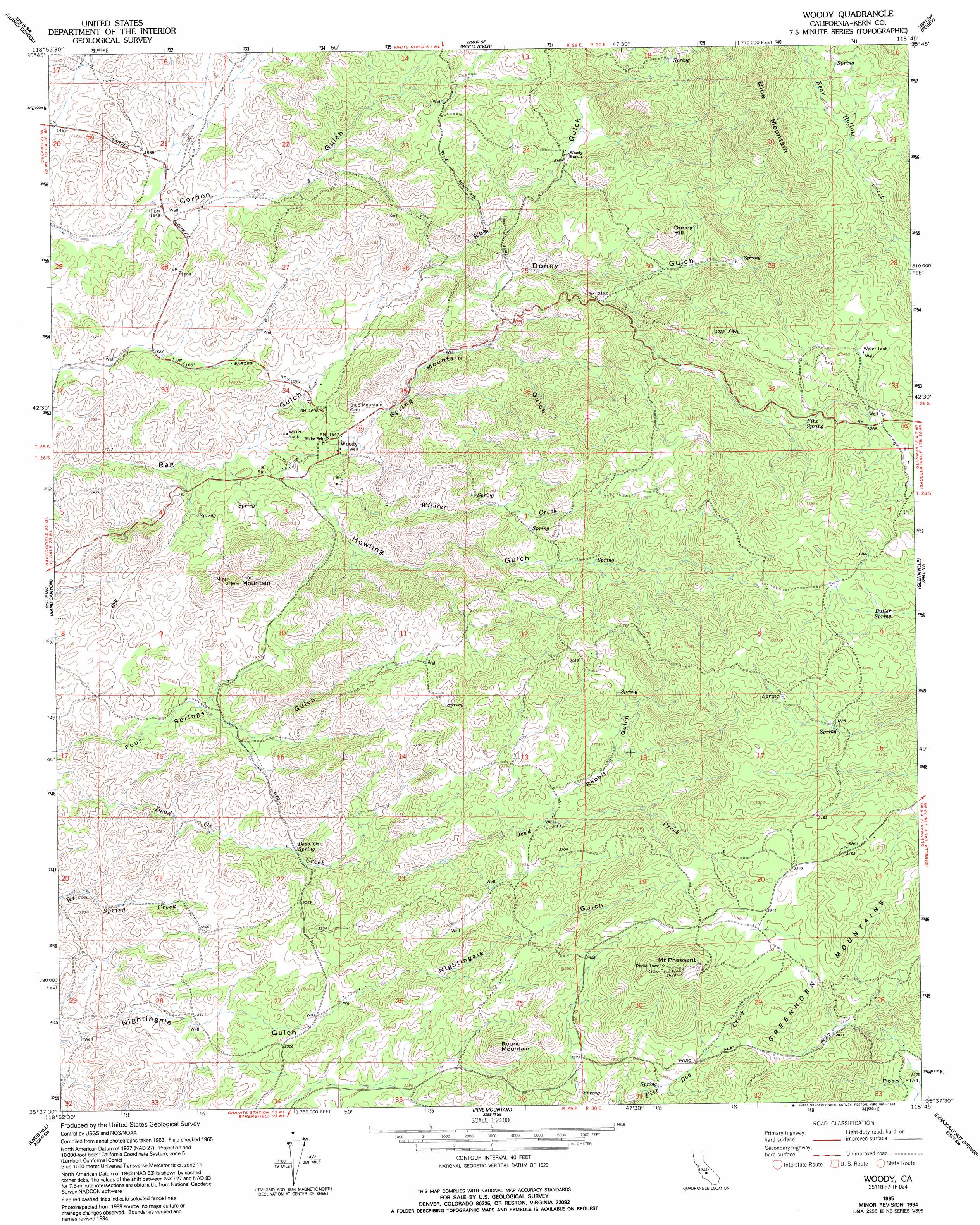
USGS Topo Quad 35118f7 - 1:24,000 scale
| Topo Map Name: | Woody |
| USGS Topo Quad ID: | 35118f7 |
| Print Size: | ca. 21 1/4" wide x 27" high |
| Southeast Coordinates: | 35.625° N latitude / 118.75° W longitude |
| Map Center Coordinates: | 35.6875° N latitude / 118.8125° W longitude |
| U.S. State: | CA |
| Filename: | o35118f7.jpg |
| Download Map JPG Image: | Woody topo map 1:24,000 scale |
| Map Type: | Topographic |
| Topo Series: | 7.5´ |
| Map Scale: | 1:24,000 |
| Source of Map Images: | United States Geological Survey (USGS) |
| Alternate Map Versions: |
Woody CA 1965, updated 1966 Download PDF Buy paper map Woody CA 1965, updated 1994 Download PDF Buy paper map Woody CA 2012 Download PDF Buy paper map Woody CA 2015 Download PDF Buy paper map |
1:24,000 Topo Quads surrounding Woody
Ducor |
Fountain Springs |
Gibbon Peak |
California Hot Springs |
Johnsondale |
Richgrove |
Quincy School |
White River |
Posey |
Tobias Peak |
Deepwell Ranch |
Sand Canyon |
Woody |
Glennville |
Alta Sierra |
North Of Oildale |
Knob Hill |
Pine Mountain |
Democrat Hot Springs |
Miracle Hot Springs |
Oildale |
Oil Center |
Rio Bravo Ranch |
Mount Adelaide |
Breckenridge Mountain |
> Back to 35118e1 at 1:100,000 scale
> Back to 35118a1 at 1:250,000 scale
> Back to U.S. Topo Maps home
Woody topo map: Gazetteer
Woody: Flats
Wood Flats elevation 1076m 3530′Woody Flats elevation 1042m 3418′
Woody: Populated Places
Woody elevation 504m 1653′Woody: Springs
Butler Spring elevation 976m 3202′Dead Ox Spring elevation 594m 1948′
Fine Spring elevation 934m 3064′
Woody: Streams
Wildcat Creek elevation 508m 1666′Woody: Summits
Doney Hill elevation 866m 2841′Iron Mountain elevation 745m 2444′
Mount Pheasant elevation 1103m 3618′
Round Mountain elevation 903m 2962′
Woody: Valleys
Doney Gulch elevation 547m 1794′Howling Gulch elevation 472m 1548′
Rabbit Gulch elevation 765m 2509′
Spring Mountain Gulch elevation 486m 1594′
Woody digital topo map on disk
Buy this Woody topo map showing relief, roads, GPS coordinates and other geographical features, as a high-resolution digital map file on DVD:
Southern Sierra Nevada, California & Southern Nevada
Buy digital topo maps: Southern Sierra Nevada, California & Southern Nevada