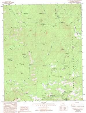
California Hot Springs Topo Map California
To zoom in, hover over the map of California Hot Springs
USGS Topo Quad 35118h6 - 1:24,000 scale
| Topo Map Name: | California Hot Springs |
| USGS Topo Quad ID: | 35118h6 |
| Print Size: | ca. 21 1/4" wide x 27" high |
| Southeast Coordinates: | 35.875° N latitude / 118.625° W longitude |
| Map Center Coordinates: | 35.9375° N latitude / 118.6875° W longitude |
| U.S. State: | CA |
| Filename: | o35118h6.jpg |
| Download Map JPG Image: | California Hot Springs topo map 1:24,000 scale |
| Map Type: | Topographic |
| Topo Series: | 7.5´ |
| Map Scale: | 1:24,000 |
| Source of Map Images: | United States Geological Survey (USGS) |
| Alternate Map Versions: |
California Hot Springs CA 1986, updated 1987 Download PDF Buy paper map California Hot Springs CA 1986, updated 1994 Download PDF Buy paper map California Hot Springs CA 2012 Download PDF Buy paper map California Hot Springs CA 2015 Download PDF Buy paper map |
| FStopo: | US Forest Service topo California Hot Springs is available: Download FStopo PDF Download FStopo TIF |
1:24,000 Topo Quads surrounding California Hot Springs
> Back to 35118e1 at 1:100,000 scale
> Back to 35118a1 at 1:250,000 scale
> Back to U.S. Topo Maps home
California Hot Springs topo map: Gazetteer
California Hot Springs: Bends
Devils Den elevation 1391m 4563′California Hot Springs: Flats
Parker Meadow elevation 1962m 6437′Soldier Meadow elevation 2257m 7404′
Upper Parker Meadow elevation 1992m 6535′
California Hot Springs: Gaps
Cain Spring Gap elevation 885m 2903′Cold Springs Saddle elevation 1761m 5777′
Dead Mule Saddle elevation 1510m 4954′
Parker Pass elevation 1970m 6463′
Skunk Spring Saddle elevation 1157m 3795′
Sycamore Gap elevation 722m 2368′
California Hot Springs: Mines
Bull Point Mine elevation 835m 2739′California Hot Springs: Populated Places
California Hot Springs elevation 939m 3080′Pine Flat elevation 1133m 3717′
Redwood Corral elevation 1803m 5915′
Stone Place elevation 574m 1883′
California Hot Springs: Ridges
Devils Thumb elevation 1110m 3641′Gordon Hills elevation 1521m 4990′
Jon Hill elevation 919m 3015′
Pinnell Camp Ridge elevation 1093m 3585′
Rattlesnake Ridge elevation 1289m 4229′
Thompson Ridge elevation 1307m 4288′
California Hot Springs: Slopes
Buck Slide elevation 1842m 6043′California Hot Springs: Springs
Cain Spring elevation 725m 2378′Chute Spring elevation 1537m 5042′
Mud Spring elevation 1617m 5305′
Poison Oak Spring elevation 926m 3038′
Skunk Spring elevation 1041m 3415′
Sycamore Spring elevation 1164m 3818′
California Hot Springs: Streams
Alder Creek elevation 1058m 3471′Capinero Creek elevation 1027m 3369′
Cold Springs Creek elevation 584m 1916′
Merry Creek elevation 917m 3008′
North Fork Gordon Creek elevation 801m 2627′
Redwood Creek elevation 1397m 4583′
Rube Creek elevation 583m 1912′
South Fork Gordon Creek elevation 810m 2657′
Starvation Creek elevation 1092m 3582′
Tyler Creek elevation 751m 2463′
California Hot Springs: Summits
Cold Springs Peak elevation 1843m 6046′Corral Hill elevation 1185m 3887′
Hatchet Peak elevation 1930m 6332′
Lone Pine Mountain elevation 1540m 5052′
North Cold Spring elevation 2050m 6725′
North Cold Spring Peak elevation 1916m 6286′
Parker Peak elevation 2316m 7598′
Thompson Peak elevation 1321m 4333′
Tyler Peak elevation 1163m 3815′
California Hot Springs: Trails
Parker Meadow Stock Driveway elevation 1543m 5062′California Hot Springs: Woods
North Cold Spring Grove elevation 1760m 5774′Parker Peak Grove elevation 1982m 6502′
California Hot Springs digital topo map on disk
Buy this California Hot Springs topo map showing relief, roads, GPS coordinates and other geographical features, as a high-resolution digital map file on DVD:
Southern Sierra Nevada, California & Southern Nevada
Buy digital topo maps: Southern Sierra Nevada, California & Southern Nevada


