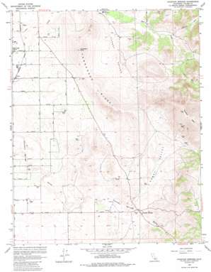
Fountain Springs Topo Map California
To zoom in, hover over the map of Fountain Springs
USGS Topo Quad 35118h8 - 1:24,000 scale
| Topo Map Name: | Fountain Springs |
| USGS Topo Quad ID: | 35118h8 |
| Print Size: | ca. 21 1/4" wide x 27" high |
| Southeast Coordinates: | 35.875° N latitude / 118.875° W longitude |
| Map Center Coordinates: | 35.9375° N latitude / 118.9375° W longitude |
| U.S. State: | CA |
| Filename: | o35118h8.jpg |
| Download Map JPG Image: | Fountain Springs topo map 1:24,000 scale |
| Map Type: | Topographic |
| Topo Series: | 7.5´ |
| Map Scale: | 1:24,000 |
| Source of Map Images: | United States Geological Survey (USGS) |
| Alternate Map Versions: |
Fountain Springs CA 1965, updated 1966 Download PDF Buy paper map Fountain Springs CA 1965, updated 1982 Download PDF Buy paper map Fountain Springs CA 1965, updated 1986 Download PDF Buy paper map Fountain Springs CA 1965, updated 1988 Download PDF Buy paper map Fountain Springs CA 2012 Download PDF Buy paper map Fountain Springs CA 2015 Download PDF Buy paper map |
1:24,000 Topo Quads surrounding Fountain Springs
> Back to 35118e1 at 1:100,000 scale
> Back to 35118a1 at 1:250,000 scale
> Back to U.S. Topo Maps home
Fountain Springs topo map: Gazetteer
Fountain Springs: Populated Places
Fountain Springs elevation 245m 803′Lempon (historical) elevation 159m 521′
Ultra elevation 157m 515′
Fountain Springs: Ridges
Tennessee Ridge elevation 350m 1148′Fountain Springs: Summits
Quedow Mountain elevation 734m 2408′Tennessee Knob elevation 428m 1404′
Fountain Springs: Valleys
Hewey Valley elevation 231m 757′Hungry Hollow elevation 182m 597′
Fountain Springs digital topo map on disk
Buy this Fountain Springs topo map showing relief, roads, GPS coordinates and other geographical features, as a high-resolution digital map file on DVD:
Southern Sierra Nevada, California & Southern Nevada
Buy digital topo maps: Southern Sierra Nevada, California & Southern Nevada


