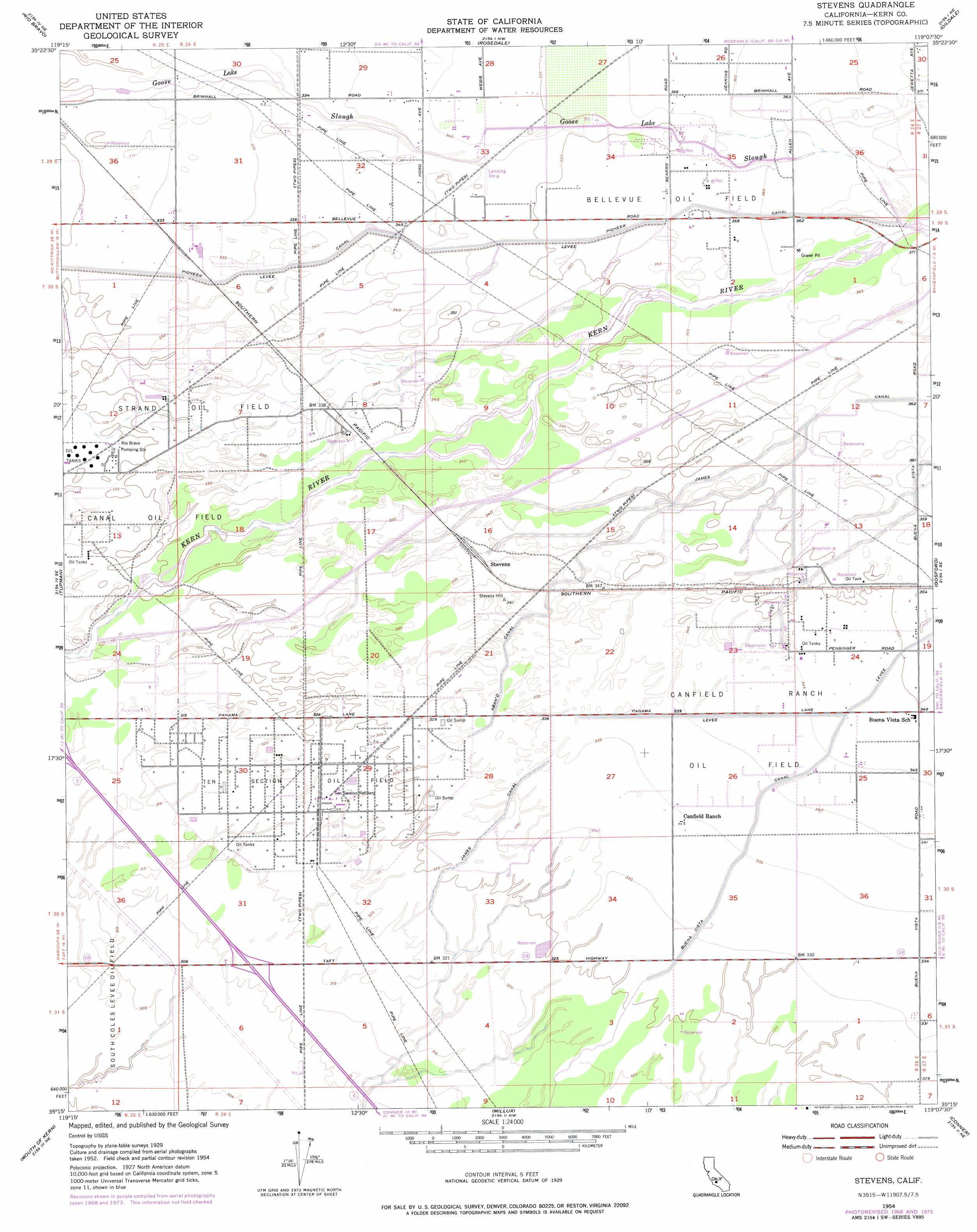
Stevens Topo Map California
To zoom in, hover over the map of Stevens
USGS Topo Quad 35119c2 - 1:24,000 scale
| Topo Map Name: | Stevens |
| USGS Topo Quad ID: | 35119c2 |
| Print Size: | ca. 21 1/4" wide x 27" high |
| Southeast Coordinates: | 35.25° N latitude / 119.125° W longitude |
| Map Center Coordinates: | 35.3125° N latitude / 119.1875° W longitude |
| U.S. State: | CA |
| Filename: | o35119c2.jpg |
| Download Map JPG Image: | Stevens topo map 1:24,000 scale |
| Map Type: | Topographic |
| Topo Series: | 7.5´ |
| Map Scale: | 1:24,000 |
| Source of Map Images: | United States Geological Survey (USGS) |
| Alternate Map Versions: |
Stevens CA 1950 Download PDF Buy paper map Stevens CA 1954, updated 1955 Download PDF Buy paper map Stevens CA 1954, updated 1970 Download PDF Buy paper map Stevens CA 1954, updated 1976 Download PDF Buy paper map Stevens CA 1954, updated 1976 Download PDF Buy paper map Stevens CA 2012 Download PDF Buy paper map Stevens CA 2015 Download PDF Buy paper map |
1:24,000 Topo Quads surrounding Stevens
Wasco Sw |
Wasco |
Famoso |
North Of Oildale |
Knob Hill |
Buttonwillow |
Rio Bravo |
Rosedale |
Oildale |
Oil Center |
East Elk Hills |
Tupman |
Stevens |
Gosford |
Lamont |
Taft |
Buena Vista Lakebed |
Millux |
Conner |
Weed Patch |
Maricopa |
Pentland |
Conner Sw |
Coal Oil Canyon |
Mettler |
> Back to 35119a1 at 1:100,000 scale
> Back to 35118a1 at 1:250,000 scale
> Back to U.S. Topo Maps home
Stevens topo map: Gazetteer
Stevens: Airports
Joe Gottlieb Field elevation 106m 347′Stevens: Canals
Buena Vista Canal elevation 101m 331′James Canal elevation 109m 357′
Pioneer Canal elevation 106m 347′
Stevens: Oilfields
Bellevue Oil Field elevation 109m 357′Canal Oil Field elevation 98m 321′
Canfield Ranch Oil Field elevation 105m 344′
Strand Oil Field elevation 101m 331′
Ten Section Oil Field elevation 98m 321′
Stevens: Populated Places
Stevens elevation 104m 341′Strand (historical) elevation 103m 337′
Stevens digital topo map on disk
Buy this Stevens topo map showing relief, roads, GPS coordinates and other geographical features, as a high-resolution digital map file on DVD:
Southern Sierra Nevada, California & Southern Nevada
Buy digital topo maps: Southern Sierra Nevada, California & Southern Nevada