Reward Topo Map California
To zoom in, hover over the map of Reward
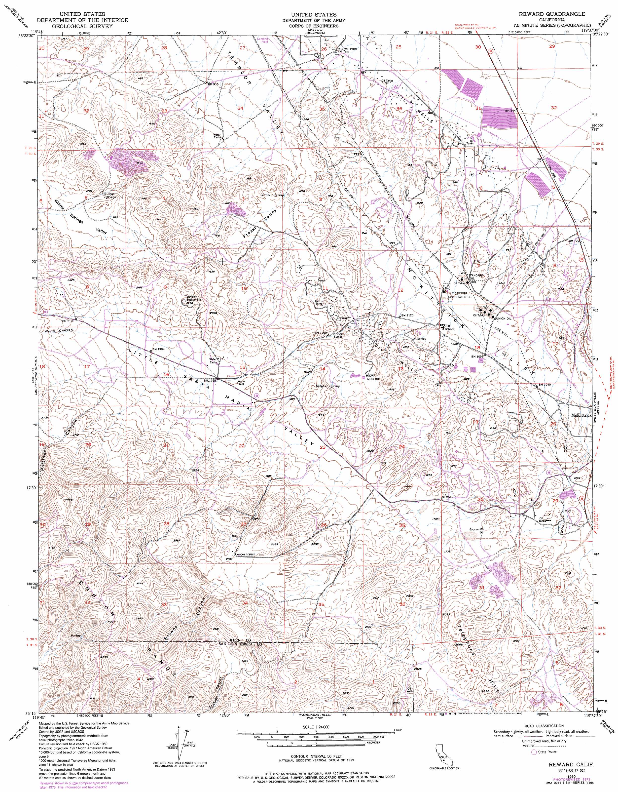
USGS Topo Quad 35119c6 - 1:24,000 scale
| Topo Map Name: | Reward |
| USGS Topo Quad ID: | 35119c6 |
| Print Size: | ca. 21 1/4" wide x 27" high |
| Southeast Coordinates: | 35.25° N latitude / 119.625° W longitude |
| Map Center Coordinates: | 35.3125° N latitude / 119.6875° W longitude |
| U.S. State: | CA |
| Filename: | o35119c6.jpg |
| Download Map JPG Image: | Reward topo map 1:24,000 scale |
| Map Type: | Topographic |
| Topo Series: | 7.5´ |
| Map Scale: | 1:24,000 |
| Source of Map Images: | United States Geological Survey (USGS) |
| Alternate Map Versions: |
Reward CA 1950, updated 1969 Download PDF Buy paper map Reward CA 1950, updated 1976 Download PDF Buy paper map Reward CA 1950, updated 1976 Download PDF Buy paper map Reward CA 1950, updated 1988 Download PDF Buy paper map Reward CA 1951 Download PDF Buy paper map Reward CA 2012 Download PDF Buy paper map Reward CA 2015 Download PDF Buy paper map |
1:24,000 Topo Quads surrounding Reward
Shale Point |
Blackwells Corner |
Lost Hills |
Semitropic |
Wasco Sw |
Las Yeguas Ranch |
Carneros Rocks |
Belridge |
Lokern |
Buttonwillow |
Simmler |
Mckittrick Summit |
Reward |
West Elk Hills |
East Elk Hills |
Chimineas Ranch |
Painted Rock |
Panorama Hills |
Fellows |
Taft |
Taylor Canyon |
Caliente Mountain |
Wells Ranch |
Elkhorn Hills |
Maricopa |
> Back to 35119a1 at 1:100,000 scale
> Back to 35118a1 at 1:250,000 scale
> Back to U.S. Topo Maps home
Reward topo map: Gazetteer
Reward: Basins
Willow Springs Valley elevation 513m 1683′Reward: Oilfields
Standard Oil elevation 296m 971′Tidewater Associated Oil elevation 307m 1007′
Union Oil elevation 310m 1017′
Welport Oil elevation 215m 705′
Reward: Populated Places
Olig (historical) elevation 314m 1030′Reward elevation 389m 1276′
Reward: Springs
Frazer Spring elevation 346m 1135′Sulphur Spring elevation 479m 1571′
Willow Springs elevation 487m 1597′
Reward: Valleys
Browns Canyon elevation 770m 2526′Frazer Valley elevation 300m 984′
Little Santa Maria Valley elevation 543m 1781′
Maddux Canyon elevation 756m 2480′
Mama Pottinger Canyon elevation 671m 2201′
Pottinger Canyon elevation 674m 2211′
Temblor Valley elevation 305m 1000′
Wood Canyon elevation 630m 2066′
Reward digital topo map on disk
Buy this Reward topo map showing relief, roads, GPS coordinates and other geographical features, as a high-resolution digital map file on DVD:
Southern Sierra Nevada, California & Southern Nevada
Buy digital topo maps: Southern Sierra Nevada, California & Southern Nevada