Simmler Topo Map California
To zoom in, hover over the map of Simmler
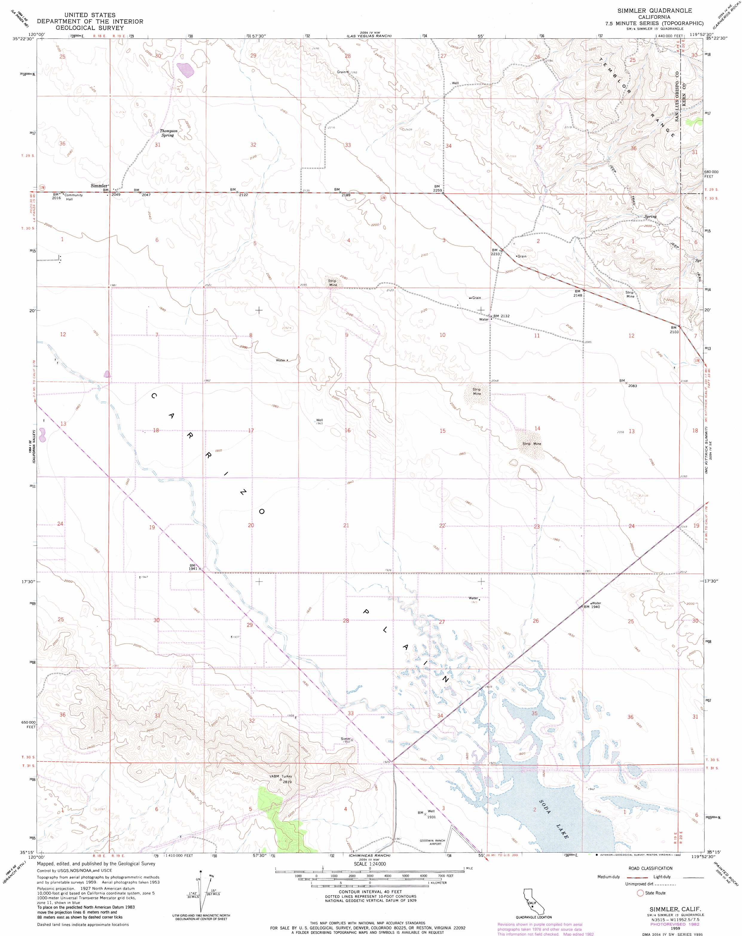
USGS Topo Quad 35119c8 - 1:24,000 scale
| Topo Map Name: | Simmler |
| USGS Topo Quad ID: | 35119c8 |
| Print Size: | ca. 21 1/4" wide x 27" high |
| Southeast Coordinates: | 35.25° N latitude / 119.875° W longitude |
| Map Center Coordinates: | 35.3125° N latitude / 119.9375° W longitude |
| U.S. State: | CA |
| Filename: | o35119c8.jpg |
| Download Map JPG Image: | Simmler topo map 1:24,000 scale |
| Map Type: | Topographic |
| Topo Series: | 7.5´ |
| Map Scale: | 1:24,000 |
| Source of Map Images: | United States Geological Survey (USGS) |
| Alternate Map Versions: |
Simmler CA 1959, updated 1961 Download PDF Buy paper map Simmler CA 1959, updated 1967 Download PDF Buy paper map Simmler CA 1959, updated 1982 Download PDF Buy paper map Simmler CA 2012 Download PDF Buy paper map Simmler CA 2015 Download PDF Buy paper map |
1:24,000 Topo Quads surrounding Simmler
Holland Canyon |
Packwood Creek |
Shale Point |
Blackwells Corner |
Lost Hills |
La Panza Ranch |
La Panza Ne |
Las Yeguas Ranch |
Carneros Rocks |
Belridge |
La Panza |
California Valley |
Simmler |
Mckittrick Summit |
Reward |
Los Machos Hills |
Branch Mountain |
Chimineas Ranch |
Painted Rock |
Panorama Hills |
Chimney Canyon |
Miranda Pine Mountain |
Taylor Canyon |
Caliente Mountain |
Wells Ranch |
> Back to 35119a1 at 1:100,000 scale
> Back to 35118a1 at 1:250,000 scale
> Back to U.S. Topo Maps home
Simmler topo map: Gazetteer
Simmler: Populated Places
Simmler elevation 624m 2047′Simmler: Springs
Thompson Spring elevation 654m 2145′Simmler digital topo map on disk
Buy this Simmler topo map showing relief, roads, GPS coordinates and other geographical features, as a high-resolution digital map file on DVD:
Southern Sierra Nevada, California & Southern Nevada
Buy digital topo maps: Southern Sierra Nevada, California & Southern Nevada