Wasco Topo Map California
To zoom in, hover over the map of Wasco
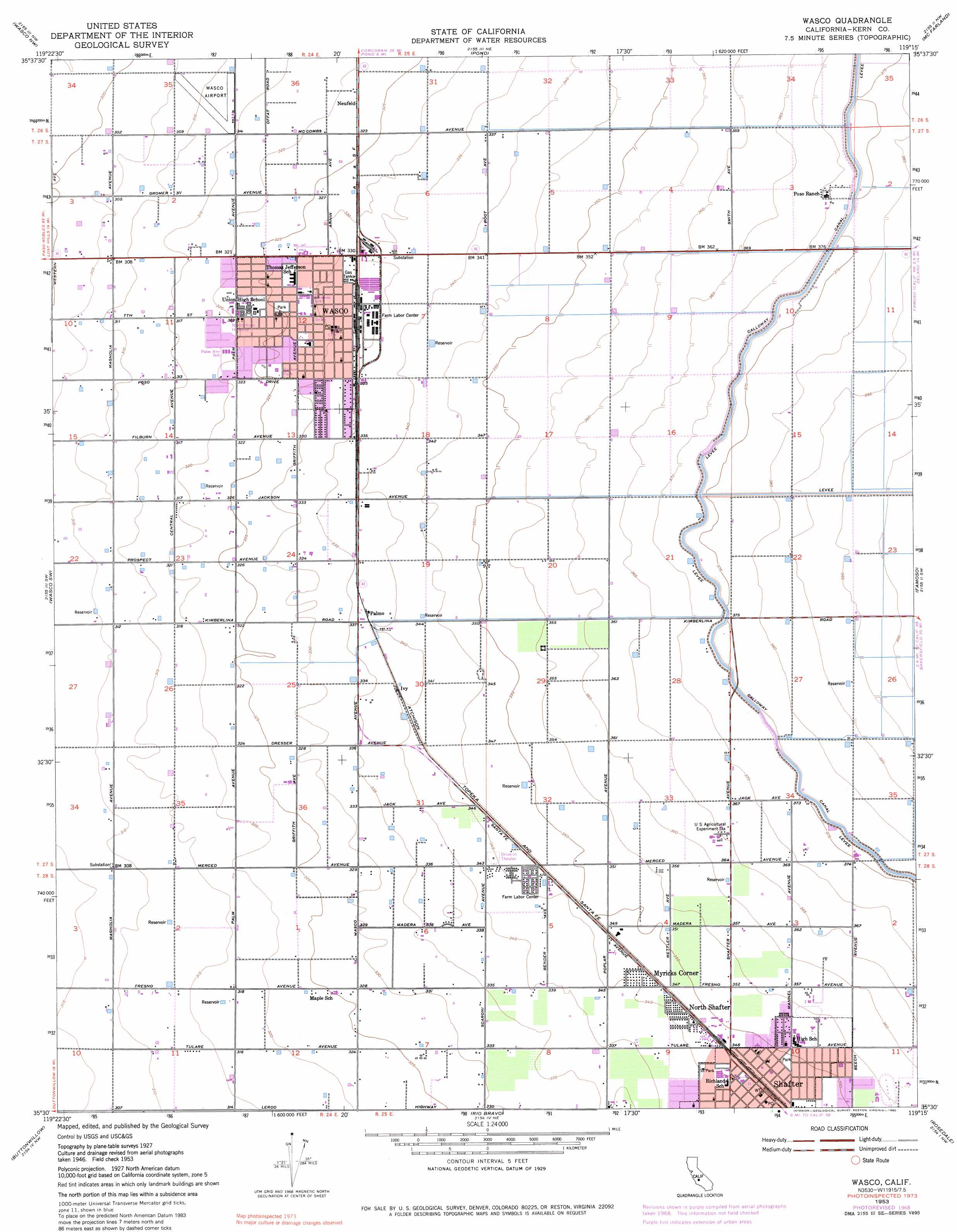
USGS Topo Quad 35119e3 - 1:24,000 scale
| Topo Map Name: | Wasco |
| USGS Topo Quad ID: | 35119e3 |
| Print Size: | ca. 21 1/4" wide x 27" high |
| Southeast Coordinates: | 35.5° N latitude / 119.25° W longitude |
| Map Center Coordinates: | 35.5625° N latitude / 119.3125° W longitude |
| U.S. State: | CA |
| Filename: | o35119e3.jpg |
| Download Map JPG Image: | Wasco topo map 1:24,000 scale |
| Map Type: | Topographic |
| Topo Series: | 7.5´ |
| Map Scale: | 1:24,000 |
| Source of Map Images: | United States Geological Survey (USGS) |
| Alternate Map Versions: |
Wasco CA 1953, updated 1954 Download PDF Buy paper map Wasco CA 1953, updated 1970 Download PDF Buy paper map Wasco CA 1953, updated 1980 Download PDF Buy paper map Wasco CA 2012 Download PDF Buy paper map Wasco CA 2015 Download PDF Buy paper map |
1:24,000 Topo Quads surrounding Wasco
Hacienda Ranch |
Allensworth |
Delano West |
Delano East |
Richgrove |
Lost Hills Ne |
Wasco Nw |
Pond |
Mcfarland |
Deepwell Ranch |
Semitropic |
Wasco Sw |
Wasco |
Famoso |
North Of Oildale |
Lokern |
Buttonwillow |
Rio Bravo |
Rosedale |
Oildale |
West Elk Hills |
East Elk Hills |
Tupman |
Stevens |
Gosford |
> Back to 35119e1 at 1:100,000 scale
> Back to 35118a1 at 1:250,000 scale
> Back to U.S. Topo Maps home
Wasco topo map: Gazetteer
Wasco: Airports
Wasco Airport elevation 95m 311′Wasco: Parks
Cormack Park elevation 100m 328′Mannel Park elevation 107m 351′
Westside Park elevation 97m 318′
Wasco: Populated Places
Myricks Corner elevation 107m 351′Neufeld elevation 99m 324′
North Shafter elevation 107m 351′
Palmo elevation 103m 337′
Shafter elevation 106m 347′
Wasco elevation 100m 328′
Wasco: Post Offices
Shafter Post Office elevation 106m 347′Wasco Post Office elevation 102m 334′
Wasco digital topo map on disk
Buy this Wasco topo map showing relief, roads, GPS coordinates and other geographical features, as a high-resolution digital map file on DVD:
Southern Sierra Nevada, California & Southern Nevada
Buy digital topo maps: Southern Sierra Nevada, California & Southern Nevada