Antelope Plain Topo Map California
To zoom in, hover over the map of Antelope Plain
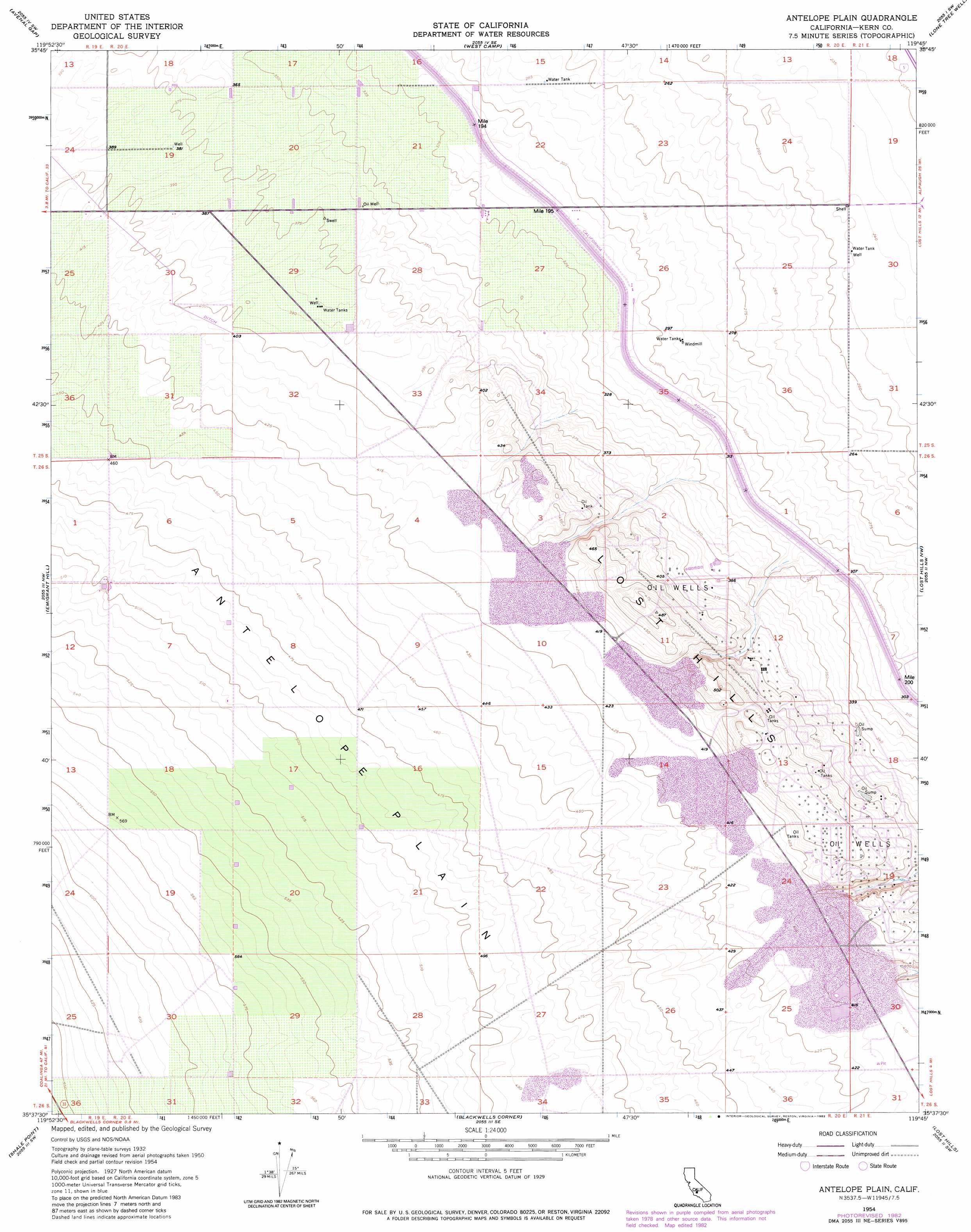
USGS Topo Quad 35119f7 - 1:24,000 scale
| Topo Map Name: | Antelope Plain |
| USGS Topo Quad ID: | 35119f7 |
| Print Size: | ca. 21 1/4" wide x 27" high |
| Southeast Coordinates: | 35.625° N latitude / 119.75° W longitude |
| Map Center Coordinates: | 35.6875° N latitude / 119.8125° W longitude |
| U.S. State: | CA |
| Filename: | o35119f7.jpg |
| Download Map JPG Image: | Antelope Plain topo map 1:24,000 scale |
| Map Type: | Topographic |
| Topo Series: | 7.5´ |
| Map Scale: | 1:24,000 |
| Source of Map Images: | United States Geological Survey (USGS) |
| Alternate Map Versions: |
Antelope Plain CA 1954, updated 1956 Download PDF Buy paper map Antelope Plain CA 1954, updated 1974 Download PDF Buy paper map Antelope Plain CA 1954, updated 1976 Download PDF Buy paper map Antelope Plain CA 1954, updated 1976 Download PDF Buy paper map Antelope Plain CA 1954, updated 1982 Download PDF Buy paper map Antelope Plain CA 1954, updated 1982 Download PDF Buy paper map Antelope Plain CA 2012 Download PDF Buy paper map Antelope Plain CA 2015 Download PDF Buy paper map |
1:24,000 Topo Quads surrounding Antelope Plain
Kettleman Plain |
Los Viejos |
Dudley Ridge |
Hacienda Ranch Nw |
Hacienda Ranch Ne |
Pyramid Hills |
Avenal Gap |
West Camp |
Lone Tree Well |
Hacienda Ranch |
Sawtooth Ridge |
Emigrant Hill |
Antelope Plain |
Lost Hills Nw |
Lost Hills Ne |
Packwood Creek |
Shale Point |
Blackwells Corner |
Lost Hills |
Semitropic |
La Panza Ne |
Las Yeguas Ranch |
Carneros Rocks |
Belridge |
Lokern |
> Back to 35119e1 at 1:100,000 scale
> Back to 35118a1 at 1:250,000 scale
> Back to U.S. Topo Maps home
Antelope Plain digital topo map on disk
Buy this Antelope Plain topo map showing relief, roads, GPS coordinates and other geographical features, as a high-resolution digital map file on DVD:
Southern Sierra Nevada, California & Southern Nevada
Buy digital topo maps: Southern Sierra Nevada, California & Southern Nevada