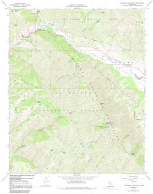
Miranda Pine Mountain Topo Map California
To zoom in, hover over the map of Miranda Pine Mountain
USGS Topo Quad 35120a1 - 1:24,000 scale
| Topo Map Name: | Miranda Pine Mountain |
| USGS Topo Quad ID: | 35120a1 |
| Print Size: | ca. 21 1/4" wide x 27" high |
| Southeast Coordinates: | 35° N latitude / 120° W longitude |
| Map Center Coordinates: | 35.0625° N latitude / 120.0625° W longitude |
| U.S. State: | CA |
| Filename: | o35120a1.jpg |
| Download Map JPG Image: | Miranda Pine Mountain topo map 1:24,000 scale |
| Map Type: | Topographic |
| Topo Series: | 7.5´ |
| Map Scale: | 1:24,000 |
| Source of Map Images: | United States Geological Survey (USGS) |
| Alternate Map Versions: |
Miranda Pine Mtn CA 1967, updated 1969 Download PDF Buy paper map Miranda Pine Mtn CA 1967, updated 1980 Download PDF Buy paper map Miranda Pine Mtn CA 1967, updated 1991 Download PDF Buy paper map Miranda Pine Mountain CA 1995, updated 2000 Download PDF Buy paper map Miranda Pine Mountain CA 2012 Download PDF Buy paper map Miranda Pine Mountain CA 2015 Download PDF Buy paper map |
| FStopo: | US Forest Service topo Miranda Pine Mountain is available: Download FStopo PDF Download FStopo TIF |
1:24,000 Topo Quads surrounding Miranda Pine Mountain
> Back to 35120a1 at 1:100,000 scale
> Back to 35120a1 at 1:250,000 scale
> Back to U.S. Topo Maps home
Miranda Pine Mountain topo map: Gazetteer
Miranda Pine Mountain: Flats
Pine Flat elevation 860m 2821′Miranda Pine Mountain: Pillars
Twin Rocks elevation 602m 1975′Miranda Pine Mountain: Ridges
Sycamore Ridge elevation 786m 2578′Miranda Pine Mountain: Springs
Gifford Spring elevation 655m 2148′Johnson Surprise Spring elevation 924m 3031′
Miranda Pine Spring elevation 1204m 3950′
Plowshare Spring elevation 661m 2168′
Plowshare Spring elevation 429m 1407′
Porter Spring elevation 936m 3070′
Quail Spring elevation 425m 1394′
Miranda Pine Mountain: Streams
Sheep Camp Creek elevation 547m 1794′Sycamore Creek elevation 410m 1345′
Miranda Pine Mountain: Summits
Brown Mountain elevation 759m 2490′Miranda Pine Mountain elevation 1259m 4130′
Plowshare Peak elevation 1187m 3894′
Porter Peak elevation 1032m 3385′
Timber Peak elevation 1452m 4763′
Treplett Mountain elevation 1165m 3822′
Miranda Pine Mountain: Trails
Indians Trail elevation 582m 1909′Kerry Canyon Trail elevation 680m 2230′
Lake Ridge Trail elevation 756m 2480′
Miranda Pine Mountain: Valleys
Brown Canyon elevation 379m 1243′Cuyama Valley elevation 387m 1269′
Gypsum Canyon elevation 404m 1325′
Miranda Pine Mountain digital topo map on disk
Buy this Miranda Pine Mountain topo map showing relief, roads, GPS coordinates and other geographical features, as a high-resolution digital map file on DVD:


