Creston Topo Map California
To zoom in, hover over the map of Creston
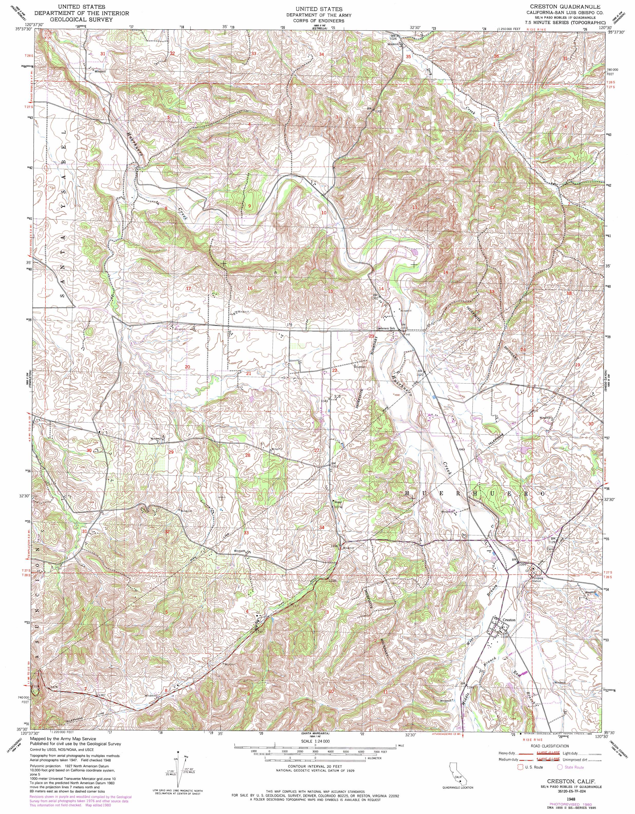
USGS Topo Quad 35120e5 - 1:24,000 scale
| Topo Map Name: | Creston |
| USGS Topo Quad ID: | 35120e5 |
| Print Size: | ca. 21 1/4" wide x 27" high |
| Southeast Coordinates: | 35.5° N latitude / 120.5° W longitude |
| Map Center Coordinates: | 35.5625° N latitude / 120.5625° W longitude |
| U.S. State: | CA |
| Filename: | o35120e5.jpg |
| Download Map JPG Image: | Creston topo map 1:24,000 scale |
| Map Type: | Topographic |
| Topo Series: | 7.5´ |
| Map Scale: | 1:24,000 |
| Source of Map Images: | United States Geological Survey (USGS) |
| Alternate Map Versions: |
Creston CA 1948, updated 1952 Download PDF Buy paper map Creston CA 1948, updated 1956 Download PDF Buy paper map Creston CA 1948, updated 1980 Download PDF Buy paper map Creston CA 1948, updated 1980 Download PDF Buy paper map Creston CA 1948, updated 1985 Download PDF Buy paper map Creston CA 2012 Download PDF Buy paper map Creston CA 2015 Download PDF Buy paper map |
1:24,000 Topo Quads surrounding Creston
Bradley |
San Miguel |
Ranchito Canyon |
Cholame Hills |
Cholame Valley |
Adelaida |
Paso Robles |
Estrella |
Shandon |
Cholame |
York Mountain |
Templeton |
Creston |
Shedd Canyon |
Camatta Canyon |
Morro Bay North |
Atascadero |
Santa Margarita |
Wilson Corner |
Camatta Ranch |
Morro Bay South |
San Luis Obispo |
Lopez Mountain |
Santa Margarita Lake |
Pozo Summit |
> Back to 35120e1 at 1:100,000 scale
> Back to 35120a1 at 1:250,000 scale
> Back to U.S. Topo Maps home
Creston topo map: Gazetteer
Creston: Populated Places
Creston elevation 341m 1118′Linne elevation 326m 1069′
Creston: Streams
East Branch Huerhuero Creek elevation 342m 1122′Middle Branch Huerhuero Creek elevation 342m 1122′
West Branch Huerhuero Creek elevation 319m 1046′
Creston: Valleys
Dry Canyon elevation 313m 1026′Creston digital topo map on disk
Buy this Creston topo map showing relief, roads, GPS coordinates and other geographical features, as a high-resolution digital map file on DVD: