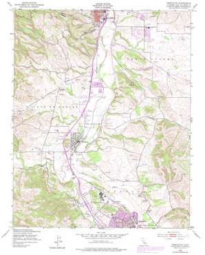
Templeton Topo Map California
To zoom in, hover over the map of Templeton
USGS Topo Quad 35120e6 - 1:24,000 scale
| Topo Map Name: | Templeton |
| USGS Topo Quad ID: | 35120e6 |
| Print Size: | ca. 21 1/4" wide x 27" high |
| Southeast Coordinates: | 35.5° N latitude / 120.625° W longitude |
| Map Center Coordinates: | 35.5625° N latitude / 120.6875° W longitude |
| U.S. State: | CA |
| Filename: | o35120e6.jpg |
| Download Map JPG Image: | Templeton topo map 1:24,000 scale |
| Map Type: | Topographic |
| Topo Series: | 7.5´ |
| Map Scale: | 1:24,000 |
| Source of Map Images: | United States Geological Survey (USGS) |
| Alternate Map Versions: |
Templeton CA 1948, updated 1952 Download PDF Buy paper map Templeton CA 1948, updated 1965 Download PDF Buy paper map Templeton CA 1948, updated 1972 Download PDF Buy paper map Templeton CA 1948, updated 1979 Download PDF Buy paper map Templeton CA 1948, updated 1979 Download PDF Buy paper map Templeton CA 2012 Download PDF Buy paper map Templeton CA 2015 Download PDF Buy paper map |
1:24,000 Topo Quads surrounding Templeton
> Back to 35120e1 at 1:100,000 scale
> Back to 35120a1 at 1:250,000 scale
> Back to U.S. Topo Maps home
Templeton topo map: Gazetteer
Templeton: Airports
Twin Cities Community Hospital Heliport elevation 260m 853′Templeton: Parks
Caso Robles Park elevation 235m 770′Centennial Park and Swimming Pool elevation 247m 810′
Melody Park elevation 237m 777′
Robbins Field Ball Park elevation 224m 734′
Royal Oaks Park elevation 258m 846′
Sherwood Park elevation 243m 797′
Templeton Athletic Fields elevation 243m 797′
Turtle Creek Park elevation 253m 830′
Templeton: Populated Places
Asuncion elevation 257m 843′Templeton elevation 246m 807′
Templeton: Post Offices
Templeton Post Office elevation 246m 807′Templeton: Reservoirs
Lake Ysabel (historical) elevation 231m 757′Templeton: Springs
Neals Spring elevation 303m 994′Sulphur Spring elevation 274m 898′
Templeton: Streams
Atascadero Creek elevation 250m 820′Graves Creek elevation 233m 764′
Paso Robles Creek elevation 232m 761′
Templeton: Valleys
Kiler Canyon elevation 226m 741′Peachy Canyon elevation 226m 741′
Templeton digital topo map on disk
Buy this Templeton topo map showing relief, roads, GPS coordinates and other geographical features, as a high-resolution digital map file on DVD:


