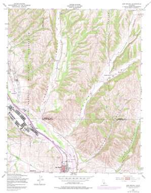
San Miguel Topo Map California
To zoom in, hover over the map of San Miguel
USGS Topo Quad 35120g6 - 1:24,000 scale
| Topo Map Name: | San Miguel |
| USGS Topo Quad ID: | 35120g6 |
| Print Size: | ca. 21 1/4" wide x 27" high |
| Southeast Coordinates: | 35.75° N latitude / 120.625° W longitude |
| Map Center Coordinates: | 35.8125° N latitude / 120.6875° W longitude |
| U.S. State: | CA |
| Filename: | o35120g6.jpg |
| Download Map JPG Image: | San Miguel topo map 1:24,000 scale |
| Map Type: | Topographic |
| Topo Series: | 7.5´ |
| Map Scale: | 1:24,000 |
| Source of Map Images: | United States Geological Survey (USGS) |
| Alternate Map Versions: |
San Miguel CA 1948, updated 1952 Download PDF Buy paper map San Miguel CA 1948, updated 1967 Download PDF Buy paper map San Miguel CA 1948, updated 1979 Download PDF Buy paper map San Miguel CA 1948, updated 1979 Download PDF Buy paper map San Miguel CA 2012 Download PDF Buy paper map San Miguel CA 2015 Download PDF Buy paper map |
1:24,000 Topo Quads surrounding San Miguel
> Back to 35120e1 at 1:100,000 scale
> Back to 35120a1 at 1:250,000 scale
> Back to U.S. Topo Maps home
San Miguel topo map: Gazetteer
San Miguel: Parks
Garelli Field elevation 201m 659′San Miguel Park elevation 199m 652′
San Miguel: Populated Places
McKay elevation 183m 600′Nacimiento elevation 194m 636′
San Miguel elevation 193m 633′
San Miguel: Streams
Big Sandy Creek elevation 177m 580′San Miguel: Valleys
Deer Canyon elevation 306m 1003′Indian Valley elevation 177m 580′
Mahoney Canyon elevation 183m 600′
Portuguese Canyon elevation 293m 961′
Tunnel Canyon elevation 404m 1325′
Vineyard Canyon elevation 181m 593′
San Miguel digital topo map on disk
Buy this San Miguel topo map showing relief, roads, GPS coordinates and other geographical features, as a high-resolution digital map file on DVD:


